Category:Weston Underwood, Buckinghamshire
Aller à la navigation
Aller à la recherche
English: Weston Underwood is a village and civil parish in the Borough of Milton Keynes, ceremonial Buckinghamshire, England. It is located about a mile west of Olney.
Norsk bokmål: Weston Underwood er en landsby og et verdslig sogn i Milton Keynes i England. Stedet ligger omkring halvannen kilometer vest for Olney.
village britannique  | |||||
| Téléverser des médias | |||||
| Nature de l’élément | |||||
|---|---|---|---|---|---|
| Lieu | Milton Keynes (borough), Buckinghamshire, Angleterre du Sud-Est, Angleterre | ||||
 | |||||
Sous-catégories
Cette catégorie comprend seulement la sous-catégorie ci-dessous.
Média dans la catégorie « Weston Underwood, Buckinghamshire »
Cette catégorie comprend 70 fichiers, dont les 70 ci-dessous.
-
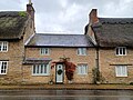
 1 and 2 High Street, Weston Underwood.jpg 4 000 × 3 000 ; 3,13 Mio
-
 Approaching Weston Underwood - geograph.org.uk - 204411.jpg 640 × 480 ; 111 kio
-
 Beside the hidden reservoir - geograph.org.uk - 6130651.jpg 768 × 1 024 ; 346 kio
-
 Bridleway beside Kilwick Wood - geograph.org.uk - 6130658.jpg 768 × 1 024 ; 390 kio
-
 Bridleway near Ravenstone - geograph.org.uk - 6130650.jpg 768 × 1 024 ; 370 kio
-
 Bridleway North-west of Weston Underwood - geograph.org.uk - 203631.jpg 640 × 480 ; 133 kio
-
 Bridleway to Hungry Hall - geograph.org.uk - 3301751.jpg 1 600 × 1 067 ; 488 kio
-
 Bridleway towards Hungary Hall - geograph.org.uk - 6130654.jpg 768 × 1 024 ; 344 kio
-
 Broken bridge on a disused railway - geograph.org.uk - 3301756.jpg 1 600 × 1 066 ; 540 kio
-
 Brook running down to the Great Ouse - geograph.org.uk - 3301890.jpg 1 600 × 1 067 ; 481 kio
-
 Clock House, Weston Underwood 01.jpg 4 000 × 3 000 ; 3,77 Mio
-
 Clock House, Weston Underwood 02.jpg 4 000 × 3 000 ; 3,11 Mio
-
 Cobbled Paving in Weston Underwood - geograph.org.uk - 1535224.jpg 640 × 449 ; 254 kio
-
 Course of the disused Bedford - Northampton line - geograph.org.uk - 3301765.jpg 1 600 × 1 065 ; 426 kio
-
 Disused Bedford - Northampton line - geograph.org.uk - 3301790.jpg 1 600 × 1 067 ; 542 kio
-
 Disused Railway - geograph.org.uk - 204198.jpg 640 × 480 ; 137 kio
-
 Entrance gate to Weston Underwood 01.jpg 4 000 × 3 000 ; 5,27 Mio
-
 Entrance gate to Weston Underwood 02.jpg 4 000 × 3 000 ; 3,29 Mio
-
 Entrance gate to Weston Underwood 03.jpg 4 000 × 3 000 ; 3,91 Mio
-
 Entrance gate to Weston Underwood 04.jpg 4 000 × 3 000 ; 3,33 Mio
-
 Fields - geograph.org.uk - 203633.jpg 640 × 480 ; 139 kio
-
 Footpath down to the Great Ouse - geograph.org.uk - 3301894.jpg 1 200 × 1 600 ; 465 kio
-
 Footpath towards Tyringham - geograph.org.uk - 3293095.jpg 1 600 × 1 067 ; 511 kio
-
 Former Railway, near Hungary Hall - geograph.org.uk - 454536.jpg 640 × 428 ; 119 kio
-
 Gap in the hedge - geograph.org.uk - 3301906.jpg 1 600 × 1 069 ; 517 kio
-
 Gate on the path to Hungry Hall - geograph.org.uk - 3301770.jpg 1 600 × 1 067 ; 488 kio
-
 Gated entrance to Weston Underwood - geograph.org.uk - 195515.jpg 640 × 480 ; 63 kio
-
 Grange Cottage, Weston Underwood 01.jpg 4 000 × 3 000 ; 3,37 Mio
-
 Grange Cottage, Weston Underwood 02.jpg 4 000 × 3 000 ; 2,72 Mio
-
 Grange Farmhouse, Weston Underwood.jpg 4 000 × 3 000 ; 3,44 Mio
-
 Grazing sheep by the pumping house - geograph.org.uk - 3301885.jpg 1 600 × 1 068 ; 385 kio
-
 Hall Barn, Weston Underwood.jpg 4 000 × 3 000 ; 2,56 Mio
-
 Hedge by the Milton Keynes Boundary Walk - geograph.org.uk - 3301815.jpg 1 600 × 1 065 ; 377 kio
-
 Hedge by the path down to the river - geograph.org.uk - 3301895.jpg 1 600 × 1 067 ; 270 kio
-
 Horses near Children's Play Area - geograph.org.uk - 204415.jpg 640 × 335 ; 88 kio
-
 House by the track to Hungry Hall - geograph.org.uk - 3301873.jpg 1 600 × 1 067 ; 314 kio
-
 House on the way in to Weston Underwood - geograph.org.uk - 3301880.jpg 1 600 × 1 067 ; 449 kio
-
 Hungary Hall - geograph.org.uk - 452920.jpg 640 × 428 ; 119 kio
-
 Hungry Hall from the bridleway - geograph.org.uk - 3301772.jpg 1 600 × 1 067 ; 241 kio
-
 Keepers Cottage, Weston Underwood.jpg 4 000 × 3 000 ; 3,54 Mio
-
 Leaving Weston Underwood - geograph.org.uk - 6130653.jpg 768 × 1 024 ; 196 kio
-
 Milton Keynes Boundary Walk by a farm building - geograph.org.uk - 3301786.jpg 1 600 × 1 067 ; 444 kio
-
 Milton Keynes Boundary Walk in Weston Park - geograph.org.uk - 3301870.jpg 1 600 × 1 067 ; 416 kio
-
 Permissive Way - geograph.org.uk - 6130660.jpg 768 × 1 024 ; 334 kio
-
 Road from Weston Underwood - geograph.org.uk - 203611.jpg 640 × 480 ; 95 kio
-
 Spinney by Pheasant's Nest farm - geograph.org.uk - 3301809.jpg 1 600 × 1 068 ; 387 kio
-
 Stile near Hungary Hall - geograph.org.uk - 454452.jpg 640 × 428 ; 96 kio
-
 The Manor House, Weston Underwood 01.jpg 4 000 × 3 000 ; 3,11 Mio
-
 The Manor House, Weston Underwood 02.jpg 4 000 × 3 000 ; 3,17 Mio
-
 The Manor House, Weston Underwood 03.jpg 4 000 × 3 000 ; 3,13 Mio
-
 The Old Store, Weston Underwood.jpg 4 000 × 3 000 ; 3,14 Mio
-
 The track to Hungry Hall - geograph.org.uk - 3301776.jpg 1 600 × 1 067 ; 388 kio
-
 The track to Woolwich Barn - geograph.org.uk - 195520.jpg 640 × 480 ; 63 kio
-
 Towards Weston Underwood - geograph.org.uk - 6130652.jpg 768 × 1 024 ; 297 kio
-
 Track down to the stream - geograph.org.uk - 3301807.jpg 1 600 × 1 067 ; 405 kio
-
 Track to Pheasant's Nest Farm - geograph.org.uk - 3301865.jpg 1 600 × 1 067 ; 384 kio
-
 Trackway - geograph.org.uk - 6130656.jpg 768 × 1 024 ; 221 kio
-
 Trees by a stream on the far side of a stubble field - geograph.org.uk - 3301801.jpg 1 600 × 1 068 ; 525 kio
-
 View from a Small Road - geograph.org.uk - 203608.jpg 640 × 480 ; 99 kio
-
 Village Post Office, Weston Underwood - geograph.org.uk - 1535207.jpg 449 × 640 ; 171 kio
-
 Walls to Kitchen Garden, Weston Park, Weston Underwood.jpg 4 000 × 3 000 ; 2,88 Mio
-
 Well Kept Footpath - geograph.org.uk - 204410.jpg 640 × 480 ; 122 kio
-
 Bridge over Disused Railway - geograph.org.uk - 204201.jpg 640 × 480 ; 145 kio
-
 Weston Underwood - geograph.org.uk - 195518.jpg 640 × 480 ; 89 kio
-
 Weston Underwood - geograph.org.uk - 3301877.jpg 1 600 × 1 067 ; 447 kio
-
 Weston Underwood, Bridleway from Ravenstone - geograph.org.uk - 4341929.jpg 640 × 480 ; 89 kio
-

-
 Weston Underwood, The Village Hall - geograph.org.uk - 4347304.jpg 640 × 480 ; 62 kio
-
 Weston Underwood, Weston House Gate Piers - geograph.org.uk - 4347320.jpg 640 × 480 ; 72 kio
-
 Woodlands Farm - geograph.org.uk - 3301795.jpg 1 600 × 1 068 ; 332 kio


