Category:Westwell, Kent
Aller à la navigation
Aller à la recherche
English: Westwell is a village and civil parish with a population of 740, located north of Ashford in Kent, South East England.
village britannique  | |||||
| Téléverser des médias | |||||
| Nature de l’élément | |||||
|---|---|---|---|---|---|
| Lieu | Ashford (borough), Kent, Angleterre du Sud-Est, Angleterre | ||||
| Superficie |
| ||||
 | |||||
Sous-catégories
Cette catégorie comprend 3 sous-catégories, dont les 3 ci-dessous.
Média dans la catégorie « Westwell, Kent »
Cette catégorie comprend 163 fichiers, dont les 163 ci-dessous.
-
 A gap in the stack of lorries on the M20 - geograph.org.uk - 4585286.jpg 1 024 × 402 ; 65 kio
-
 A lane near Westwell - geograph.org.uk - 4044415.jpg 3 000 × 4 000 ; 4,61 Mio
-
 A rainy field with Sheep - geograph.org.uk - 3996097.jpg 3 696 × 2 448 ; 2,31 Mio
-
 A smoking tree by the North Downs Way - geograph.org.uk - 4923262.jpg 3 456 × 4 608 ; 4,88 Mio
-
 Access road to Dean Court - geograph.org.uk - 1455917.jpg 640 × 480 ; 96 kio
-
 Approaching Westwell from the west - geograph.org.uk - 2926330.jpg 783 × 586 ; 116 kio
-
 Arthur's Seat - geograph.org.uk - 1409470.jpg 640 × 480 ; 280 kio
-
 Barns at Lacton Manor - geograph.org.uk - 1143455.jpg 640 × 480 ; 114 kio
-
 Beefeater restaurant - geograph.org.uk - 5948769.jpg 1 920 × 1 080 ; 382 kio
-
 Calves at Dean Court - geograph.org.uk - 4044410.jpg 4 000 × 3 000 ; 3,96 Mio
-
 Calves near Dean Court - geograph.org.uk - 4044409.jpg 3 826 × 2 863 ; 1,43 Mio
-
 Cattle at Dean Court - geograph.org.uk - 4044401.jpg 4 000 × 3 000 ; 4,2 Mio
-
 Closure of road past Westwell Mill - geograph.org.uk - 5100256.jpg 3 264 × 2 448 ; 2,73 Mio
-
 Court Lodge, Westwell - geograph.org.uk - 2928998.jpg 587 × 440 ; 109 kio
-
 Crossroads and the Wheel Inn at Westwell - geograph.org.uk - 4934488.jpg 3 807 × 2 855 ; 2,06 Mio
-
 Crouches Manor House.jpg 1 632 × 1 224 ; 851 kio
-
 CTRL over Watery Lane - geograph.org.uk - 1325842.jpg 640 × 480 ; 62 kio
-
 Dean Cottage - geograph.org.uk - 1764438.jpg 640 × 480 ; 110 kio
-
 Digge Court Cottages - geograph.org.uk - 1502049.jpg 640 × 427 ; 80 kio
-
 Digges Court - geograph.org.uk - 408332.jpg 640 × 424 ; 292 kio
-
 Dunn Street Farm Campsite - geograph.org.uk - 1455912.jpg 640 × 480 ; 77 kio
-
 Dunn Street Farmhouse - geograph.org.uk - 1409479.jpg 640 × 480 ; 266 kio
-
 Elvey Farmhouse - geograph.org.uk - 1325853.jpg 640 × 480 ; 76 kio
-
 Ex-Caravan in Wrotham Wood - geograph.org.uk - 1377147.jpg 640 × 480 ; 106 kio
-
 Farmland near Westwell - geograph.org.uk - 3040781.jpg 640 × 480 ; 80 kio
-
 Farmland near Westwell - geograph.org.uk - 3040881.jpg 640 × 480 ; 82 kio
-
 Farmland near Westwell - geograph.org.uk - 3040942.jpg 640 × 480 ; 63 kio
-
 Farmland near Westwell - geograph.org.uk - 3042274.jpg 640 × 480 ; 72 kio
-
 Farmland near Westwell - geograph.org.uk - 3042350.jpg 640 × 480 ; 81 kio
-
 Farmland near Westwell - geograph.org.uk - 3042353.jpg 640 × 480 ; 71 kio
-
 Field by the A20, Potter's Corner - geograph.org.uk - 4905486.jpg 2 048 × 1 536 ; 905 kio
-
 Field on Westwell Down - geograph.org.uk - 4619134.jpg 1 600 × 1 067 ; 693 kio
-
 Field with sheep - geograph.org.uk - 6027163.jpg 1 024 × 768 ; 266 kio
-
 Field with sheep - geograph.org.uk - 6027177.jpg 1 024 × 768 ; 398 kio
-
 Fields and railway line from M20 - geograph.org.uk - 2433043.jpg 640 × 480 ; 58 kio
-
 Flint Cottage - geograph.org.uk - 1325985.jpg 640 × 480 ; 125 kio
-
 Flooded farmland near Tutt Hill - geograph.org.uk - 1143498.jpg 640 × 480 ; 130 kio
-
 Footpath to Tutt Hill - geograph.org.uk - 3041828.jpg 640 × 480 ; 103 kio
-
 Gap in Skeat's Wood - geograph.org.uk - 4618993.jpg 1 600 × 1 067 ; 621 kio
-
 Gold Hill at Westwell Downs - geograph.org.uk - 4934437.jpg 4 000 × 3 000 ; 4,42 Mio
-
 Gold Hill at Westwell Downs - geograph.org.uk - 4934455.jpg 4 000 × 3 000 ; 3,98 Mio
-
 Green Box - geograph.org.uk - 3040651.jpg 640 × 480 ; 91 kio
-
 Green Tunnel on Westwell Downs - geograph.org.uk - 4619153.jpg 1 600 × 1 067 ; 634 kio
-
 Hare ^ Hounds, Potters Corner - geograph.org.uk - 2077055.jpg 3 365 × 2 524 ; 2 Mio
-
 House at Westwell - geograph.org.uk - 1502070.jpg 640 × 427 ; 90 kio
-
 House on the A20 near Tutt Hill - geograph.org.uk - 3423739.jpg 2 048 × 1 536 ; 1,53 Mio
-
 House on Westwell Lane - geograph.org.uk - 1143485.jpg 640 × 480 ; 99 kio
-
 Houses on Westwell Lane at Sunset - geograph.org.uk - 1143555.jpg 640 × 480 ; 107 kio
-
 HS1 - geograph.org.uk - 3041913.jpg 640 × 480 ; 73 kio
-
 In Wrotham Wood - geograph.org.uk - 6026913.jpg 1 024 × 768 ; 466 kio
-
 Information sign for exiting from M20 - geograph.org.uk - 3489097.jpg 640 × 480 ; 45 kio
-
 Javelin at Tutt Hill - geograph.org.uk - 1143547.jpg 640 × 480 ; 91 kio
-
 Kingswood House - geograph.org.uk - 1325884.jpg 640 × 480 ; 103 kio
-
 Lacton Manor - geograph.org.uk - 1143465.jpg 640 × 480 ; 139 kio
-
 Lane towards Challock - geograph.org.uk - 5862613.jpg 1 024 × 684 ; 302 kio
-
 Lane towards the A252 - geograph.org.uk - 3996093.jpg 3 368 × 2 288 ; 3,86 Mio
-
 M20 - geograph.org.uk - 4612447.jpg 640 × 462 ; 43 kio
-
 M20 - geograph.org.uk - 4612456.jpg 640 × 426 ; 33 kio
-
 M20 and railway NW of Ashford, aerial 2017 - geograph.org.uk - 5534492.jpg 533 × 800 ; 56 kio
-
 M20 approaching HS1 Overbridge - geograph.org.uk - 4572829.jpg 640 × 426 ; 50 kio
-
 M20 bridge carries Sandyhurst Lane - geograph.org.uk - 2578242.jpg 3 634 × 2 502 ; 1,1 Mio
-
 M20 going under railway line - geograph.org.uk - 5410620.jpg 640 × 479 ; 60 kio
-
 M20 railway-bridge carries CTRL - geograph.org.uk - 2578238.jpg 3 223 × 1 998 ; 910 kio
-
 M20 westbound towards junction 8 - geograph.org.uk - 4064987.jpg 1 600 × 1 043 ; 965 kio
-
 M20, Southbound - geograph.org.uk - 4612444.jpg 640 × 371 ; 29 kio
-
 Maidstone Road, Hothfield - geograph.org.uk - 4906240.jpg 2 048 × 1 536 ; 946 kio
-
 Malthouse Cottages - geograph.org.uk - 1764356.jpg 640 × 427 ; 68 kio
-
 Motorway, train and CTRL - geograph.org.uk - 1325833.jpg 640 × 480 ; 71 kio
-
 Nash Court - geograph.org.uk - 1325849.jpg 640 × 480 ; 78 kio
-
 Nash Court Farm - geograph.org.uk - 1764354.jpg 640 × 427 ; 63 kio
-
 National Trail On Westwell Downs - geograph.org.uk - 4619129.jpg 1 600 × 1 067 ; 752 kio
-
 North Downs view in 1987 - geograph.org.uk - 3455274.jpg 866 × 591 ; 159 kio
-
 North Downs Way beside Skeat's Wood - geograph.org.uk - 4617640.jpg 1 600 × 1 067 ; 658 kio
-
 North Downs Way by Skeat's Wood - geograph.org.uk - 4618991.jpg 1 600 × 1 067 ; 487 kio
-
 North Downs Way crosses Dunn Street - geograph.org.uk - 1455900.jpg 640 × 480 ; 129 kio
-
 North Downs Way heading West out of Skeat's Wood - geograph.org.uk - 4617804.jpg 1 600 × 1 067 ; 628 kio
-
 North Downs Way in Westwell Downs - geograph.org.uk - 1325989.jpg 640 × 480 ; 102 kio
-
 North Downs Way, near Westwell, Kent - geograph.org.uk - 2625826.jpg 426 × 640 ; 210 kio
-

-
 Ordnance Survey Flush Bracket 2890 - geograph.org.uk - 4934484.jpg 3 783 × 2 837 ; 2,57 Mio
-
 Parking area on the A20 near Tutt Hill - geograph.org.uk - 3423746.jpg 2 048 × 1 536 ; 1,52 Mio
-
 Pilgrims Way - geograph.org.uk - 4619001.jpg 1 600 × 1 067 ; 676 kio
-
 Pilgrims Way - geograph.org.uk - 5862607.jpg 1 024 × 768 ; 423 kio
-
 Pilgrims way westwell.jpg 640 × 480 ; 158 kio
-
 Pilgrims Way, Westwell - geograph.org.uk - 1764375.jpg 640 × 427 ; 76 kio
-
 Police vehicles refuge on M25 - geograph.org.uk - 3489095.jpg 640 × 480 ; 52 kio
-
 Pond at Digges Court - geograph.org.uk - 1143480.jpg 640 × 480 ; 270 kio
-
 Rail bridges cross the M20 - geograph.org.uk - 3602286.jpg 3 796 × 2 989 ; 2,07 Mio
-
 Railway bridge over Watery Lane - geograph.org.uk - 1325844.jpg 640 × 480 ; 93 kio
-
 Railway bridges goes over the M20 - geograph.org.uk - 4064994.jpg 1 600 × 1 067 ; 1 006 kio
-
 Railway bridges over the M20 - geograph.org.uk - 1143502.jpg 640 × 480 ; 77 kio
-
 Railway bridges over the M20 - geograph.org.uk - 4612435.jpg 640 × 411 ; 41 kio
-
 Railways come together - geograph.org.uk - 1143535.jpg 640 × 480 ; 182 kio
-
 Ripple Pond in Ripple Wood - geograph.org.uk - 1325836.jpg 640 × 480 ; 116 kio
-
 Ripple Wood beside the CTRL - geograph.org.uk - 1325797.jpg 640 × 480 ; 63 kio
-
 Road at Tumbledown Hill - geograph.org.uk - 3996073.jpg 3 696 × 2 448 ; 3,93 Mio
-
 Road closed warning sign - geograph.org.uk - 5100275.jpg 3 264 × 2 448 ; 3,11 Mio
-
 Road drainage improvements - geograph.org.uk - 5100238.jpg 2 448 × 3 264 ; 2,51 Mio
-
 Road junction at Dunn Street - geograph.org.uk - 1455895.jpg 640 × 480 ; 102 kio
-
 Road junction at Westwell - geograph.org.uk - 3996086.jpg 3 696 × 2 448 ; 2,32 Mio
-
 Sandyhurst Lane - geograph.org.uk - 5862506.jpg 1 024 × 768 ; 329 kio
-
 Sandyhurst Lane bridge, M20 - geograph.org.uk - 4612460.jpg 640 × 426 ; 42 kio
-
 Sandyhurst Lane bridge, M20 - geograph.org.uk - 6306808.jpg 1 024 × 576 ; 108 kio
-
 Sheep around an old hollow tree - geograph.org.uk - 4044386.jpg 4 000 × 3 000 ; 4,06 Mio
-
 Sheep by Westwell Lane - geograph.org.uk - 4044369.jpg 4 000 × 3 000 ; 4,1 Mio
-
 Sheep in field by Westwell Lane - geograph.org.uk - 4044376.jpg 4 000 × 3 000 ; 4,21 Mio
-
 Shottenden Manor - geograph.org.uk - 1325879.jpg 640 × 480 ; 63 kio
-
 Squids Gate Farm - geograph.org.uk - 1764360.jpg 640 × 480 ; 74 kio
-
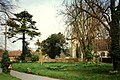
 St Mary's Church, Westwell - geograph.org.uk - 3102641.jpg 4 000 × 3 000 ; 4,07 Mio
-
 Stile at sunset - geograph.org.uk - 1143551.jpg 640 × 480 ; 105 kio
-
 T Denne and Sons Mill in 1987 - geograph.org.uk - 1885944.jpg 800 × 560 ; 98 kio
-
 The A20, Potter's Corner - geograph.org.uk - 3429275.jpg 2 048 × 1 536 ; 1,47 Mio
-
 The A20, Potter's Corner - geograph.org.uk - 4905487.jpg 2 048 × 1 536 ; 1,48 Mio
-
 The branch line to Charing - geograph.org.uk - 1325777.jpg 640 × 480 ; 108 kio
-
 The green at Westwell - geograph.org.uk - 2926364.jpg 816 × 612 ; 165 kio
-
 The lane between The Mill and the crossroads - geograph.org.uk - 2927555.jpg 816 × 612 ; 172 kio
-
 The M20 towards the M25 and London - geograph.org.uk - 4064972.jpg 1 600 × 1 200 ; 1,08 Mio
-
 The Mill at Westwell - geograph.org.uk - 2926421.jpg 816 × 612 ; 119 kio
-
 The Mill Business Park - geograph.org.uk - 1885973.jpg 620 × 465 ; 112 kio
-
 The Mill House, Westwell - geograph.org.uk - 1502087.jpg 640 × 427 ; 80 kio
-
 The North Downs Way by Dunn Street - geograph.org.uk - 4923254.jpg 4 608 × 3 456 ; 5,21 Mio
-
 The North Downs Way by Stubyer's Wood - geograph.org.uk - 4923249.jpg 4 608 × 3 456 ; 5,2 Mio
-

-
 The Wheel Inn, Westwell - geograph.org.uk - 1344472.jpg 640 × 480 ; 66 kio
-
 The Wheel Inn, Westwell - geograph.org.uk - 2068349.jpg 2 304 × 3 072 ; 1,66 Mio
-
 The Wheel Inn, Westwell, Kent - geograph.org.uk - 2625932.jpg 640 × 401 ; 223 kio
-
 The Woolpack - geograph.org.uk - 3040584.jpg 640 × 480 ; 61 kio
-
 The Woolpack, Hothfield Common - geograph.org.uk - 2077067.jpg 3 488 × 2 616 ; 2,04 Mio
-
 Track by Stubyers Wood - geograph.org.uk - 6026906.jpg 1 024 × 768 ; 411 kio
-
 Track near Kent Gliding Club - geograph.org.uk - 6026909.jpg 1 024 × 768 ; 506 kio
-
 Track to Home Farm - geograph.org.uk - 1325961.jpg 640 × 360 ; 57 kio
-
 Trailer in Wrotham Wood - geograph.org.uk - 1764379.jpg 640 × 480 ; 141 kio
-

-
 Tumbledown Hill - geograph.org.uk - 5862596.jpg 1 024 × 684 ; 266 kio
-
 Tumbledown Hill enters Westwell - geograph.org.uk - 5862602.jpg 1 024 × 768 ; 363 kio
-

-
 View by the A20, Potter's Corner - geograph.org.uk - 3429274.jpg 2 048 × 1 536 ; 1,47 Mio
-
 View from below Giddyhorn Toll - geograph.org.uk - 1325975.jpg 640 × 360 ; 64 kio
-
 View from North Downs Way - geograph.org.uk - 1326002.jpg 640 × 360 ; 37 kio
-
 View from the North Downs Way - geograph.org.uk - 4619139.jpg 1 600 × 1 067 ; 629 kio
-
 View to Dean Court - geograph.org.uk - 1455907.jpg 640 × 360 ; 55 kio
-
 View to Dean Court - geograph.org.uk - 1491523.jpg 640 × 427 ; 84 kio
-
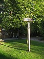
 Village Green and Village Sign - geograph.org.uk - 1344480.jpg 640 × 480 ; 126 kio
-
 Water wheel and Mill House, Westwell - geograph.org.uk - 2210637.jpg 1 150 × 780 ; 509 kio
-
 Water Wheel of the Mill House - geograph.org.uk - 1502091.jpg 427 × 640 ; 101 kio
-
 Watery Lane - geograph.org.uk - 2510273.jpg 554 × 415 ; 112 kio
-
 Watery Lane in 1987 - geograph.org.uk - 2476966.jpg 1 123 × 787 ; 186 kio
-
 Westwell - geograph.org.uk - 2210631.jpg 1 119 × 735 ; 505 kio
-
 Westwell - geograph.org.uk - 2210633.jpg 1 132 × 754 ; 577 kio
-
 Westwell Lane - geograph.org.uk - 3042247.jpg 640 × 480 ; 75 kio
-
 Westwell Lane Bridge - geograph.org.uk - 4612437.jpg 640 × 376 ; 41 kio
-
 Westwell Lane over the M20 Motorway - geograph.org.uk - 1325794.jpg 640 × 480 ; 89 kio
-
 Westwell Lane over the railways - geograph.org.uk - 1325787.jpg 640 × 480 ; 63 kio
-
 Westwell Village Fete - geograph.org.uk - 3100335.jpg 4 000 × 3 000 ; 4,28 Mio
-
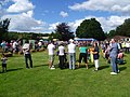 Westwell Village Fete - geograph.org.uk - 3102628.jpg 4 000 × 3 000 ; 4,25 Mio
-
 Westwell Village Green - geograph.org.uk - 3102633.jpg 3 000 × 4 000 ; 4,17 Mio
-
 Westwell Village Sign - geograph.org.uk - 2068352.jpg 2 304 × 3 072 ; 2,87 Mio
-
 Westwell Water Works - geograph.org.uk - 1245047.jpg 640 × 480 ; 53 kio
-
 Westwell, Converted oast house 3 - geograph.org.uk - 5528414.jpg 5 520 × 3 680 ; 4,98 Mio
-
 Westwell, Kent - geograph.org.uk - 2627498.jpg 640 × 480 ; 149 kio
-
 Wheat field below Westwell Downs - geograph.org.uk - 5862105.jpg 1 024 × 768 ; 404 kio
-
 The lane from Westwell to Challock - geograph.org.uk - 385447.jpg 640 × 480 ; 136 kio
-
 Westwell village green - geograph.org.uk - 68309.jpg 428 × 640 ; 92 kio


