Category:Wetheral
Aller à la navigation
Aller à la recherche
English: Wetheral is a village and civil parish in the City of Carlisle in Cumbria, England. At the 2001 census it had a population of 5,203. The village serves mostly as a dormitory community for nearby Carlisle. Along with nearby Scotby, and the merged villages of Warwick Bridge, Corby Hill and Little Corby, it is one of the most affluent areas of North Cumbria.
ville du Royaume-Uni  | |||||
| Téléverser des médias | |||||
| Nature de l’élément | |||||
|---|---|---|---|---|---|
| Lieu | cité de Carlisle, Cumbria, Angleterre du Nord-Ouest, Angleterre | ||||
 | |||||
Sous-catégories
Cette catégorie comprend 18 sous-catégories, dont les 18 ci-dessous.
A
- Aglionby (3 F)
- Allenwood, Cumbria (4 F)
B
- Broadwath (4 F)
C
- Corby Bridge (14 F)
- Corby Viaduct (2 F)
G
H
S
- Scotby Bridge (1 F)
- St Constantine's Cells (1 F)
W
- Warwick Bridge (bridge) (4 F)
- Wetheral Priory (9 F)
- Wetheral railway station (14 F)
Média dans la catégorie « Wetheral »
Cette catégorie comprend 516 fichiers, dont les 200 ci-dessous.
(page précédente) (page suivante)-
 "Flights of Fancy" stone seat - geograph.org.uk - 2622960.jpg 483 × 640 ; 314 kio
-
 156469 approaching Wetheral (Cumbria) - June 2016 - geograph.org.uk - 5003918.jpg 1 250 × 862 ; 994 kio
-
 158796 at Duncowfold - May 2017 - geograph.org.uk - 5405315.jpg 1 500 × 843 ; 1,49 Mio
-
 46233 'Duchess of Sutherland' - geograph.org.uk - 2993210.jpg 640 × 428 ; 67 kio
-
 A bridleway to Scotby Shield - geograph.org.uk - 2938202.jpg 800 × 600 ; 134 kio
-
 A corner of Atkinson's Plantation - geograph.org.uk - 5535176.jpg 640 × 427 ; 405 kio
-
 A path heading towards Warwick-on-Eden - geograph.org.uk - 2938275.jpg 800 × 600 ; 100 kio
-
 A path leading towards Wetheral Plain - geograph.org.uk - 2938196.jpg 800 × 600 ; 182 kio
-
 A red sandstone bus stop - geograph.org.uk - 4303863.jpg 640 × 485 ; 425 kio
-
 A69 Eastbound, near Warwick-on-Eden - geograph.org.uk - 3191050.jpg 640 × 481 ; 449 kio
-
 A69 heading east - geograph.org.uk - 3209619.jpg 640 × 480 ; 71 kio
-
 A69 Junction with the M6 Motorway - geograph.org.uk - 6005177.jpg 4 160 × 3 120 ; 3,24 Mio
-
 A69 Westbound - geograph.org.uk - 3191057.jpg 640 × 481 ; 469 kio
-
 A69 westbound at Warwick-on-Eden - geograph.org.uk - 3551624.jpg 640 × 479 ; 107 kio
-
 A69 westbound in Warwick Bridge - geograph.org.uk - 3551352.jpg 640 × 481 ; 64 kio
-
 A69 westbound near Whoof House - geograph.org.uk - 3551636.jpg 640 × 481 ; 60 kio
-
 A69-Plains Road junction - geograph.org.uk - 3551628.jpg 640 × 480 ; 75 kio
-

-
 Aglionby sewage works - geograph.org.uk - 4609139.jpg 640 × 480 ; 439 kio
-
 All Saints' Church, Scotby - April 2017 (1) - geograph.org.uk - 5355157.jpg 1 500 × 1 195 ; 1,63 Mio
-
 All Saints' Church, Scotby - April 2017 (2) - geograph.org.uk - 5355163.jpg 812 × 1 200 ; 696 kio
-
 An expanse of sand deposited by floodwater - geograph.org.uk - 4898625.jpg 640 × 480 ; 423 kio
-
 Apartment Block at Warwick Bridge - geograph.org.uk - 5408395.jpg 3 777 × 2 359 ; 2,02 Mio
-
 Approaching Junction 43 heading north - geograph.org.uk - 2948486.jpg 640 × 450 ; 63 kio
-
 Barn at Birkhill Farm - geograph.org.uk - 4234553.jpg 640 × 480 ; 157 kio
-
 Bridge NEC2-160, Newcastle-Carlisle Railway - geograph.org.uk - 2622939.jpg 640 × 484 ; 380 kio
-
 Bridge over the Wash Beck - geograph.org.uk - 2622906.jpg 640 × 480 ; 363 kio
-
 Bridleway, Stripes - geograph.org.uk - 1870192.jpg 640 × 480 ; 213 kio
-
 Bus going through the Narrows at Cotehill - geograph.org.uk - 3668374.jpg 640 × 480 ; 339 kio
-

-

-
 Cairn Beck fish pass - geograph.org.uk - 2975835.jpg 480 × 640 ; 322 kio
-
 Carlisle golf course - geograph.org.uk - 2525534.jpg 1 024 × 768 ; 1,01 Mio
-
 Carlisle golf course - geograph.org.uk - 2525538.jpg 640 × 480 ; 95 kio
-
 Chapel in Cumwhinton - geograph.org.uk - 2530181.jpg 1 024 × 768 ; 604 kio
-
 Church of St John the Evangelist - geograph.org.uk - 4904071.jpg 640 × 461 ; 105 kio
-
 Church of St John the Evangelist, Cotehill - May 2017 (1) - geograph.org.uk - 5405300.jpg 1 500 × 1 021 ; 1,76 Mio
-

-
 Church of St John the Evangelist, Cotehill - May 2017 (3) - geograph.org.uk - 5405305.jpg 1 500 × 1 352 ; 1,97 Mio
-
 Church of St John the Evangelist, Cotehill - May 2017 (4) - geograph.org.uk - 5405307.jpg 1 500 × 1 001 ; 1,89 Mio
-
 Church of St John the Evangelist, Cotehill - May 2017 (5) - geograph.org.uk - 5405309.jpg 1 500 × 1 057 ; 1,85 Mio
-

-

-
 City of Carlisle , The M6 Motorway - geograph.org.uk - 4939797.jpg 6 000 × 4 000 ; 7,13 Mio
-
 City of Carlisle , The M6 Motorway - geograph.org.uk - 4939800.jpg 6 000 × 4 000 ; 5,95 Mio
-
 Co-operative store, Warwick Bridge, in 2007 - geograph.org.uk - 2975833.jpg 640 × 455 ; 324 kio
-
 Cobbled farmyard - geograph.org.uk - 3668410.jpg 640 × 480 ; 322 kio
-
 Contented cattle - geograph.org.uk - 2527068.jpg 1 024 × 768 ; 854 kio
-
 Converted church, Heads Nook - geograph.org.uk - 5027477.jpg 640 × 480 ; 359 kio
-
 Converted farm buildings, Tithebarn Hill - geograph.org.uk - 4303867.jpg 640 × 426 ; 331 kio
-
 Converted Methodist chapel - geograph.org.uk - 4716137.jpg 640 × 480 ; 401 kio
-
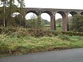
 Corby Bridge - geograph.org.uk - 1945201.jpg 3 835 × 2 575 ; 1,63 Mio
-
 Corby Bridge - geograph.org.uk - 4233792.jpg 480 × 640 ; 157 kio
-
 Corby Bridge - geograph.org.uk - 5477539.jpg 4 192 × 2 476 ; 1,43 Mio
-
 Corby Bridge Inn - geograph.org.uk - 2177608.jpg 1 024 × 768 ; 141 kio
-
 Corby Bridge signal box - geograph.org.uk - 4234580.jpg 640 × 480 ; 124 kio
-
 Corby Bridge, Wetheral - geograph.org.uk - 6155483.jpg 1 280 × 960 ; 606 kio
-
 Corby Bridge, Wetheral - geograph.org.uk - 6155513.jpg 1 280 × 960 ; 605 kio
-
 Corby Bridge, Wetheral - September 2016 - geograph.org.uk - 5127919.jpg 1 250 × 1 052 ; 1,2 Mio
-
 Corby Gates Signal Box - geograph.org.uk - 2177602.jpg 1 024 × 768 ; 167 kio
-
 Cotehill - geograph.org.uk - 4314492.jpg 800 × 600 ; 347 kio
-
 Cotehill School - geograph.org.uk - 4054344.jpg 640 × 480 ; 241 kio
-
 Cotehill Village Hall - geograph.org.uk - 3673750.jpg 640 × 427 ; 257 kio
-
 Cottages at Froddle Crook - geograph.org.uk - 5171203.jpg 640 × 480 ; 294 kio
-
 Cottages by the A69 - geograph.org.uk - 2525444.jpg 1 024 × 768 ; 738 kio
-
 Cottages by the Cotehill Viaduct - geograph.org.uk - 5170687.jpg 640 × 480 ; 245 kio
-
 Country road at Low House - geograph.org.uk - 2820661.jpg 1 024 × 575 ; 157 kio
-
 Covered reservoir at Wetheral Shield - geograph.org.uk - 5169607.jpg 640 × 480 ; 309 kio
-
 Cricket match at Wetheral (geograph 2622962).jpg 640 × 480 ; 268 kio
-
 Crown Hotel, Wetheral - geograph.org.uk - 164099.jpg 640 × 480 ; 129 kio
-
 Crown Hotel, Wetheral - geograph.org.uk - 6155459.jpg 1 280 × 960 ; 439 kio
-
 Crows gleaning in a recently harvested field - geograph.org.uk - 5169521.jpg 640 × 480 ; 229 kio
-
 Cumberland County Council drain cover - April 2017 - geograph.org.uk - 5353840.jpg 1 500 × 965 ; 1 001 kio
-
 Cumberland County Council sign at Aiketgate - geograph.org.uk - 4574417.jpg 640 × 480 ; 51 kio
-
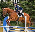
 Cumbrian Horse Trials, Warwick Hall - 22 July 2018 (1) - geograph.org.uk - 5851693.jpg 1 412 × 3 191 ; 3,55 Mio
-
 Cumbrian Horse Trials, Warwick Hall - 22 July 2018 (10) - geograph.org.uk - 5851721.jpg 1 248 × 2 578 ; 3,23 Mio
-
 Cumbrian Horse Trials, Warwick Hall - 22 July 2018 (11) - geograph.org.uk - 5851725.jpg 3 537 × 4 343 ; 3,85 Mio
-
 Cumbrian Horse Trials, Warwick Hall - 22 July 2018 (12) - geograph.org.uk - 5851736.jpg 5 431 × 4 326 ; 3,82 Mio
-
 Cumbrian Horse Trials, Warwick Hall - 22 July 2018 (13) - geograph.org.uk - 5851740.jpg 2 024 × 3 478 ; 3,66 Mio
-
 Cumbrian Horse Trials, Warwick Hall - 22 July 2018 (14) - geograph.org.uk - 5851742.jpg 2 804 × 3 375 ; 4,04 Mio
-
 Cumbrian Horse Trials, Warwick Hall - 22 July 2018 (15) - geograph.org.uk - 5851743.jpg 2 113 × 3 239 ; 3,08 Mio
-
 Cumbrian Horse Trials, Warwick Hall - 22 July 2018 (16) - geograph.org.uk - 5851746.jpg 2 393 × 3 713 ; 5,91 Mio
-
 Cumbrian Horse Trials, Warwick Hall - 22 July 2018 (17) - geograph.org.uk - 5851752.jpg 2 152 × 4 083 ; 4,21 Mio
-
 Cumbrian Horse Trials, Warwick Hall - 22 July 2018 (18) - geograph.org.uk - 5851753.jpg 3 029 × 5 172 ; 2,79 Mio
-
 Cumbrian Horse Trials, Warwick Hall - 22 July 2018 (19) - geograph.org.uk - 5851767.jpg 2 830 × 2 955 ; 4,37 Mio
-
 Cumbrian Horse Trials, Warwick Hall - 22 July 2018 (2) - geograph.org.uk - 5851697.jpg 3 793 × 4 006 ; 2,91 Mio
-
 Cumbrian Horse Trials, Warwick Hall - 22 July 2018 (20) - geograph.org.uk - 5851770.jpg 6 261 × 3 483 ; 3,89 Mio
-
 Cumbrian Horse Trials, Warwick Hall - 22 July 2018 (21) - geograph.org.uk - 5851771.jpg 5 106 × 3 711 ; 3,25 Mio
-
 Cumbrian Horse Trials, Warwick Hall - 22 July 2018 (3) - geograph.org.uk - 5851702.jpg 5 496 × 4 511 ; 2,96 Mio
-
 Cumbrian Horse Trials, Warwick Hall - 22 July 2018 (4) - geograph.org.uk - 5851705.jpg 4 853 × 4 375 ; 3,85 Mio
-
 Cumbrian Horse Trials, Warwick Hall - 22 July 2018 (5) - geograph.org.uk - 5851710.jpg 1 546 × 3 193 ; 3,51 Mio
-
 Cumbrian Horse Trials, Warwick Hall - 22 July 2018 (6) - geograph.org.uk - 5851713.jpg 4 899 × 3 562 ; 2,88 Mio
-
 Cumbrian Horse Trials, Warwick Hall - 22 July 2018 (7) - geograph.org.uk - 5851715.jpg 4 760 × 4 162 ; 3,84 Mio
-
 Cumbrian Horse Trials, Warwick Hall - 22 July 2018 (8) - geograph.org.uk - 5851718.jpg 3 346 × 3 026 ; 1,99 Mio
-
 Cumbrian Horse Trials, Warwick Hall - 22 July 2018 (9) - geograph.org.uk - 5851719.jpg 3 814 × 4 020 ; 3,07 Mio
-
 Cumwhinton Primary School - geograph.org.uk - 5169532.jpg 640 × 480 ; 259 kio
-
 Cumwhinton Station (as was) - geograph.org.uk - 5169545.jpg 640 × 480 ; 253 kio
-
 Cumwhinton village - geograph.org.uk - 2530175.jpg 640 × 480 ; 87 kio
-
 Direction Sign - Signpost by Broomfallen Road, Cumwhinton - geograph.org.uk - 6049477.jpg 1 114 × 1 668 ; 138 kio
-
 Direction Sign - Signpost on the B6263 in Cumwhinton - geograph.org.uk - 6093888.jpg 1 749 × 1 179 ; 88 kio
-
 Disused chapel, Cumwhinton - geograph.org.uk - 2530193.jpg 640 × 480 ; 114 kio
-
 Down-a-gate Community Centre - geograph.org.uk - 4303896.jpg 640 × 426 ; 381 kio
-
 Down-a-gate playing fields - geograph.org.uk - 4234609.jpg 640 × 480 ; 118 kio
-
 Dry Beck Viaduct - geograph.org.uk - 2820630.jpg 1 024 × 677 ; 114 kio
-
 Drybeck Viaduct.jpg 640 × 480 ; 97 kio
-
 Eden Bank - geograph.org.uk - 357132.jpg 640 × 427 ; 103 kio
-
 Eden Brows - geograph.org.uk - 5170670.jpg 640 × 480 ; 323 kio
-
 Eden Valley Farmland - geograph.org.uk - 5713868.jpg 640 × 425 ; 76 kio
-
 Edenbrows Wood and the River Eden - geograph.org.uk - 5493256.jpg 800 × 600 ; 101 kio
-
 Englethwaite Hall Caravan Club Site - geograph.org.uk - 2704172.jpg 1 600 × 1 200 ; 433 kio
-
 Entering Cumwhinton - geograph.org.uk - 4695929.jpg 640 × 480 ; 52 kio
-
 Entering Great Corby - geograph.org.uk - 2938295.jpg 800 × 600 ; 162 kio
-
 Entering Wetheral - geograph.org.uk - 2938224.jpg 800 × 600 ; 98 kio
-
 Entrance to Cumberland Breweries, Great Corby - geograph.org.uk - 5204010.jpg 1 250 × 930 ; 971 kio
-
 Entrance to Scotby Primary School - geograph.org.uk - 2622900.jpg 640 × 479 ; 274 kio
-
 Entrance to Wetheral Station - geograph.org.uk - 825241.jpg 640 × 480 ; 105 kio
-
 Farm Access Track, Warwick-on-Eden - geograph.org.uk - 3191053.jpg 640 × 426 ; 443 kio
-
 Farm drive to Wallace Field - geograph.org.uk - 2820697.jpg 1 024 × 575 ; 137 kio
-
 Farm track near Wrayside - geograph.org.uk - 3670110.jpg 640 × 480 ; 285 kio
-
 Farm track north of Aglionby - geograph.org.uk - 5535172.jpg 640 × 427 ; 354 kio
-
 Farm track, Cumwhinton - geograph.org.uk - 4314475.jpg 800 × 600 ; 476 kio
-
 Farmland near Rose Hill - geograph.org.uk - 3209633.jpg 640 × 480 ; 43 kio
-
 Farmland towards Healds Wood - geograph.org.uk - 3209654.jpg 640 × 480 ; 56 kio
-
 Farmland west of the M6 - geograph.org.uk - 3823059.jpg 640 × 471 ; 57 kio
-
 Farmland, Great Corby - geograph.org.uk - 3430913.jpg 640 × 480 ; 40 kio
-
 Farmland, Scotby - geograph.org.uk - 3430893.jpg 640 × 480 ; 47 kio
-
 Farmland, Warwick-on-Eden - geograph.org.uk - 3209663.jpg 640 × 480 ; 83 kio
-
 Farmland, Wetheral - geograph.org.uk - 4333980.jpg 640 × 640 ; 229 kio
-
 Farmland, Wetheral Plain - geograph.org.uk - 3430897.jpg 640 × 480 ; 46 kio
-
 Faustin Hill - Wetheral - Carlisle - UK - 2009-12-13.JPG 4 000 × 3 000 ; 5,74 Mio
-
 Fence and old sign at former landfill site - geograph.org.uk - 5484662.jpg 640 × 480 ; 360 kio
-
 Field near Long Strumble Farm - geograph.org.uk - 5170244.jpg 640 × 480 ; 316 kio
-
 Field off Peter Gate - geograph.org.uk - 5169666.jpg 640 × 481 ; 251 kio
-
 Field with sheep - geograph.org.uk - 5169564.jpg 640 × 481 ; 300 kio
-
 Field with sheep at Wetheral Pasture - geograph.org.uk - 5169622.jpg 640 × 480 ; 340 kio
-
 Field, Stripes - geograph.org.uk - 4314484.jpg 800 × 600 ; 349 kio
-
 Field, track and hedgerow north of Great Corby - geograph.org.uk - 4234464.jpg 640 × 480 ; 201 kio
-

-
 Fields at Moor Yeat - geograph.org.uk - 4429321.jpg 640 × 480 ; 67 kio
-
 Fields beside High Stand - geograph.org.uk - 4054389.jpg 640 × 480 ; 257 kio
-
 Fields by the lane to Cumwhitton - geograph.org.uk - 4235112.jpg 640 × 480 ; 119 kio
-
 Fields in the floor of the Eden valley - geograph.org.uk - 5171207.jpg 640 × 480 ; 300 kio
-
 Fields near Cotehill - geograph.org.uk - 3561362.jpg 1 024 × 768 ; 192 kio
-
 Fields with sheep near Knot Hill Farm - geograph.org.uk - 5170238.jpg 640 × 480 ; 290 kio
-

-
 Flooding by the River Eden - geograph.org.uk - 3152283.jpg 640 × 430 ; 51 kio
-
 Flooding by the River Eden - geograph.org.uk - 3152292.jpg 640 × 430 ; 41 kio
-
 Floodplain living up to its name - geograph.org.uk - 3152295.jpg 640 × 430 ; 38 kio
-
 Fly-tipped rubbish in a country lane - geograph.org.uk - 2622952.jpg 640 × 480 ; 411 kio
-
 Folly - geograph.org.uk - 2708779.jpg 2 049 × 1 754 ; 715 kio
-
 Footpath from Warwick Mill to Burnrigg Road - geograph.org.uk - 2975830.jpg 480 × 640 ; 385 kio
-
 Footpath level crossing southeast of Cumwhinton - geograph.org.uk - 5092982.jpg 480 × 640 ; 444 kio
-
 Footpath sign and sheep - geograph.org.uk - 2525565.jpg 1 024 × 768 ; 807 kio
-
 Footpath to Scotby - geograph.org.uk - 2525541.jpg 1 024 × 768 ; 1,17 Mio
-
 Former "Bay Horse", Burnrigg - September 2017 (1) - geograph.org.uk - 5553987.jpg 1 250 × 975 ; 1,35 Mio
-
 Former "Bay Horse", Burnrigg - September 2017 (2) - geograph.org.uk - 5553988.jpg 1 250 × 831 ; 1,44 Mio
-
 Former "Bay Horse", Burnrigg - September 2017 (3) - geograph.org.uk - 5553989.jpg 683 × 1 250 ; 927 kio
-
 Former "Corby Bridge Inn" - January 2017 - geograph.org.uk - 5264171.jpg 1 250 × 834 ; 867 kio
-
 Former "Horse ^ Jockey" pub - Cumwhinton - April 2017 - geograph.org.uk - 5353745.jpg 1 095 × 1 200 ; 724 kio
-
 Former "Salutation Inn", Allenwood - August 2017 (1) - geograph.org.uk - 5503595.jpg 1 250 × 858 ; 1,06 Mio
-
 Former "Salutation Inn", Allenwood - August 2017 (2) - geograph.org.uk - 5503599.jpg 1 250 × 853 ; 916 kio
-
 Former "Salutation Inn", Allenwood - August 2017 (3) - geograph.org.uk - 5503600.jpg 774 × 1 250 ; 993 kio
-
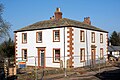
 Former Council Offices, Wetheral - November 2016 - geograph.org.uk - 5208473.jpg 1 250 × 1 038 ; 1,42 Mio
-
 Former landfill site (Duranhill South Sidings) - geograph.org.uk - 5484654.jpg 640 × 480 ; 360 kio
-
 Froddle Crook - geograph.org.uk - 2820982.jpg 1 024 × 682 ; 254 kio
-
 Frozen to the spot^ - geograph.org.uk - 5204008.jpg 1 250 × 1 152 ; 1,78 Mio
-
 Gable end - geograph.org.uk - 935473.jpg 640 × 480 ; 147 kio
-
 Gates Near High Wood - geograph.org.uk - 825267.jpg 640 × 480 ; 86 kio
-
 Gateway to Froddle Crook Cottage - geograph.org.uk - 5170619.jpg 640 × 480 ; 396 kio
-
 Gateway to the Corby Castle Estate - geograph.org.uk - 4234542.jpg 640 × 480 ; 190 kio
-
 George pub sign, Warwick Bridge 2007 - geograph.org.uk - 2975834.jpg 640 × 479 ; 344 kio
-
 Ghyll Road, Scotby - geograph.org.uk - 2937791.jpg 800 × 600 ; 99 kio
-
 Graveyard at St Leonard's Church - geograph.org.uk - 4303852.jpg 640 × 480 ; 469 kio
-
 Grazing and pylon near Cringles Farm - geograph.org.uk - 4695925.jpg 640 × 480 ; 37 kio
-
 Grazing land beside the Eden river - geograph.org.uk - 2421306.jpg 640 × 480 ; 80 kio
-
 Grazing near Cringles Farm - geograph.org.uk - 4695923.jpg 640 × 480 ; 49 kio
-
 Grazing near Duncowfold - geograph.org.uk - 3823053.jpg 640 × 447 ; 54 kio
-
 Grazing near Scotby Shield - geograph.org.uk - 3819714.jpg 640 × 440 ; 84 kio
-
 Grazing near Wetheral Shield - geograph.org.uk - 3823057.jpg 640 × 483 ; 58 kio
-
 Grazing north of Cumwhinton - geograph.org.uk - 3823058.jpg 640 × 455 ; 60 kio
-
 Grazing towards Brackenbank Wood - geograph.org.uk - 3820663.jpg 640 × 475 ; 51 kio
-
 Grazing towards Edenbrows Wood - geograph.org.uk - 3823052.jpg 640 × 478 ; 65 kio
-
 Grazing, Wallace Field - geograph.org.uk - 3819705.jpg 640 × 482 ; 64 kio
-
 Great Corby - village scene - geograph.org.uk - 4716263.jpg 640 × 427 ; 456 kio
-
 Great Corby Village Hall - geograph.org.uk - 4716106.jpg 640 × 480 ; 317 kio
-
 Great Corby War Memorial - geograph.org.uk - 4716118.jpg 480 × 640 ; 438 kio
-
 Harvested field in the Eden Valley - geograph.org.uk - 5493260.jpg 800 × 600 ; 125 kio
-
 Hay bales, Cumwhinton - geograph.org.uk - 4055703.jpg 640 × 480 ; 266 kio
-
 Heading east towards Cumwhinton - geograph.org.uk - 4695926.jpg 640 × 480 ; 46 kio
-
 Heading north from Cumwhinton - geograph.org.uk - 4695931.jpg 640 × 480 ; 55 kio
-
 Heads Nook Village Hall - geograph.org.uk - 5029352.jpg 640 × 480 ; 399 kio
-
 Heritage Open Day - Warwick Bridge Mill - geograph.org.uk - 5977056.jpg 640 × 480 ; 83 kio
-
 High Stand Plantation - geograph.org.uk - 4054373.jpg 640 × 480 ; 357 kio
-
 High Stand Plantation - geograph.org.uk - 4054382.jpg 640 × 480 ; 283 kio
-
 High Stand Plantation - geograph.org.uk - 4232428.jpg 640 × 480 ; 118 kio
-
 Holme Eden Church - geograph.org.uk - 1166764.jpg 640 × 480 ; 138 kio
-
 Holme Eden Lodge - geograph.org.uk - 1480851.jpg 640 × 480 ; 103 kio
-
 Holme Eden War Memorial - geograph.org.uk - 1483784.jpg 640 × 480 ; 138 kio
-
 Holme Gate Farm - geograph.org.uk - 862584.jpg 640 × 480 ; 348 kio
-
 Honeysuckle on an old field gate - geograph.org.uk - 3668400.jpg 640 × 446 ; 180 kio

_-_June_2016_-_geograph.org.uk_-_5003918.jpg)


_-_geograph.org.uk_-_5355157.jpg)
_-_geograph.org.uk_-_5355163.jpg)


.jpg)
_(12001016663).jpg)


_-_geograph.org.uk_-_5405300.jpg)
_-_geograph.org.uk_-_5405301.jpg)
_-_geograph.org.uk_-_5405305.jpg)
_-_geograph.org.uk_-_5405307.jpg)
_-_geograph.org.uk_-_5405309.jpg)


.jpg)


_-_geograph.org.uk_-_5851693.jpg)
_-_geograph.org.uk_-_5851721.jpg)
_-_geograph.org.uk_-_5851725.jpg)
_-_geograph.org.uk_-_5851736.jpg)
_-_geograph.org.uk_-_5851740.jpg)
_-_geograph.org.uk_-_5851742.jpg)
_-_geograph.org.uk_-_5851743.jpg)
_-_geograph.org.uk_-_5851746.jpg)
_-_geograph.org.uk_-_5851752.jpg)
_-_geograph.org.uk_-_5851753.jpg)
_-_geograph.org.uk_-_5851767.jpg)
_-_geograph.org.uk_-_5851697.jpg)
_-_geograph.org.uk_-_5851770.jpg)
_-_geograph.org.uk_-_5851771.jpg)
_-_geograph.org.uk_-_5851702.jpg)
_-_geograph.org.uk_-_5851705.jpg)
_-_geograph.org.uk_-_5851710.jpg)
_-_geograph.org.uk_-_5851713.jpg)
_-_geograph.org.uk_-_5851715.jpg)
_-_geograph.org.uk_-_5851718.jpg)
_-_geograph.org.uk_-_5851719.jpg)

_-_geograph.org.uk_-_5169545.jpg)


_-_geograph.org.uk_-_5553987.jpg)
_-_geograph.org.uk_-_5553988.jpg)
_-_geograph.org.uk_-_5553989.jpg)


_-_geograph.org.uk_-_5503595.jpg)
_-_geograph.org.uk_-_5503599.jpg)
_-_geograph.org.uk_-_5503600.jpg)

_-_geograph.org.uk_-_5484654.jpg)


