Category:Whatcom County, Washington
Vai alla navigazione
Vai alla ricerca
Counties of Washington (state): Adams · Asotin · Benton · Chelan · Clallam · Clark · Columbia · Cowlitz · Douglas · Ferry · Franklin · Garfield · Grant · Grays Harbor · Island · Jefferson · King · Kitsap · Kittitas · Klickitat · Lewis · Lincoln · Mason · Okanogan · Pacific · Pend Oreille · Pierce · San Juan · Skagit · Skamania · Snohomish · Spokane · Stevens · Thurston · Wahkiakum · Walla Walla · Whatcom · Whitman · Yakima
contea statunitense dello stato di Washington    | |||||
| Carica un file multimediale | |||||
| Istanza di | |||||
|---|---|---|---|---|---|
| Luogo | Washington, Pacifico nordoccidentale, Washington, Stati del Pacifico | ||||
| Capitale | |||||
| Data di fondazione o creazione |
| ||||
| Popolazione |
| ||||
| Superficie |
| ||||
| sito web ufficiale | |||||
 | |||||
Sottocategorie
Questa categoria contiene le 51 sottocategorie indicate di seguito, su un totale di 51.
B
- Bellingham Bay (54 F)
C
- Chuckanut Bay (6 F)
- Custer, Washington (6 F)
D
- Desolation Peak Lookout (8 F)
F
- Fort Bellingham (2 F)
G
- Gorge Creek Falls (11 F)
H
- Hiking at Mount Baker (24 F)
K
- KRPI (1 F)
L
- Lawrence, Washington (1 F)
M
- Maple Falls, Washington (9 F)
N
- Nooksack Falls (45 F)
P
- Padden Creek (10 F)
- Paul Bunyans Stump (11 F)
R
- Racehorse Falls (4 F)
S
- Sehome Hill (36 F)
- Semiahmoo Harbor Light (1 F)
- South Whatcom Fire Authority (3 F)
T
File nella categoria "Whatcom County, Washington"
Questa categoria contiene 126 file, indicati di seguito, su un totale di 126.
-
 2022-04-26 02 Banner Image for WikiV topic, Lummi Island WA USA.jpg 6 048 × 864; 3,75 MB
-
-

-
 Bellingham, WA, USA - panoramio (1).jpg 1 536 × 2 048; 2,79 MB
-
 Bellingham, WA, USA - panoramio (2).jpg 5 020 × 2 496; 3,74 MB
-
 Brenda and Jerry resting in the Shade - Flickr - brewbooks.jpg 3 264 × 1 932; 3,76 MB
-

-

-

-
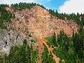
 Chuckanut Quarry, Chuckanut, Washington, July 29, 1900 (KIEHL 284).jpeg 767 × 599; 128 KB
-
 Climbing up Rainy Pass (1458001284).jpg 1 024 × 768; 769 KB
-
 Clouds over a mountain valley (Unsplash).jpg 5 472 × 3 648; 9,69 MB
-
 Clouds rolling over North Cascades near Diablo Lake (1667741904).jpg 948 × 621; 249 KB
-
 Colonial Peak.jpg 3 264 × 2 448; 3,48 MB
-
 Custer Substation (33233588643).jpg 948 × 628; 239 KB
-
 Cyrus Gates Overlook - Flickr - brewbooks.jpg 3 264 × 2 448; 3,19 MB
-
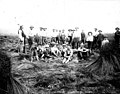
 Davis Ranch, 1919 (29800354293).jpg 1 200 × 1 163; 310 KB
-
 Easton Glacier - Flickr - brewbooks.jpg 4 128 × 3 096; 1,91 MB
-

-
 Energy for the way most people in USA travel (14374851269).jpg 2 308 × 1 731; 933 KB
-

-
-

-
 Flax field, Whatcom Co, Washington, 1893 (INDOCC 128).jpg 768 × 591; 117 KB
-
 Flickr - brewbooks - Centipede Cloud (1).jpg 1 785 × 1 679; 604 KB
-
 Flickr - brewbooks - Centipede Cloud.jpg 2 043 × 1 484; 922 KB
-
 Flickr - brewbooks - i081206 113.jpg 2 592 × 1 944; 1,63 MB
-
 Flickr - brewbooks - i081206 115.jpg 2 592 × 1 944; 1,64 MB
-
 Flickr - brewbooks - i081206 117.jpg 2 592 × 1 663; 1,24 MB
-
 Flickr - brewbooks - i081206 123.jpg 2 592 × 1 808; 1,47 MB
-
 Flickr - brewbooks - i081206 125.jpg 2 592 × 1 944; 1,56 MB
-
 Flickr - brewbooks - i081206 128.jpg 2 592 × 1 944; 1,54 MB
-
 Flickr - brewbooks - i081206 138.jpg 2 592 × 1 944; 1,12 MB
-
 Flickr - brewbooks - Looking up to site of Lake Ann.jpg 2 592 × 1 944; 1,51 MB
-
 Flickr - brewbooks - metamorphosed banded chert (3).jpg 2 592 × 1 944; 1,71 MB
-
 Flickr - brewbooks - Silk Road Plant Display.jpg 2 729 × 2 218; 2,74 MB
-
 FMIB 34446 Samish Salmon Hatchery, Showing New Concrete Rearing Ponds.jpeg 1 010 × 555; 126 KB
-

-
 From Brown Road in Whatcom County (34043150293).jpg 2 304 × 1 728; 1,26 MB
-
 From Nooksack River Dike Trail (32546959422).jpg 1 536 × 1 152; 666 KB
-
 From Toad Lake Road. (36336660536).jpg 2 304 × 1 728; 724 KB
-
 From Toad Lake Road. (36381260815).jpg 2 304 × 1 728; 1,35 MB
-
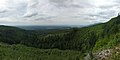
 Galbraith Mountain Bellingham view.jpg 2 240 × 1 364; 1,23 MB
-
 Glorious North Cascades (Unsplash).jpg 3 787 × 5 681; 9,63 MB
-
 Gravel pit in Whatcom County, Washington , 1918 (INDOCC 1738).jpg 768 × 588; 57 KB
-
 Group of Nooksack Indians with Old Tolowie, ca 1903 (MOHAI 6485).jpg 700 × 439; 60 KB
-
 Heliotrope Hike - Coleman Ridge - panoramio (1).jpg 6 442 × 3 014; 6,6 MB
-
 Heliotrope Hike - Coleman Ridge - panoramio.jpg 2 448 × 3 264; 2,73 MB
-
 Highway 20 in North Cascades (37059157505).jpg 2 048 × 1 536; 1,83 MB
-
 Interstate 5 southbound, south of Bellingham, WA near Lake Padden 01.jpg 6 000 × 4 000; 10,27 MB
-
 Interstate 5 southbound, south of Bellingham, WA near Lake Padden 02.jpg 6 000 × 4 000; 11,08 MB
-
 Jack Mountain North Cascades.jpg 5 066 × 4 330; 20,48 MB
-
 Jackson Glacier (4457629441).jpg 2 272 × 1 704; 1,23 MB
-
 Joules Graves January 2021 - 01.jpg 6 000 × 4 000; 12,07 MB
-
 Joules Graves January 2021 - 02.jpg 6 000 × 4 000; 13,28 MB
-
 Joules Graves January 2021 - 03.jpg 6 000 × 4 000; 12,09 MB
-
 Lincoln Peak - Flickr - brewbooks.jpg 4 608 × 3 456; 3,85 MB
-
 Loggers at Hozomeen Camp, 1953.jpg 3 051 × 2 449; 3,36 MB
-

-

-
 Marmot King of the Hill - Flickr - brewbooks.jpg 4 128 × 2 192; 1,35 MB
-
 Marmotville - Flickr - brewbooks (1).jpg 4 128 × 3 096; 1,5 MB
-
 Marmotville - Flickr - brewbooks (2).jpg 2 786 × 2 391; 545 KB
-
 Marmotville - Flickr - brewbooks (3).jpg 3 709 × 2 093; 1,19 MB
-
 Marmotville - Flickr - brewbooks (4).jpg 4 128 × 3 096; 1,18 MB
-
 Marmotville - Flickr - brewbooks (5).jpg 3 932 × 3 096; 2,39 MB
-
 Marmotville - Flickr - brewbooks (6).jpg 4 128 × 3 096; 1,4 MB
-
 Marmotville - Flickr - brewbooks.jpg 3 724 × 2 734; 1,28 MB
-
 Mazama - panoramio.jpg 1 880 × 2 816; 6,29 MB
-
-

-
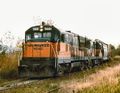 MILW U30B 5601.jpg 652 × 505; 82 KB
-
 Mist on Winchester Mountain (Unsplash).jpg 2 500 × 1 604; 1,29 MB
-
 Mountain in the Clouds - Flickr - brewbooks.jpg 3 096 × 3 924; 1,44 MB
-
 Mountaineers on a snowy peak (Unsplash).jpg 5 858 × 3 905; 12,76 MB
-
 My Bigfoot sighting (1457138061).jpg 768 × 1 024; 783 KB
-
 Near Ross Lake (1458000842).jpg 768 × 1 024; 658 KB
-
 Neve Glacier from PCT near Slate Pass.JPG 4 608 × 3 456; 3,51 MB
-
 North Cascades National Park, United States (Unsplash a38486QPWfY).jpg 3 000 × 1 688; 3,77 MB
-
 North from maple beach.jpg 3 072 × 2 048; 1,67 MB
-
 North Lake Samish Drive overpass over southbound Interstate 5.jpg 6 000 × 4 000; 11,52 MB
-
 Not Fire But Fog (231766343).jpeg 2 048 × 1 365; 324 KB
-
-
 Passing back side of BP Oil Refinery near Point Whitehorn Road (18149293266).jpg 2 304 × 1 728; 1,1 MB
-
 Pylon at Hannegan Road near Bellingham, Washington US 2017 A.jpg 2 308 × 1 731; 1,51 MB
-
 Pylon at Hannegan Road near Bellingham, Washington US 2017 B.jpg 2 304 × 1 728; 1,66 MB
-
 Quiet before the storm (Unsplash).jpg 4 000 × 5 000; 5,44 MB
-
 Quite a sunset near Highway 9 east of Bellingham (14534755657).jpg 2 304 × 1 728; 987 KB
-
 Rock and Roll Trail head - panoramio.jpg 2 448 × 3 264; 3,98 MB
-
 Roundabout entering Blaine Washington - panoramio.jpg 4 000 × 3 000; 2,12 MB
-
 Rufus Creek Falls in Lookout Mountain Preserve, Sudden Valley, WA.jpg 3 024 × 4 032; 4,32 MB
-
 Sheridian Trail - panoramio (1).jpg 2 448 × 3 264; 2,7 MB
-
 Sheridian Trail - panoramio.jpg 2 448 × 3 264; 1,64 MB
-
 Sky1232323.JPG 3 264 × 2 448; 2,51 MB
-
 Slater Road entrance to Noocksac Dike Trail (32616252903).jpg 4 608 × 3 456; 5,06 MB
-
 Standing near Easton Glacier - Flickr - brewbooks.jpg 3 890 × 2 715; 1,86 MB
-

-

-
 Stimpson Family Nature Reserve, Bellingham, United States (Unsplash).jpg 4 032 × 3 024; 3,9 MB
-
 Summer - panoramio (27).jpg 3 264 × 2 448; 2,19 MB
-
 Sunrise ride (9209678177).jpg 2 304 × 1 728; 586 KB
-
 Sunrise ride (9212462782).jpg 2 304 × 1 728; 583 KB
-
 The Road Back (138544701).jpeg 1 463 × 2 048; 562 KB
-
 The sunset looked like fire soon after I arrived (14698190566).jpg 2 304 × 1 728; 657 KB
-
 This is actually sunset (14741052743).jpg 2 304 × 1 728; 874 KB
-
 Thunder Creek - Flickr - brewbooks.jpg 3 264 × 2 448; 3,74 MB
-
 USA Whatcom County, Washington age pyramid.svg 520 × 600; 8 KB
-
 Van Zandt, WA - Everybodys Store 01.jpg 6 000 × 4 000; 10,51 MB
-
 Van Zandt, WA - former church 01.jpg 4 512 × 2 888; 5,79 MB
-
 View from tower.jpg 3 941 × 2 955; 3,6 MB
-

-
 View of Twin Sisters - Flickr - brewbooks.jpg 2 897 × 1 726; 1,08 MB
-
 Waterfall along Rainy Pass (36871038356).jpg 2 048 × 1 536; 2,92 MB
-
 Waterfall and creek in woods (Unsplash).jpg 3 914 × 4 893; 5,26 MB
-
 Waterfall feeding Thunder Creek - Flickr - brewbooks (1).jpg 2 448 × 3 264; 5,06 MB
-
 Waterfall feeding Thunder Creek - Flickr - brewbooks.jpg 3 264 × 2 448; 4,24 MB
-
 Wells Creek Falls.JPG 2 736 × 3 648; 2,5 MB
-
 Whatcom County Sheriff's Office- Stealth Dodge Charger (17248379812).jpg 5 184 × 3 456; 3,93 MB
-
 White clouds around snowy mountains (Unsplash).jpg 3 992 × 2 242; 4,45 MB
-
 Winter sunset from Marine Drive, Bellingham Bay (8375245917).jpg 800 × 600; 158 KB
-
 Woman fishing near Diablo Dam, 1953.jpg 1 200 × 1 142; 125 KB
-
 구름으로 덮힌 Mt. Baker WA - panoramio.jpg 2 304 × 1 728; 1,65 MB
-
 설경 Mt. Baker WA - panoramio.jpg 2 304 × 1 728; 1,69 MB
-
 설경에 덮힌 가을 Mt. Baker WA - panoramio.jpg 2 304 × 1 728; 1,75 MB
-
 시월의 마지막 날 North Cascades WA - panoramio.jpg 2 304 × 1 728; 1,73 MB
-
 정상으로 가는 길 Mt. Baker WA - panoramio.jpg 2 304 × 1 728; 1,89 MB
.jpg)
.jpeg)
.jpg)
.jpg)

.jpg)
.jpeg)
.jpg)
.jpeg)
.jpg)
.jpg)
.jpg)

.jpg)

.jpg)

.jpg)
.jpg)
.jpeg)
.jpeg)
.jpeg)
.jpg)
.jpg)


.jpg)


.jpeg)
.jpg)
.jpg)
.jpg)
.jpg)

.jpg)
.jpg)
.jpg)
.jpg)

.jpg)


.jpg)


,_ca_1919_(SPWS_620).jpg)
.jpg)

.jpg)
.jpg)
.jpg)
.jpg)
.jpg)
.jpg)


.jpg)
.jpg)

.jpg)

.jpg)
.jpg)
.jpg)

.jpg)


.jpeg)

.jpg)


.jpg)
.jpg)


.jpg)


.jpg)

.jpg)
.jpg)
.jpg)
.jpg)
.jpg)
.jpg)
.jpeg)
.jpg)
.jpg)


.jpeg)

.jpg)
.jpg)
.jpg)


.jpg)
.jpg)
.jpg)


