Category:Whitebridge, Scotland
Jump to navigation
Jump to search
village in Highland, Scotland, UK  | |||||
| Upload media | |||||
| Instance of | |||||
|---|---|---|---|---|---|
| Location |
| ||||
 | |||||
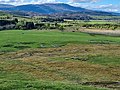
English: Whitebridge is a small village on the southeast side of Loch Ness in central Scotland. It is roughly 25 miles from Inverness and eight miles from Fort Augustus. Whitebridge is home to fewer than 100 people spread over roughly 5 miles. It is a very popular tourist destination. Most of the permanent residents are farmers or gamekeepers, or commute to work in Inverness. Most children attend Stratherrick Primary School in the neighbouring village of Gorthleck.
Subcategories
This category has only the following subcategory.
Media in category "Whitebridge, Scotland"
The following 33 files are in this category, out of 33 total.
-
 Abandoned settlement near Whitebridge.jpg 4,032 × 3,024; 3.26 MB
-
 Allt na Caillich above River Fechlin - geograph.org.uk - 835246.jpg 640 × 359; 94 KB
-

-
 Cattle grazing in field - geograph.org.uk - 588721.jpg 640 × 426; 103 KB
-
 Cumrack Burn from Brein Lodge - geograph.org.uk - 800156.jpg 640 × 480; 71 KB
-
 View from Whitebridge Hotel Carpark - geograph.org.uk - 1022886.jpg 640 × 480; 53 KB
-
 Whitebridge - 1981 - geograph.org.uk - 2249127.jpg 2,272 × 1,514; 370 KB
-
 Whitebridge - geograph.org.uk - 2300739.jpg 3,447 × 2,536; 3.81 MB
-

-
 Whitebridge Hotel - geograph.org.uk - 1855061.jpg 800 × 627; 140 KB
-
 Whitebridge Hotel.jpg 4,032 × 3,024; 4.38 MB
-
 Whitebridge old bridge 1.jpg 4,032 × 3,024; 6.57 MB
-
 Whitebridge old bridge 3.jpg 4,032 × 3,024; 7 MB
-
 Whitebridge old bridge.jpg 3,024 × 4,032; 4.58 MB
-
 A fast flowing Burn - geograph.org.uk - 573065.jpg 480 × 640; 296 KB
-
 Allt Breineag Near Whitebridge - geograph.org.uk - 1067831.jpg 640 × 480; 113 KB
-
 Allt Brieneag Near Whitebridge - geograph.org.uk - 1067838.jpg 640 × 480; 112 KB
-
 Allt Dubh Cuil na Creige - geograph.org.uk - 792397.jpg 640 × 480; 91 KB
-
 Allt Dubh Cuil na Creige Ford - geograph.org.uk - 792718.jpg 640 × 480; 126 KB
-
 Allt Dubh Cùil na Creige Track - geograph.org.uk - 829881.jpg 640 × 480; 87 KB
-

-
 Beinn Mheadhoin above Glac an Lòin - geograph.org.uk - 800985.jpg 640 × 431; 58 KB
-

-
 Beinn Mheadhoin from Across Allt Dubh - geograph.org.uk - 812616.jpg 640 × 380; 39 KB
-

-
 Beul a' Chasain Looking North - geograph.org.uk - 795404.jpg 640 × 480; 47 KB
-
 Beul a' Chasain Top 707m - geograph.org.uk - 800512.jpg 640 × 480; 74 KB
-
 Beul a' Chasain Tops - geograph.org.uk - 800613.jpg 640 × 480; 69 KB
-
 Compass farmyard - geograph.org.uk - 499150.jpg 640 × 480; 48 KB
-
 Grazing at Whitebridge - geograph.org.uk - 499144.jpg 640 × 480; 62 KB
-
 Loch Knockie - geograph.org.uk - 499124.jpg 640 × 427; 41 KB
-
 Mouth of the Allt an t-Sluichd - geograph.org.uk - 488627.jpg 640 × 480; 292 KB
-
 The River Fechlin at White Bridge - geograph.org.uk - 573020.jpg 640 × 480; 288 KB


