Category:Whorlton, North Yorkshire
Jump to navigation
Jump to search
hamlet and civil parish in North Yorkshire, UK  | |||||
| Upload media | |||||
| Instance of | |||||
|---|---|---|---|---|---|
| Location | Hambleton, North Yorkshire, Yorkshire and the Humber, England | ||||
| Population |
| ||||
| Area |
| ||||
 | |||||
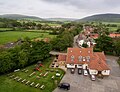
English: Whorlton is a hamlet and civil parish in the Hambleton district of North Yorkshire, England. It is very near Swainby and the A19, and 6 miles south west of Stokesley. Features include the remains of Whorlton Castle and the Church of the Holy Rood.
Subcategories
This category has the following 4 subcategories, out of 4 total.
Media in category "Whorlton, North Yorkshire"
The following 200 files are in this category, out of 467 total.
(previous page) (next page)-
 'Traffic Diverted' Sign - geograph.org.uk - 2704275.jpg 640 × 427; 239 KB
-
 A dip ^ a rise - geograph.org.uk - 3840705.jpg 4,000 × 3,000; 3.34 MB
-
 A moorjock on Barker’s Ridge - geograph.org.uk - 5949217.jpg 640 × 427; 82 KB
-
 A172 between Ingleby Cross and Swainby - geograph.org.uk - 3824166.jpg 4,315 × 2,620; 1.46 MB
-
 A172, Gold Hill - geograph.org.uk - 2647546.jpg 640 × 428; 82 KB
-
 A172, Swainby - geograph.org.uk - 2647537.jpg 640 × 428; 86 KB
-
 A172, Swainby - geograph.org.uk - 5089076.jpg 1,024 × 683; 273 KB
-
 A19 heading north - geograph.org.uk - 3278715.jpg 1,200 × 900; 266 KB
-
 A19 lay-by - geograph.org.uk - 5631485.jpg 640 × 480; 47 KB
-
 Ailesbury Mine Entrance - geograph.org.uk - 2291205.jpg 1,280 × 853; 590 KB
-
 All Hallows Church, Swainby - geograph.org.uk - 6086323.jpg 1,024 × 768; 174 KB
-
 Approaching Harfa Bank Farm - geograph.org.uk - 4137440.jpg 4,000 × 2,248; 5.47 MB
-
 Autumn trees below Scarth Nick - geograph.org.uk - 2701695.jpg 3,872 × 2,592; 4.76 MB
-
 Avenue of Yews - geograph.org.uk - 5885915.jpg 640 × 427; 99 KB
-
 Back Lane - geograph.org.uk - 3528870.jpg 1,600 × 1,200; 614 KB
-
 Barker's Crags - geograph.org.uk - 1112012.jpg 640 × 427; 96 KB
-
 Barker's Crags - geograph.org.uk - 1112016.jpg 640 × 427; 84 KB
-
 Barker's Crags - geograph.org.uk - 1112044.jpg 640 × 427; 63 KB
-
 Barker's Crags - geograph.org.uk - 2719001.jpg 3,888 × 2,592; 1.18 MB
-
 Barker's Ridge - geograph.org.uk - 5517671.jpg 2,048 × 1,536; 1.21 MB
-
 Barkers Crags, Scugdale - geograph.org.uk - 1529414.jpg 640 × 427; 70 KB
-
 Barn near to Raikes Farm - geograph.org.uk - 5342131.jpg 1,499 × 886; 1.14 MB
-
 Bathed in winter sun - geograph.org.uk - 2151209.jpg 3,296 × 2,472; 1.55 MB
-
 Beacon Hill - geograph.org.uk - 2718883.jpg 3,390 × 1,917; 636 KB
-
 Beak Hills - geograph.org.uk - 2719029.jpg 2,710 × 1,608; 610 KB
-
 Beech, Clain Wood - geograph.org.uk - 5956970.jpg 640 × 427; 208 KB
-
 Benchmark on the side of the Old Church Tower, Whorlton - geograph.org.uk - 3838142.jpg 2,992 × 4,000; 4.43 MB
-
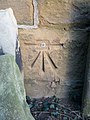
 Benchmark on the side of Whorlton Gatehouse - geograph.org.uk - 3838138.jpg 4,000 × 3,000; 4.27 MB
-
 Bend on Coalmire Lane - geograph.org.uk - 5089131.jpg 1,024 × 683; 414 KB
-
 Bilsdale West Moor - geograph.org.uk - 4641923.jpg 640 × 480; 109 KB
-
 Bird Trap, below Barker's Ridge - geograph.org.uk - 6177431.jpg 640 × 427; 114 KB
-
 Black Moor - geograph.org.uk - 2718832.jpg 3,357 × 2,423; 1.03 MB
-
 Black Moor - geograph.org.uk - 2718978.jpg 3,709 × 2,559; 1.28 MB
-
 Black Moor - geograph.org.uk - 2718979.jpg 3,815 × 2,483; 1.26 MB
-
 Black Moor - geograph.org.uk - 2718981.jpg 3,754 × 2,480; 1.41 MB
-
 Black Moor - geograph.org.uk - 2718984.jpg 3,888 × 2,397; 1.16 MB
-
 Black Ridge - geograph.org.uk - 4111377.jpg 1,600 × 1,200; 722 KB
-
 Blacksmiths and Swainby - geograph.org.uk - 4978613.jpg 1,600 × 1,222; 467 KB
-
 Blacksmiths Arms and view towards Hutton Rudby - geograph.org.uk - 4978620.jpg 1,600 × 1,199; 485 KB
-
 Blocked Public Bridleway - geograph.org.uk - 6163699.jpg 640 × 360; 141 KB
-
 Blocked Public Bridleway - geograph.org.uk - 6163702.jpg 640 × 360; 107 KB
-
 Bluebells in Clain Wood - geograph.org.uk - 4494149.jpg 6,000 × 4,000; 5.07 MB
-
 Boulderfield, Clain Wood - geograph.org.uk - 3450866.jpg 640 × 360; 107 KB
-
 Boundary stone - geograph.org.uk - 2634439.jpg 640 × 360; 230 KB
-
 Boundary Stone and Green Howe - geograph.org.uk - 1836601.jpg 4,000 × 3,000; 2.77 MB
-
 Boundary stone beside Cleveland Way below Live Moor - geograph.org.uk - 4137412.jpg 3,946 × 2,148; 6.2 MB
-
 Boundary stone on Live Moor - geograph.org.uk - 4495537.jpg 6,000 × 4,000; 3.7 MB
-
 Boundary Stone with OS Cut Mark - geograph.org.uk - 5613271.jpg 405 × 640; 108 KB
-
 Boundary Stone, Ingdale Ridge - geograph.org.uk - 2299445.jpg 640 × 427; 268 KB
-
 Boundary stones on Ingdale Ridge - geograph.org.uk - 6155176.jpg 1,024 × 768; 269 KB
-
 Bracken covered hillside - geograph.org.uk - 2635359.jpg 640 × 360; 241 KB
-
 Bracken pastures. - geograph.org.uk - 4316848.jpg 640 × 386; 76 KB
-
 Brian's Pond - geograph.org.uk - 4036952.jpg 1,600 × 1,200; 470 KB
-
 Brian's Pond - geograph.org.uk - 4641926.jpg 640 × 480; 65 KB
-
 Brian's Pond at Clough Gill Top - geograph.org.uk - 4137462.jpg 4,000 × 2,248; 5.59 MB
-

-
 Bridge over Scugdale Beck in Swainby - geograph.org.uk - 4491204.jpg 6,000 × 4,000; 4.8 MB
-
 Bridge over Scugdale Beck, Swainby - geograph.org.uk - 2291242.jpg 1,280 × 853; 357 KB
-
 Bridge, Swainby - geograph.org.uk - 5089087.jpg 1,024 × 683; 289 KB
-
 Broken Wall, Scugdale - geograph.org.uk - 1112048.jpg 640 × 427; 67 KB
-
 Buildings of gliding club from Cleveland Way - geograph.org.uk - 2276972.jpg 1,600 × 1,200; 1.64 MB
-
 Burnt heather on Gold Hill - geograph.org.uk - 4495560.jpg 6,000 × 4,000; 6.29 MB
-
 Cairn on heather moorland, Black Moor - geograph.org.uk - 5483431.jpg 1,499 × 901; 1.12 MB
-
 Cairn, Whorlton Moor - geograph.org.uk - 1359080.jpg 640 × 427; 55 KB
-
 Cairn, Whorlton Moor - geograph.org.uk - 1359084.jpg 640 × 427; 48 KB
-
 Car park, Quarry Lane - geograph.org.uk - 3439503.jpg 640 × 480; 136 KB
-
 Car park, Scarth Gap - geograph.org.uk - 5090414.jpg 800 × 533; 184 KB
-
 Carlton moor. - geograph.org.uk - 2202832.jpg 640 × 480; 54 KB
-
 Cattle-trodden ground near to Raikes Farm - geograph.org.uk - 5342111.jpg 1,500 × 1,125; 1.71 MB
-
 Churchyard of Whorlton Old Church - geograph.org.uk - 4500513.jpg 6,000 × 4,000; 6.12 MB
-
 Clain Wood - geograph.org.uk - 2634447.jpg 640 × 360; 272 KB
-
 Clain Wood - geograph.org.uk - 2635326.jpg 640 × 360; 269 KB
-
 Clain Wood - geograph.org.uk - 2635337.jpg 640 × 360; 260 KB
-
 Clain Wood - geograph.org.uk - 2718853.jpg 3,888 × 2,592; 2.33 MB
-
 Clarke's Plantation - geograph.org.uk - 2719000.jpg 3,888 × 2,592; 1.75 MB
-
 Cleveland Way - geograph.org.uk - 5927167.jpg 1,024 × 768; 181 KB
-
 Cleveland Way - geograph.org.uk - 6086337.jpg 1,024 × 768; 285 KB
-
 Cleveland Way heading towards Arncliffe Wood - geograph.org.uk - 4054793.jpg 1,500 × 882; 1.14 MB
-
 Cleveland Way heading towards Scarth Nick - geograph.org.uk - 4055002.jpg 1,500 × 929; 1.19 MB
-
 Cleveland Way on Scarth Wood Moor - geograph.org.uk - 6156762.jpg 1,024 × 768; 228 KB
-
 Cleveland Way, Live Moor - geograph.org.uk - 18910.jpg 640 × 480; 79 KB
-

-

-
 Clouds over the fence - geograph.org.uk - 2647530.jpg 640 × 428; 76 KB
-
 Coal Hill - geograph.org.uk - 2718890.jpg 2,958 × 2,592; 764 KB
-
 Coal Hill - geograph.org.uk - 2718974.jpg 3,888 × 2,592; 1.74 MB
-
 Coalmire - geograph.org.uk - 2718857.jpg 3,888 × 2,592; 2.71 MB
-
 Coalmire - geograph.org.uk - 3450858.jpg 640 × 360; 132 KB
-
 Coalmire Lane - geograph.org.uk - 5089134.jpg 1,024 × 683; 358 KB
-
 Coalmire Lane - geograph.org.uk - 5089138.jpg 1,024 × 683; 348 KB
-
 Coalmire Road - geograph.org.uk - 3450848.jpg 640 × 360; 113 KB
-
 Cod Beck - geograph.org.uk - 4781250.jpg 1,920 × 1,280; 837 KB
-
 Cod Beck - geograph.org.uk - 4781302.jpg 1,920 × 1,280; 949 KB
-
 Cod Beck - geograph.org.uk - 4788421.jpg 1,920 × 1,266; 854 KB
-
 Cod Beck - geograph.org.uk - 6156738.jpg 1,024 × 768; 399 KB
-
 Cod Beck at High Dam - geograph.org.uk - 4781249.jpg 1,920 × 1,280; 929 KB
-
 Cod Beck at High Dam - geograph.org.uk - 4788423.jpg 2,782 × 1,879; 1.14 MB
-
 Cod Beck Reservoir - geograph.org.uk - 4788425.jpg 1,920 × 1,205; 626 KB
-
 Cod Beck Reservoir - geograph.org.uk - 6162802.jpg 640 × 360; 101 KB
-
 Cottage near High Farm - geograph.org.uk - 3598665.jpg 640 × 480; 188 KB
-
 Cottages at Huthwaite Green - geograph.org.uk - 2291229.jpg 1,280 × 960; 403 KB
-
 Cottages on the edge of Swainby - geograph.org.uk - 4494104.jpg 6,000 × 4,000; 4.25 MB
-
 Cottongrass, Whorlton Moor - geograph.org.uk - 1359174.jpg 427 × 640; 70 KB
-
 Cowshed, Summerfield Farm - geograph.org.uk - 1481375.jpg 640 × 427; 74 KB
-
 Crabdale Beck - geograph.org.uk - 2299386.jpg 640 × 427; 290 KB
-
 Crepuscular Rays - geograph.org.uk - 4662486.jpg 640 × 360; 60 KB
-
 Crook Beck through Swainby - geograph.org.uk - 4338309.jpg 1,333 × 1,000; 1.74 MB
-
 Defence ^ Luxury - geograph.org.uk - 2151204.jpg 3,296 × 2,472; 1.78 MB
-
 Descending towards Live Moor Plantation - geograph.org.uk - 4137416.jpg 4,000 × 2,248; 5.88 MB
-
 Disused stables beside Whorlton Castle - geograph.org.uk - 5340714.jpg 1,500 × 874; 1.1 MB
-
 Ditch Crossing Point - geograph.org.uk - 1481404.jpg 640 × 427; 97 KB
-
 Drainage Ditch, Near Thorn Hill - geograph.org.uk - 1481448.jpg 427 × 640; 99 KB
-
 Edge of the Bracken, Whorlton Moor - geograph.org.uk - 1359142.jpg 427 × 640; 50 KB
-
 End of Ditch Near Thorn Hill - geograph.org.uk - 1481441.jpg 427 × 640; 103 KB
-
 Estate road climbing on Whorlton Moor - geograph.org.uk - 5483427.jpg 1,500 × 1,125; 1.35 MB
-
 Estate road on snowed moorland - geograph.org.uk - 4338573.jpg 1,500 × 947; 1.02 MB
-
 Estate road passing memorial bench - geograph.org.uk - 4055288.jpg 1,500 × 1,125; 1.36 MB
-
 Fallen Boundary Stone, Scarth Wood Moor - geograph.org.uk - 4764361.jpg 640 × 480; 127 KB
-
 Far Moor - geograph.org.uk - 3451686.jpg 640 × 360; 82 KB
-
 Farm Access and Public Footpath - geograph.org.uk - 1481349.jpg 640 × 427; 69 KB
-
 Farm track at Heathwaite - geograph.org.uk - 5340681.jpg 1,500 × 1,125; 1.39 MB
-
 Farm Track between Faceby and Whorlton - geograph.org.uk - 1718656.jpg 1,280 × 853; 384 KB
-
 Farm Track to Trenholme House - geograph.org.uk - 1481343.jpg 640 × 427; 76 KB
-
 Farmland beside the A1 - geograph.org.uk - 6333542.jpg 1,024 × 768; 534 KB
-
 Farmland off Coalmire Lane - geograph.org.uk - 3602300.jpg 640 × 480; 172 KB
-
 Farmland, Trenholme Bridge - geograph.org.uk - 3278713.jpg 1,200 × 900; 280 KB
-
 Field of Barley Off Whorlton Lane - geograph.org.uk - 475674.jpg 427 × 640; 218 KB
-
 Field on the edge of Swainby - geograph.org.uk - 4491169.jpg 6,000 × 4,000; 3.53 MB
-
 Field with animal feeder - geograph.org.uk - 5340686.jpg 1,499 × 804; 1.13 MB
-
 Fields with trees - geograph.org.uk - 4339320.jpg 1,500 × 959; 1.66 MB
-
 Flagged path on Live Moor - geograph.org.uk - 5931728.jpg 1,024 × 768; 758 KB
-
 Flush bracket - geograph.org.uk - 5379822.jpg 2,338 × 1,943; 827 KB
-
 Fog Close - geograph.org.uk - 2718910.jpg 3,888 × 2,592; 1.44 MB
-
 Footbridge and ford - geograph.org.uk - 6086353.jpg 1,024 × 768; 284 KB
-
 Footbridge over Piper beck. - geograph.org.uk - 4316857.jpg 640 × 360; 99 KB
-
 Footbridge over Scugdale Beck - geograph.org.uk - 3835192.jpg 3,240 × 4,320; 3.15 MB
-
 Footbridge ^ ford at Sheep Wash - geograph.org.uk - 6157697.jpg 1,024 × 769; 320 KB
-
 Footpath on Scarth Wood Moor - geograph.org.uk - 3610294.jpg 1,600 × 1,064; 586 KB
-
 Footpath to Faceby - geograph.org.uk - 4500465.jpg 6,000 × 4,000; 4.88 MB
-
 Ford and footbridge over Piper Grain - geograph.org.uk - 4494201.jpg 6,000 × 4,000; 5.5 MB
-
 Ford at Cod Beck Reservoir - geograph.org.uk - 3806974.jpg 3,872 × 2,592; 4.13 MB
-
 Ford at Scugdale - geograph.org.uk - 4659483.jpg 600 × 400; 432 KB
-
 Ford on Piper Beck - geograph.org.uk - 5931727.jpg 1,024 × 768; 1 MB
-
 Former Gliding Club - geograph.org.uk - 2250638.jpg 427 × 640; 254 KB
-
 Former Gliding Club - geograph.org.uk - 2250645.jpg 640 × 427; 275 KB
-
 Gathering of farm equipment - geograph.org.uk - 4500504.jpg 6,000 × 4,000; 3.98 MB
-
 Glider Station Taxiway - geograph.org.uk - 1158708.jpg 427 × 640; 171 KB
-
 Glider tug on carlton bank - geograph.org.uk - 5737178.jpg 1,024 × 768; 173 KB
-
 Gold Hill and Live Moor - geograph.org.uk - 775996.jpg 640 × 427; 241 KB
-
 Goldgate Bridge - geograph.org.uk - 3838113.jpg 4,000 × 3,000; 3.22 MB
-
 Greene Howe - geograph.org.uk - 2718987.jpg 3,888 × 2,361; 1.35 MB
-
 Grouse butt - geograph.org.uk - 3451678.jpg 640 × 360; 140 KB
-
 Harfa Bank - geograph.org.uk - 3451046.jpg 640 × 360; 105 KB
-
 Harfa Bank Farm - geograph.org.uk - 2718876.jpg 3,677 × 2,285; 1.33 MB
-
 Harfa Bank Farm - geograph.org.uk - 3835535.jpg 4,309 × 2,160; 1.53 MB
-
 Harfa Bank Farm - geograph.org.uk - 4137441.jpg 3,932 × 2,118; 5.12 MB
-
 Harfa House - geograph.org.uk - 2718878.jpg 3,081 × 2,451; 1,023 KB
-
 Harfa House - geograph.org.uk - 3451051.jpg 640 × 360; 87 KB
-
 Hay Field, Near Summerfield Farm - geograph.org.uk - 1481410.jpg 427 × 640; 74 KB
-
 Hay Field, Near Summerfield Farm - geograph.org.uk - 1481412.jpg 640 × 427; 92 KB
-
 Head of Crabdale - geograph.org.uk - 6155167.jpg 1,024 × 768; 333 KB
-
 Head of Scugdale - geograph.org.uk - 4137452.jpg 4,000 × 2,248; 4.96 MB
-
 Heather and bracken covered slopes. - geograph.org.uk - 4316928.jpg 640 × 342; 53 KB
-
 Heather moorland near Faceby Bank - geograph.org.uk - 4495573.jpg 6,000 × 4,000; 5.13 MB
-
 High Street, Swainby - geograph.org.uk - 4491173.jpg 6,000 × 4,000; 4.74 MB
-
 High Street, Swainby - geograph.org.uk - 4491208.jpg 6,000 × 4,000; 3.3 MB
-
 High Street, Swainby - geograph.org.uk - 5089103.jpg 1,024 × 683; 308 KB
-
 High Street, Swainby - geograph.org.uk - 5094350.jpg 800 × 533; 176 KB
-
 High Street, Swainby - geograph.org.uk - 6086329.jpg 1,024 × 768; 207 KB
-
 High West Cote - geograph.org.uk - 2718818.jpg 3,744 × 2,320; 1.12 MB
-
 Hill road on Whorlton Moor - geograph.org.uk - 5990618.jpg 2,000 × 1,308; 2.18 MB
-
 Hillside bluebells - geograph.org.uk - 4500453.jpg 6,000 × 4,000; 6.47 MB
-
 Hither Moor - geograph.org.uk - 5254286.jpg 640 × 427; 98 KB
-
 Hollin Hill - geograph.org.uk - 2718881.jpg 3,888 × 2,592; 1.32 MB
-
 Hollin Hill Farm - geograph.org.uk - 4494210.jpg 6,000 × 4,000; 2.44 MB
-
 Holy Well Gill - geograph.org.uk - 6055193.jpg 640 × 360; 117 KB
-
 Horace hedgehog on the stroll - geograph.org.uk - 4107681.jpg 735 × 654; 565 KB
-
 Horse grazing by Whorl Hill Farm - geograph.org.uk - 4500434.jpg 6,000 × 4,000; 4.6 MB
-
 In Scugdale - geograph.org.uk - 4036923.jpg 1,600 × 1,200; 524 KB
-
 In Whorlton churchyard - geograph.org.uk - 3835652.jpg 3,240 × 4,320; 2.13 MB
-
 Inside the disabled toilets at Swainby - geograph.org.uk - 5722180.jpg 6,000 × 4,000; 6.18 MB
-
 Inside the men's toilets at Swainby - geograph.org.uk - 5722176.jpg 6,000 × 4,000; 5.84 MB
-
 Inside the women's toilet at Swainby - geograph.org.uk - 5722137.jpg 6,000 × 4,000; 6.35 MB
-
 It's a road^ - geograph.org.uk - 3451673.jpg 640 × 360; 127 KB
-
 Jet Workings at Harfa Bank - geograph.org.uk - 4661472.jpg 4,000 × 3,000; 3.57 MB
-
 Kilton House - geograph.org.uk - 2647525.jpg 640 × 428; 103 KB
-
 Landrover track, Whorlton Moor - geograph.org.uk - 3451675.jpg 640 × 360; 95 KB
-
 Live Moor - geograph.org.uk - 2719004.jpg 3,888 × 1,683; 679 KB
-

-
 Live Moor Hillfort - geograph.org.uk - 4878246.jpg 640 × 480; 126 KB
-
 Live Moor Hillfort - geograph.org.uk - 4878251.jpg 640 × 480; 138 KB
-
 Live Moor Plantation - geograph.org.uk - 3834714.jpg 3,240 × 4,320; 3.91 MB
-
 Looking Back at Trenholme Farm - geograph.org.uk - 1481408.jpg 640 × 427; 91 KB
-
 Looking down Scugdale - geograph.org.uk - 3835556.jpg 3,240 × 4,320; 1.78 MB
-
 Looking north from top of Carlton Bank - geograph.org.uk - 4137337.jpg 3,912 × 2,076; 5.74 MB
-
 Lurking in the bracken - geograph.org.uk - 2151213.jpg 2,931 × 1,723; 984 KB
-
 Memorial bench overlooking Scarth Wood Moor - geograph.org.uk - 2700408.jpg 3,872 × 2,592; 3.58 MB
-
 Milepost by the old road - geograph.org.uk - 3824160.jpg 4,320 × 3,240; 2.21 MB
-
 Minor road along Scarth Wood Moor - geograph.org.uk - 2096092.jpg 2,048 × 1,536; 685 KB
-
 Minor road in Scugdale - geograph.org.uk - 5340830.jpg 1,500 × 1,125; 2.11 MB


