Category:Wildeman (Lemmer)
Jump to navigation
Jump to search
| Object location | | View all coordinates using: OpenStreetMap |
|---|
building  | |||||
| Upload media | |||||
| Instance of | |||||
|---|---|---|---|---|---|
| Location | Lemmer, De Fryske Marren, Friesland, Netherlands | ||||
| Street address |
| ||||
| Located on street | |||||
| Heritage designation |
| ||||
| Inception |
| ||||
 | |||||
|
This is a category about rijksmonument number 25771
|
| Address |
|
Media in category "Wildeman (Lemmer)"
The following 10 files are in this category, out of 10 total.
-
 De Schulpen6 Lemmer.jpg 3,648 × 2,736; 955 KB
-
 Herberg De Wildeman Lemmer.jpg 3,296 × 2,336; 449 KB
-

-
 Lemmer (14) (8400205982).jpg 2,560 × 1,920; 1.31 MB
-
 Lemmer (30) (8383325252).jpg 4,368 × 2,912; 3.32 MB
-
 Lemmer (31) (8382242307).jpg 2,912 × 4,368; 4.13 MB
-
 Lemmer (32) (8382241155).jpg 2,188 × 2,300; 1.2 MB
-
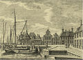
 Lemmer met Wildeman.jpg 840 × 598; 370 KB
-
 Lemmer met Wildeman2.jpg 738 × 538; 362 KB
-
 Voorgevel - Lemmer - 20138626 - RCE.jpg 1,200 × 813; 211 KB


_(8400205982).jpg)
_(8383325252).jpg)
_(8382242307).jpg)
_(8382241155).jpg)


