Category:Wilhelminapark (Tilburg)
Jump to navigation
Jump to search
| Object location | | View all coordinates using: OpenStreetMap |
|---|
Nederlands: Afbeeldingen van het stadspark en de straat het Wilhelminapark in Tilburg in de provincie Noord-Brabant in het zuiden van Nederland (bron [1];[2]; [3])
park in Tilburg, the Netherlands | |||||
| Upload media | |||||
| Instance of | |||||
|---|---|---|---|---|---|
| Named after | |||||
| Location | Tilburg, North Brabant, Netherlands | ||||
| Inception |
| ||||
 | |||||
Nederlands: Het Wilhelminapark is een stadspark in Tilburg in de provincie Noord-Brabant in het zuiden van Nederland, deel van het Rijksbeschermd gezicht Wilhelminapark/Goirkestraat, aangewezen op 7 maart 2014 met gebiedsnummer 1686.
Zie: Tilburgse herdgang beschermd stadsgezicht
Zie: Tilburgse herdgang beschermd stadsgezicht
Subcategories
This category has the following 6 subcategories, out of 6 total.
D
S
- Standbeeld Petrus Donders (14 F)
W
- Wilhelminapark 124, Tilburg (10 F)
- Wilhelminapark 31, Tilburg (3 F)
- Wilhelminapark 36, Tilburg (5 F)
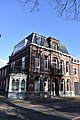
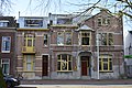
Media in category "Wilhelminapark (Tilburg)"
The following 55 files are in this category, out of 55 total.
-
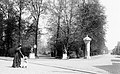
 Aanleg Wilhelminapark Tilburg 1898.jpg 736 × 519; 107 KB
-
 Amerikaanse Paardenkastanje, geënt.jpg 1,728 × 2,304; 1.21 MB
-
 Boomstamtafel, salontafel.jpg 1,106 × 877; 268 KB
-
 Boomwortels bedekt met mos, Wilhelminapark (Tilburg).jpg 2,304 × 1,728; 1.57 MB
-
 Bruggetje in het Wilhelminapark te Tilburg.jpg 3,917 × 2,827; 3.91 MB
-
 Driekleurige beuk.jpg 1,618 × 2,158; 849 KB
-
 Het Wilhelminapark in Tilburg.jpg 4,096 × 3,072; 6.22 MB
-
 IMG 20171005 163021 Wilhelminapark Tilburg Description Ginkgo Biloba.jpg 4,160 × 2,336; 3.42 MB
-
 IMG 20171005 183320 Wilhelminapark Tilburg fallen leaf Ginkgo Biloba.jpg 4,160 × 2,336; 4.32 MB
-
 Ingang Wilhelminapark Tilburg met twee herten (ca 1900).jpg 941 × 584; 143 KB
-
 Muziekkiosk Wilhelminapark 1902.jpg 800 × 466; 102 KB
-
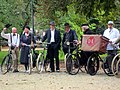 Oude fietsen in het Wilhelminapark (2).jpg 4,608 × 3,456; 4.19 MB
-
 Overzicht - Tilburg - 20209476 - RCE.jpg 1,200 × 788; 272 KB
-
 Overzicht - Tilburg - 20209483 - RCE.jpg 788 × 1,200; 200 KB
-
 Overzicht voorgevel - Tilburg - 20344329 - RCE.jpg 1,200 × 1,200; 331 KB
-
 Overzicht voorgevel - Tilburg - 20344332 - RCE.jpg 1,188 × 1,200; 284 KB
-
 Overzicht voorgevel en rechter zijgevel, politiepost - Tilburg - 20344334 - RCE.jpg 1,183 × 1,200; 308 KB
-
 Overzicht voorgevels - Tilburg - 20344331 - RCE.jpg 1,190 × 1,200; 298 KB
-
 Overzicht voorgevels herenhuizen - Tilburg - 20344327 - RCE.jpg 1,197 × 1,200; 307 KB
-
 Palmtrees around statue base.jpg 3,072 × 4,096; 4 MB
-
 PARK013 - 1.jpg 814 × 611; 185 KB
-
 PARK013 - 2.jpg 803 × 563; 162 KB
-
 Populus Canadensis 'Marilandica', Wilhelminapark, Tilburg.jpg 1,728 × 2,304; 1.01 MB
-
 Speeltuin met draaimolen, Wilhelminapark, Tilburg.jpg 1,971 × 1,392; 617 KB
-
 Springer ontwerp park op Veldhoven 1897.jpg 3,159 × 3,748; 2.11 MB
-
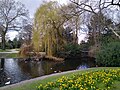
 Vijver Wilhelminapark (Tilburg).jpg 2,304 × 1,728; 1.39 MB
-
 Vijver Wilhelminapark, Tilburg.jpg 578 × 354; 172 KB
-
 Voor- en linker zijgevel - Tilburg - 20209473 - RCE.jpg 788 × 1,200; 250 KB
-
 Voor- en rechter zijgevel - Tilburg - 20209481 - RCE.jpg 788 × 1,200; 276 KB
-
 Voorgevel - Tilburg - 20209463 - RCE.jpg 788 × 1,200; 226 KB
-
 Voorgevel - Tilburg - 20209464 - RCE.jpg 788 × 1,200; 207 KB
-
 Voorgevel - Tilburg - 20209471 - RCE.jpg 1,200 × 780; 228 KB
-
 Voorgevel - Tilburg - 20209475 - RCE.jpg 788 × 1,200; 253 KB
-
 Voorgevel - Tilburg - 20209478 - RCE.jpg 788 × 1,200; 293 KB
-
 Voorgevels - Tilburg - 20209468 - RCE.jpg 788 × 1,200; 271 KB
-
 Voorgevels - Tilburg - 20209474 - RCE.jpg 788 × 1,200; 285 KB
-
 Wilhelminapark 106, Tilburg (2).jpg 4,000 × 6,000; 7.28 MB
-
 Wilhelminapark 106, Tilburg (3).jpg 6,000 × 4,000; 7.23 MB
-
 Wilhelminapark 106, Tilburg.jpg 4,000 × 6,000; 7 MB
-
 Wilhelminapark 107, Tilburg (2).jpg 4,000 × 6,000; 6.96 MB
-
 Wilhelminapark 107, Tilburg.jpg 4,000 × 6,000; 7.61 MB
-
 Wilhelminapark 107-108, Tilburg.jpg 6,000 × 4,000; 6.77 MB
-
 Wilhelminapark 108, Tilburg.jpg 4,000 × 6,000; 6.85 MB
-
 Wilhelminapark 112, Tilburg.jpg 6,000 × 4,000; 7.46 MB
-
 Wilhelminapark 112.jpg 5,184 × 3,456; 12.21 MB
-
 Wilhelminapark 126, Tilburg (2).jpg 4,000 × 6,000; 6.62 MB
-
 Wilhelminapark 126, Tilburg - voordeur.jpg 4,000 × 6,000; 6.37 MB
-
 Wilhelminapark 126, Tilburg.jpg 4,000 × 6,000; 7.34 MB
-
 Wilhelminapark 133, Tilburg (2).jpg 4,000 × 6,000; 7.22 MB
-
 Wilhelminapark 133, Tilburg.jpg 4,000 × 6,000; 7.75 MB
-
 Wilhelminapark 25, Tilburg (2).jpg 6,000 × 4,000; 6.47 MB
-
 Wilhelminapark 25, Tilburg.jpg 6,000 × 4,000; 6.8 MB
-
 Wilhelminapark 42, Tilburg (2).jpg 4,000 × 6,000; 5.41 MB
-
 Wilhelminapark 42, Tilburg (3).jpg 4,000 × 6,000; 6.43 MB
-
 Wilhelminapark 42, Tilburg.jpg 4,000 × 6,000; 6.86 MB


.jpg)


.jpg)

.jpg)


.jpg)


.jpg)
.jpg)

.jpg)


.jpg)


.jpg)

.jpg)

.jpg)
.jpg)
