Category:Willem Schouten
Salti al navigilo
Salti al serĉilo
Nederlanda navigisto  | |||||
| Alŝuti plurmedion | |||||
| Naskiĝdato | ĉirkaŭ 1577 (ĉirkaŭ), 1580, ĉirkaŭ 1567 (ĉirkaŭ) Hoorn | ||||
|---|---|---|---|---|---|
| Mortdato | 1625 Antongil Bay | ||||
| Ŝtataneco | |||||
| Okupo | |||||
| |||||
Subkategorioj
Ĉi tiu kategorio havas la 2 jenajn subkategoriojn, el 2 entute.
S
W
- Willem Schoutenstraat, Amsterdam (11 D)
Paĝoj en kategorio “Willem Schouten”
Ĉi tiu kategorio enhavas nur la jenan paĝon.
Dosieroj en kategorio “Willem Schouten”
La jenaj 40 dosieroj estas en ĉi tiu kategorio, el 40 entute.
-
 1619 Schouten map close-up (Niuas, Futuna and Alofi islands).jpg 796 × 462; 200 KB
-
 AMH-6924-KB Map of the world and chart of New Guinea.jpg 2 400 × 1 712; 961 KB
-
 AMH-7750-KB Map of the Le Maire Strait between Vuurland and Statenland.jpg 2 400 × 1 858; 990 KB
-
 AMH-8120-KB Bird's eye view of Leeuweneiland and Porto Desire.jpg 1 604 × 2 400; 708 KB
-
 AMH-8121-KB Map of the Le Maire Strait.jpg 2 400 × 1 775; 713 KB
-

-
 AMH-8123-KB View of Cocos Island and Traitors' Island.jpg 1 992 × 2 400; 840 KB
-
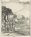 AMH-8124-KB Reception of the crew of the Eendracht on Cocoseiland.jpg 1 995 × 2 400; 1,01 MB
-
 AMH-8125-KB View of the island of Hoorn in the Pacific Ocean.jpg 1 956 × 2 400; 999 KB
-
 AMH-8126-KB Chart mapping part of the route taken by Schouten and Le Maire.jpg 2 400 × 1 034; 425 KB
-
 AMH-8127-KB Map of New Guinea and Gilolo.jpg 2 400 × 1 834; 714 KB
-
 AMH-8611-NA Map of the Le Maire Strait and the Magelhaen Strait.jpg 2 400 × 1 854; 736 KB
-
 AMH-8636-NA Map of the Le Maire Strait.jpg 1 761 × 2 400; 344 KB
-
 AMH-8637-NA Coastal views along the Le Maire Strait.jpg 2 400 × 1 878; 679 KB
-
 AMH-8638-NA Small map of Valentine's Bay in the Le Maire Strait.jpg 2 400 × 1 874; 551 KB
-

-
 De Eendracht en de Hoorn bij het vertrek uit Hoorn.png 2 160 × 1 319; 1,34 MB
-

-

-
 Het eiland Moa en Insou Nieuw Guinea after a print from 1726 Van Keulen.jpg 2 155 × 1 672; 3,1 MB
-
 ID Schouten islands.PNG 670 × 561; 20 KB
-
 Indiens de l'île de Hoorn (1616).jpeg 1 311 × 888; 1,07 MB
-
 Kaap Hoorn uit de Australische Navigatien (detail).png 318 × 247; 199 KB
-
 Kaap Hoorn uit de Australische Navigatien.png 2 460 × 1 888; 2,46 MB
-
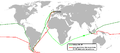
 Le Maire - Schoutens journey.PNG 300 × 150; 4 KB
-
 Le Maire en Schouten - Reis via Kaap Hoorn naar Indie 1615-1616.png 1 021 × 474; 60 KB
-

-
-

-

-
 Schouten et Le Maire repoussent les futuniens en 1616.jpeg 1 317 × 896; 1,18 MB
-
 Schouten island map - de.png 1 196 × 821; 40 KB
-
 Schouten island map.png 1 196 × 821; 41 KB
-
 Schouten Island.jpg 3 938 × 1 484; 3,85 MB
-
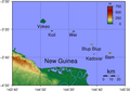 Schouten Islands (Papua New Guinea) Topography.png 1 859 × 1 295; 474 KB
-
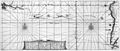
 Schouten Islands (Papua New Guinea) txu-oclc-6552576-sa55-13.jpg 5 000 × 3 769; 2,67 MB
-
 Willem Cornelisz Schouten 1625.png 833 × 896; 587 KB
-
 Schouten,Spielbergen.png 1 425 × 625; 47 KB
-
 View of Cocos Island and Traitors' Island (better quality).jpg 2 568 × 1 626; 3,19 MB
-
 Willem Cornelisz Schouten van Hoorn.jpg 1 124 × 1 329; 564 KB
.jpg)


.png)


.jpeg)
.png)


.jpg)


_Topography.png)
_txu-oclc-6552576-sa55-13.jpg)


.jpg)