Category:Willenhall
Vai alla navigazione
Vai alla ricerca
town in the Metropolitan Borough of Walsall, in the West Midlands, England  | |||||
| Carica un file multimediale | |||||
| Istanza di |
| ||||
|---|---|---|---|---|---|
| Luogo | Walsall, West Midlands, Midlands Occidentali, Inghilterra | ||||
| Popolazione |
| ||||
 | |||||
The town of Willenhall, West Midlands, England which is near to Wolverhampton and Walsall.
This is not Willenhall, Coventry, also in the West Midlands county.
Sottocategorie
Questa categoria contiene le 6 sottocategorie indicate di seguito, su un totale di 6.
File nella categoria "Willenhall"
Questa categoria contiene 112 file, indicati di seguito, su un totale di 112.
-
 'High Noon' in the Market Place - geograph.org.uk - 250898.jpg 640 × 480; 234 KB
-
 32 ^ 33 Market Place - geograph.org.uk - 2741892.jpg 640 × 480; 104 KB
-

-
 Autumn on the Curly Wyrley - geograph.org.uk - 614723.jpg 640 × 480; 212 KB
-
 Bedroom in the Locksmith's House - geograph.org.uk - 2024646.jpg 640 × 480; 234 KB
-
 Bell Inn - Market Place - geograph.org.uk - 2741882.jpg 640 × 480; 83 KB
-
 Bell Inn - Marketplace - geograph.org.uk - 3631020.jpg 1 600 × 1 200; 391 KB
-
 Bentley Cemetery Gates - geograph.org.uk - 921169.jpg 640 × 480; 81 KB
-

-
 Carnival Parade, Pinson Road Willenhall, June 1990. - geograph.org.uk - 1759896.jpg 1 921 × 1 172; 449 KB
-
 Cemetery Road Bridge - geograph.org.uk - 2051572.jpg 3 648 × 2 736; 4,1 MB
-
 Cemetery Road View - geograph.org.uk - 1198570.jpg 640 × 480; 143 KB
-
 Cholera Memorial - geograph.org.uk - 1580313.jpg 480 × 640; 130 KB
-

-
 Croft Street, Willenhall - geograph.org.uk - 1733668.jpg 2 592 × 1 944; 1,33 MB
-

-
 Dartmouth Avenue, Willenhall. - geograph.org.uk - 1008658.jpg 640 × 416; 58 KB
-
 District Boundary Marker - geograph.org.uk - 1259703.jpg 480 × 640; 363 KB
-
 Doctors Piece, Willenhall. - geograph.org.uk - 1580314.jpg 640 × 480; 93 KB
-
 Early autumn tints in the cemetery - geograph.org.uk - 250907.jpg 640 × 480; 319 KB
-
 Willenhall town flag.svg 1 500 × 900; 5 KB
-
 Footpath across the Country Park - geograph.org.uk - 475804.jpg 640 × 480; 307 KB
-

-

-
-
 Joseph Tonks.jpg 136 × 193; 17 KB
-
 Junction of Round Croft and Field Street, Willenhall - geograph.org.uk - 1767446.jpg 2 592 × 1 944; 1,42 MB
-
 Junction of Round Croft and Field Street, Willenhall - geograph.org.uk - 1767462.jpg 2 592 × 1 944; 1,08 MB
-
 Keys at the Locksmith's House Museum - geograph.org.uk - 2025111.jpg 640 × 480; 106 KB
-
 Locksmith's House - geograph.org.uk - 2024507.jpg 480 × 640; 262 KB
-
 Maha Shiv Shakti Mandir - geograph.org.uk - 1952108.jpg 870 × 653; 186 KB
-
 Main entrance to the Memorial Park, Pinson Road, Willenhall - geograph.org.uk - 1733700.jpg 2 592 × 1 944; 1,23 MB
-
 Map of Staffordshire OS Map name 063-SW, Ordnance Survey, 1883-1894.jpg 5 339 × 3 593; 5,78 MB
-
 Map of Staffordshire OS Map name 063-SW, Ordnance Survey, 1883-1894.tiff 5 339 × 3 593; 54,88 MB
-
 Native Oaks - geograph.org.uk - 508140.jpg 640 × 480; 274 KB
-
 No motor sports please^ - geograph.org.uk - 1853785.jpg 640 × 480; 241 KB
-
 Orthodontics, Penns Lane - geograph.org.uk - 1632810.jpg 480 × 640; 65 KB
-
 Park Avenue, Willenhall - geograph.org.uk - 1733708.jpg 2 592 × 1 944; 1,21 MB
-
 Parlour at the Locksmith's House - geograph.org.uk - 2024631.jpg 640 × 480; 257 KB
-
 Pinson Road, Willenhall, looking towards Field Street - geograph.org.uk - 1733695.jpg 2 592 × 1 944; 1,2 MB
-
 Rose Hill, Willenhall - geograph.org.uk - 1197804.jpg 640 × 480; 206 KB
-
 Ruined building off the Market Place - geograph.org.uk - 2741893.jpg 480 × 640; 84 KB
-
 Site of Willenhall Stafford Street Station 2010 - geograph.org.uk - 1733643.jpg 2 592 × 1 944; 1,56 MB
-
 Sneyd Brook - geograph.org.uk - 1307100.jpg 480 × 640; 234 KB
-
 Social Housing Development - Gower Street - geograph.org.uk - 3631004.jpg 1 600 × 1 200; 338 KB
-
 Spar shop on Wolverhampton Road West - geograph.org.uk - 2415757.jpg 3 872 × 2 592; 4,28 MB
-
 Sports Pitch in the Country Park - geograph.org.uk - 475822.jpg 640 × 480; 184 KB
-
 St Giles Road - geograph.org.uk - 1818250.jpg 640 × 455; 71 KB
-
 St Stephen's Avenue, Willenhall - geograph.org.uk - 1733703.jpg 2 592 × 1 944; 1,61 MB
-

-
 Supermarket petrol station - geograph.org.uk - 2314970.jpg 640 × 480; 90 KB
-
 Tams Tattoos - geograph.org.uk - 3631012.jpg 1 600 × 1 200; 378 KB
-
 Telecoms mast and footpath in Spring Bank - geograph.org.uk - 2482685.jpg 902 × 1 203; 257 KB
-
 Tesco store in Willenhall, Walsall - geograph.org.uk - 3706512.jpg 1 024 × 696; 343 KB
-
 Tesco Willenhall - geograph.org.uk - 928806.jpg 640 × 480; 52 KB
-
 The Acorn, Willenhall - geograph.org.uk - 2405699.jpg 1 496 × 1 122; 480 KB
-
 The Broadway PH, near New Invention - geograph.org.uk - 241967.jpg 640 × 480; 216 KB
-
 The County - Walsall Street - geograph.org.uk - 3631051.jpg 1 600 × 1 200; 389 KB
-
 The Crown - Cheapside - geograph.org.uk - 3631034.jpg 1 600 × 1 200; 389 KB
-
 The Forge Tavern, Spring Bank - geograph.org.uk - 2482681.jpg 1 280 × 960; 281 KB
-
 The former Bentley Canal, Willenhall - geograph.org.uk - 2482675.jpg 1 024 × 768; 314 KB
-
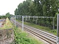
 The former railway through Willenhall - geograph.org.uk - 2482678.jpg 947 × 710; 352 KB
-

-
 The Keyway - geograph.org.uk - 2835367.jpg 800 × 600; 194 KB
-
 The Keyway View - geograph.org.uk - 2835378.jpg 640 × 480; 76 KB
-
 The Red Lion, Willenhall - geograph.org.uk - 1953741.jpg 819 × 614; 185 KB
-
 The Ring of Bells - John Street - geograph.org.uk - 2741897.jpg 602 × 480; 84 KB
-
 The Three Crowns - Stafford Street - geograph.org.uk - 3630988.jpg 1 600 × 1 201; 355 KB
-

-
 Walsall Street Junction - geograph.org.uk - 912523.jpg 640 × 480; 89 KB
-
 Willenhall - Albion Road - geograph.org.uk - 1853755.jpg 640 × 480; 161 KB
-
 Willenhall - Barcroft - geograph.org.uk - 1853769.jpg 640 × 480; 142 KB
-
 Willenhall - Elm Street School - geograph.org.uk - 1853765.jpg 640 × 480; 131 KB
-
 Willenhall - Frederick William Street - geograph.org.uk - 1853760.jpg 640 × 480; 146 KB
-
 Willenhall - New Hall Street - geograph.org.uk - 1853803.jpg 640 × 480; 121 KB
-

-
 Willenhall - St Annes Road - geograph.org.uk - 1853799.jpg 640 × 480; 153 KB
-
 Willenhall - Stringes Lane - geograph.org.uk - 1853795.jpg 640 × 480; 196 KB
-
 Willenhall former Station Site.jpg 3 860 × 2 848; 3,85 MB
-
 Willenhall Greyhound Stadium back straight c.1950.png 627 × 417; 382 KB
-
 Willenhall Greyhound Stadium home straight c.1950.png 616 × 410; 350 KB
-
 Willenhall market - geograph.org.uk - 1105075.jpg 640 × 427; 70 KB
-
 Willenhall market - geograph.org.uk - 1105097.jpg 640 × 427; 68 KB
-
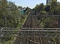
 Willenhall Railway - geograph.org.uk - 912534.jpg 640 × 480; 95 KB
-
 Willenhall Town F.C. - geograph.org.uk - 1580306.jpg 640 × 480; 54 KB
-
 Willenhall-Saint James Lane Bridge - geograph.org.uk - 1209392.jpg 640 × 480; 92 KB
-
 Willenhall.svg 482 × 476; 129 KB
-

-
 Workshops at the Locksmith's House - geograph.org.uk - 2024563.jpg 480 × 640; 258 KB
-
 Wyrley and Essington Canal, Bentley Haye - geograph.org.uk - 881375.jpg 640 × 480; 271 KB
-
 Yard at Locksmith's House - geograph.org.uk - 2024602.jpg 480 × 640; 293 KB
-
 Across the Country Park - geograph.org.uk - 475865.jpg 600 × 450; 202 KB
-
 Autumn in Rough Wood Nature Reserve - geograph.org.uk - 614716.jpg 640 × 480; 320 KB
-
 Bentley Cairn - geograph.org.uk - 668215.jpg 640 × 480; 65 KB
-
 Bentley Canal - geograph.org.uk - 838408.jpg 640 × 480; 237 KB
-
 Bentley from Emmanuel Church Grounds - geograph.org.uk - 668220.jpg 640 × 480; 81 KB
-
 Early autumn on the 'Curly Wyrley' - geograph.org.uk - 250954.jpg 640 × 480; 281 KB
-

-
 Fishing in the rain on the Curly Wyrley - geograph.org.uk - 477065.jpg 640 × 480; 279 KB
-
 Into the oak wood - geograph.org.uk - 508151.jpg 640 × 480; 362 KB
-
 Knight's Bridge - geograph.org.uk - 477040.jpg 640 × 480; 236 KB
-
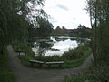 Landscaped Pool on the Bentley Estate - geograph.org.uk - 263540.jpg 640 × 480; 251 KB
-
 Lane Head Bridge - geograph.org.uk - 475907.jpg 640 × 480; 178 KB
-
 Leafy Close - geograph.org.uk - 263544.jpg 500 × 375; 205 KB
-
 Loop on the Wyrley and Essington Canal - geograph.org.uk - 475796.jpg 640 × 480; 274 KB
-

-
 Perry Hall Bridge - geograph.org.uk - 250947.jpg 640 × 480; 278 KB
-
 Poplar Avenue with autumn tints - geograph.org.uk - 263543.jpg 500 × 375; 228 KB
-

-
 The bridge and Bridge Inn at Lane Head - geograph.org.uk - 475886.jpg 640 × 480; 207 KB
-
 Willenhall Lawn Cemetery - geograph.org.uk - 175256.jpg 640 × 480; 66 KB
-
 Willenhall Rugby Club - geograph.org.uk - 454021.jpg 600 × 450; 182 KB


