Category:Metropolitan Borough of Walsall
Jump to navigation
Jump to search
metropolitan borough in West Midlands, England   | |||||
| Upload media | |||||
| Instance of | |||||
|---|---|---|---|---|---|
| Location | West Midlands, England | ||||
| Capital | |||||
| Legislative body |
| ||||
| Inception |
| ||||
| Population |
| ||||
| Area |
| ||||
| official website | |||||
 | |||||
Subcategories
This category has the following 6 subcategories, out of 6 total.
*
A
W
Media in category "Metropolitan Borough of Walsall"
The following 200 files are in this category, out of 265 total.
(previous page) (next page)-
 A wet day on Walsall Market - geograph.org.uk - 2449961.jpg 640 × 427; 85 KB
-
 Access to the main road - geograph.org.uk - 1293634.jpg 600 × 399; 276 KB
-
 Anvil stones - geograph.org.uk - 1101904.jpg 640 × 480; 349 KB
-
 Aqueduct Arch - geograph.org.uk - 1290314.jpg 640 × 480; 70 KB
-
 Barge and Wharf Bar - geograph.org.uk - 2553765.jpg 2,816 × 1,880; 2.29 MB
-
 Barons Court Hotel - geograph.org.uk - 1776399.jpg 640 × 480; 60 KB
-
 Beacon Primary School - geograph.org.uk - 1258143.jpg 640 × 480; 238 KB
-
 Beacon Way and NCN 5 - geograph.org.uk - 916011.jpg 640 × 480; 241 KB
-
 Bentley over 60's Centre - geograph.org.uk - 1197507.jpg 640 × 480; 61 KB
-
 Bentley Road South - geograph.org.uk - 1398976.jpg 480 × 640; 151 KB
-
 Bentley Road South Roundabout - geograph.org.uk - 1398978.jpg 640 × 480; 154 KB
-
 Bilston Lane Sub-Station - geograph.org.uk - 1250620.jpg 640 × 480; 49 KB
-
 Black Country Route Bridge - geograph.org.uk - 1251142.jpg 640 × 480; 76 KB
-

-
 Bloxwich Lane Meets Wolverhampton Road - geograph.org.uk - 1398948.jpg 640 × 480; 153 KB
-
 Bloxwich Signal Box - geograph.org.uk - 1016995.jpg 640 × 422; 43 KB
-
 Bloxwich Sports Ground - geograph.org.uk - 169982.jpg 640 × 426; 108 KB
-
 Boundary Mill shopping centre. - geograph.org.uk - 1558763.jpg 640 × 360; 64 KB
-
 Boundary Mills - geograph.org.uk - 1265716.jpg 640 × 480; 58 KB
-
 Bridge Street, Walsall - geograph.org.uk - 2566366.jpg 856 × 1,280; 203 KB
-
 Brook Ducks - geograph.org.uk - 1290304.jpg 480 × 640; 126 KB
-
 Bus on Bradford Street, Walsall - geograph.org.uk - 3378074.jpg 1,024 × 768; 134 KB
-
 Buses in Walsall Bus Station - geograph.org.uk - 3579473.jpg 1,472 × 1,232; 289 KB
-
 Butlers Passage - geograph.org.uk - 901777.jpg 427 × 640; 60 KB
-
 Canal wharf and barge - geograph.org.uk - 2553170.jpg 2,816 × 1,880; 1.98 MB
-

-

-
 Charles Richards Fasteners - geograph.org.uk - 1251180.jpg 640 × 480; 68 KB
-
 Churchill Road - geograph.org.uk - 1398962.jpg 640 × 480; 148 KB
-
 Churchill Road Bridge - geograph.org.uk - 1197511.jpg 640 × 480; 86 KB
-
-
 Clubhouse - geograph.org.uk - 1220205.jpg 640 × 480; 93 KB
-
 Coalpoolshops.snowday.2013.jpg 2,592 × 1,936; 1.95 MB
-
 Confluence of Sneyd Brook and River Tame - geograph.org.uk - 1307112.jpg 640 × 480; 300 KB
-
 Coppice Road View - geograph.org.uk - 1776362.jpg 640 × 480; 73 KB
-
 Coppice Woods - geograph.org.uk - 1724130.jpg 1,600 × 1,200; 666 KB
-
-
 Crescent Bridge View East - geograph.org.uk - 1251168.jpg 640 × 480; 87 KB
-
 Crescent Bridge View West - geograph.org.uk - 1251156.jpg 640 × 480; 78 KB
-
 Darwall Street, Walsall - geograph.org.uk - 2570363.jpg 1,280 × 858; 206 KB
-
 Darwall Street, Walsall - geograph.org.uk - 2570378.jpg 1,280 × 856; 215 KB
-
 Derelict school at Moxley - geograph.org.uk - 1483179.jpg 640 × 480; 115 KB
-
 Disused clay pit - geograph.org.uk - 264356.jpg 550 × 412; 158 KB
-

-
 Dovecote in Victoria Park - geograph.org.uk - 268461.jpg 600 × 450; 317 KB
-
 Dr Mark Beech.jpg 2,736 × 3,648; 3.95 MB
-
 Dumper's haunt - geograph.org.uk - 332493.jpg 640 × 383; 75 KB
-
 Farringdon Street, Walsall - geograph.org.uk - 2120290.jpg 640 × 480; 79 KB
-
 Fishmonger on Walsall Market - geograph.org.uk - 2449957.jpg 2,816 × 1,880; 2.12 MB
-
 Former Woolworth's Building, Walsall. - geograph.org.uk - 2417542.jpg 1,500 × 1,308; 1.05 MB
-
 Frederick Street, Walsall - geograph.org.uk - 2120274.jpg 640 × 480; 133 KB
-
 Freer Street, Walsall - geograph.org.uk - 3024315.jpg 1,024 × 682; 195 KB
-
 George Street , Walsall, Staffordshire - geograph.org.uk - 2261836.jpg 1,440 × 939; 937 KB
-
 Glacial Boulder, Walsall Arboretum - geograph.org.uk - 2652579.jpg 2,736 × 3,648; 4.08 MB
-
 Goodall Street, Walsall - geograph.org.uk - 2802544.jpg 801 × 1,024; 165 KB
-
 Gordon Street - geograph.org.uk - 1250679.jpg 640 × 480; 86 KB
-
 Green Lane Baptist Church - geograph.org.uk - 3355736.jpg 1,142 × 857; 336 KB
-
 Green Lane, Walsall Wood - geograph.org.uk - 1226196.jpg 640 × 480; 111 KB
-
 H S B C Walsall - geograph.org.uk - 2721024.jpg 640 × 480; 100 KB
-
 Hatherton Children's Centre - geograph.org.uk - 1307719.jpg 640 × 486; 188 KB
-
 Hatherton Lake - geograph.org.uk - 2564927.jpg 1,280 × 856; 284 KB
-
 Heading for Reyboulds Bridge - geograph.org.uk - 1293657.jpg 600 × 399; 291 KB
-
 Heath Road - geograph.org.uk - 1250647.jpg 480 × 640; 77 KB
-
 Hollanders Bridge - geograph.org.uk - 1776425.jpg 640 × 480; 74 KB
-
 Hootys Superstore - geograph.org.uk - 1197791.jpg 640 × 480; 178 KB
-

-
 It's a dead-end - geograph.org.uk - 1293605.jpg 600 × 399; 299 KB
-
 James Bridge Aqueduct - geograph.org.uk - 1290131.jpg 640 × 480; 94 KB
-
 James Bridge Aqueduct View - geograph.org.uk - 1265725.jpg 640 × 480; 91 KB
-
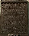 John Henry Carless plaque - geograph.org.uk - 711784.jpg 514 × 640; 79 KB
-
 Jubilee stone - geograph.org.uk - 1434874.jpg 427 × 640; 57 KB
-
 Just south of Stokes Bridge - geograph.org.uk - 1293648.jpg 600 × 399; 257 KB
-
 Kendricks Road - geograph.org.uk - 1290360.jpg 640 × 480; 81 KB
-
 Kendricks Road View - geograph.org.uk - 1290352.jpg 640 × 480; 93 KB
-
 Kent Road Junction - geograph.org.uk - 1198687.jpg 640 × 480; 85 KB
-
 King's Hill Primary - geograph.org.uk - 1252825.jpg 640 × 480; 94 KB
-
 Knights Bridge - geograph.org.uk - 1198641.jpg 640 × 480; 89 KB
-
 Large culvert under the M6 motorway - geograph.org.uk - 1307632.jpg 640 × 480; 251 KB
-
 Leicester Street, Walsall - geograph.org.uk - 2570408.jpg 1,280 × 856; 243 KB
-
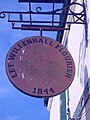 Let Willenhall Flourish - geograph.org.uk - 1198612.jpg 480 × 640; 76 KB
-
 Lighthouse Christian Mission - geograph.org.uk - 1198584.jpg 480 × 640; 52 KB
-
 Lloyds Bank - geograph.org.uk - 2613380.jpg 3,648 × 2,736; 2.65 MB
-
 Looking across the wharf - geograph.org.uk - 2553187.jpg 2,816 × 1,880; 2.42 MB
-
 Lowe Avenue Darlaston - geograph.org.uk - 1351917.jpg 640 × 425; 107 KB
-
 Lower Farm Estate - Little Bloxwich - geograph.org.uk - 1194364.jpg 640 × 474; 180 KB
-
 Lower Hall Lane - geograph.org.uk - 2939243.jpg 800 × 600; 93 KB
-
 Lower Rushall Street in Walsall, Staffordshire - geograph.org.uk - 2261595.jpg 1,440 × 927; 887 KB
-
 Lych Gate at St Matthews - geograph.org.uk - 692503.jpg 427 × 640; 83 KB
-
 Lych Gate, Pelsall Parish Church - geograph.org.uk - 264209.jpg 640 × 480; 113 KB
-
 Majorfax Chimney - geograph.org.uk - 2571999.jpg 856 × 1,280; 161 KB
-
 Maple Leaf Industrial Estate - geograph.org.uk - 1398956.jpg 640 × 480; 146 KB
-
 Market Scene - geograph.org.uk - 1709884.jpg 600 × 800; 91 KB
-
 Memorial stone - geograph.org.uk - 1434864.jpg 640 × 427; 48 KB
-

-
 Monarch's Way Bentley - geograph.org.uk - 1197528.jpg 640 × 480; 97 KB
-
 Monmer Lane Garage - geograph.org.uk - 1198607.jpg 640 × 480; 96 KB
-
 Moxley Road Garage - geograph.org.uk - 1600856.jpg 640 × 480; 72 KB
-
 Multiprint store - geograph.org.uk - 2553760.jpg 2,816 × 1,880; 2.08 MB
-
-
 New College for Walsall - geograph.org.uk - 1709831.jpg 800 × 600; 88 KB
-

-

-
 New Housing Off Bentley Road - geograph.org.uk - 1398981.jpg 640 × 480; 193 KB
-
 Noose Lane - geograph.org.uk - 1580305.jpg 640 × 480; 66 KB
-
 Nuttalls Farm, Hob's Hole Lane - geograph.org.uk - 1220204.jpg 640 × 480; 80 KB
-
 Oak Park Pitches - geograph.org.uk - 1776353.jpg 640 × 480; 67 KB
-
 OakPark.jpg 2,080 × 1,544; 708 KB
-
 OakPark2011.jpg 2,560 × 1,920; 1.89 MB
-
 Observer Building and Tudor House - geograph.org.uk - 2613364.jpg 3,648 × 2,736; 2.52 MB
-
 Overdale Drive - geograph.org.uk - 1198691.jpg 640 × 480; 57 KB
-
 Panorama-Walsall.jpg 640 × 426; 90 KB
-
 Park Lime Pits - main pool - geograph.org.uk - 1740686.jpg 600 × 450; 114 KB
-
 Park Lime Pits - main pool - geograph.org.uk - 1740704.jpg 600 × 450; 179 KB
-
 Park Street, Walsall - geograph.org.uk - 2564533.jpg 1,280 × 857; 252 KB
-
 Piled high in the scrapyard - geograph.org.uk - 643382.jpg 640 × 480; 215 KB
-
 Pipes crossing the Sneyd Brook - geograph.org.uk - 1307601.jpg 640 × 480; 287 KB
-

-
 PVFC.jpg 2,080 × 1,544; 684 KB
-
 Queen Mary's girls grammar school - geograph.org.uk - 1434766.jpg 640 × 427; 98 KB
-
 Queen Mary's girls grammar school - geograph.org.uk - 1434772.jpg 640 × 427; 106 KB
-

-
 Queen Mary's girls school - geograph.org.uk - 1434760.jpg 640 × 427; 73 KB
-
 Queen St Cemetery, Sister Dora Gate - geograph.org.uk - 1351951.jpg 425 × 640; 121 KB
-
 Railway Tavern - geograph.org.uk - 1290339.jpg 640 × 480; 81 KB
-
 Refurbished seating, Walsall Arboretum - geograph.org.uk - 2650433.jpg 3,648 × 2,736; 4.19 MB
-
 Refurbishment of boathouse - geograph.org.uk - 2652581.jpg 3,648 × 2,736; 3.58 MB
-
 River Tame at Bescot - geograph.org.uk - 451048.jpg 600 × 450; 205 KB
-
 River Tame at Darlaston Junction - geograph.org.uk - 987079.jpg 640 × 464; 62 KB
-
 River Tame near Bentley Road - geograph.org.uk - 1307129.jpg 480 × 640; 315 KB
-
 River Tame south of Bentley Road - geograph.org.uk - 1307135.jpg 640 × 480; 261 KB
-
 River Tame upstream of Bentley Mill Way - geograph.org.uk - 1307145.jpg 640 × 480; 267 KB
-

-
 Round Croft Willenhall looking towards Field Street - geograph.org.uk - 1733689.jpg 2,592 × 1,944; 1.38 MB
-
 Salisbury Primary - geograph.org.uk - 1251193.jpg 640 × 480; 69 KB
-
 Saturday Market - geograph.org.uk - 1709877.jpg 800 × 600; 128 KB
-
 Sculpture, the Bridge. - geograph.org.uk - 533936.jpg 640 × 480; 99 KB
-
 Shepwell Centre - geograph.org.uk - 1251120.jpg 640 × 480; 125 KB
-

-

-
 Shrubbery Farm - geograph.org.uk - 198676.jpg 640 × 480; 53 KB
-
 Sneyd Brook - geograph.org.uk - 1295029.jpg 480 × 640; 326 KB
-
 Sneyd Reservoir, Walsall 2008.jpg 1,600 × 1,200; 457 KB
-
 Sports Pitch in the Country Park - geograph.org.uk - 475822.jpg 640 × 480; 184 KB
-
 St Francis of Assisi Catholic College Logo.png 1,245 × 1,215; 106 KB
-
 St Matthew's Hall (geograph 6440205).jpg 1,024 × 768; 251 KB
-
 St Matthew's Hall, Walsall - geograph.org.uk - 2570399.jpg 1,280 × 856; 240 KB
-

-
 St Matthews Hall - geograph.org.uk - 2613341.jpg 3,648 × 2,736; 2.51 MB
-
 St Paul's Street, Walsall - geograph.org.uk - 3579496.jpg 1,479 × 1,232; 317 KB
-
 St Peter's church, Walsall - geograph.org.uk - 3339138.jpg 857 × 1,142; 332 KB
-
 Station Street - geograph.org.uk - 1251207.jpg 640 × 480; 85 KB
-
 Steam engine, John Shannon - geograph.org.uk - 964574.jpg 437 × 640; 94 KB
-
 Stephenson Avenue - Leamore - geograph.org.uk - 1194416.jpg 640 × 461; 170 KB
-
 Stephenson Avenue - Leamore - geograph.org.uk - 1195576.jpg 640 × 410; 152 KB
-
 Stfrancisctc.jpg 175 × 175; 9 KB
-
 Strange fountain - geograph.org.uk - 2449968.jpg 640 × 427; 94 KB
-
-
 Suburban street at Rushall - geograph.org.uk - 1368961.jpg 640 × 425; 80 KB
-
 The Bell Inn (well, it was...) - geograph.org.uk - 3339133.jpg 1,306 × 979; 275 KB
-
 The Face of Ingenuity - geograph.org.uk - 2566140.jpg 856 × 1,280; 209 KB
-
 The Face of Walsall - geograph.org.uk - 1709923.jpg 600 × 800; 102 KB
-
 The Imperial - geograph.org.uk - 2613333.jpg 3,648 × 2,736; 2.59 MB
-
 The New Birchills, Walsall - geograph.org.uk - 2120284.jpg 640 × 480; 69 KB
-
 The New Birchills, Walsall - geograph.org.uk - 2572079.jpg 1,280 × 857; 168 KB
-
 The Statue of John Henry Carless - geograph.org.uk - 711775.jpg 427 × 640; 78 KB
-
 The Tapsters at the Sportsman pub - geograph.org.uk - 3355741.jpg 1,142 × 857; 337 KB
-
 The Tesco on Blue Lane West - geograph.org.uk - 2617647.jpg 800 × 600; 253 KB
-
 The Turnotheworld at Walsall town centre wharf - geograph.org.uk - 2553175.jpg 2,816 × 1,880; 1.83 MB
-

-
-

-

-
 Two bridges Mill Lane - geograph.org.uk - 2633673.jpg 3,648 × 2,736; 1.62 MB
-
 Tyler Road, Willenhall - geograph.org.uk - 1197797.jpg 640 × 480; 188 KB
-
 Unused fountain - geograph.org.uk - 2449966.jpg 2,816 × 1,880; 2.29 MB
-
 Urban garden - geograph.org.uk - 975958.jpg 640 × 480; 114 KB
-
 Urban Motorway - geograph.org.uk - 1290413.jpg 640 × 480; 77 KB
-
 Victorian Arcade - geograph.org.uk - 2613397.jpg 3,648 × 2,736; 2.72 MB
-
 View towards Pheasey - geograph.org.uk - 15056.jpg 610 × 458; 46 KB
-
 Walsall - Green Lane - geograph.org.uk - 987020.jpg 640 × 480; 64 KB
-

-
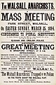 Walsall Anarchists Mass Meeting poster (1894).jpg 5,654 × 8,511; 4.36 MB
-
 Walsall Arboretum - geograph.org.uk - 2564714.jpg 1,280 × 856; 330 KB
-
 Walsall Arboretum Clock Tower - geograph.org.uk - 2567920.jpg 856 × 1,280; 265 KB
-
 Walsall Arboretum Clock Tower - geograph.org.uk - 2567932.jpg 856 × 1,280; 319 KB
-
 Walsall Arboretum Clock Tower - geograph.org.uk - 2570294.jpg 856 × 1,280; 199 KB
-
 Walsall Art Gallery - geograph.org.uk - 2219094.jpg 4,000 × 3,000; 1.79 MB
-
 Walsall Brook.jpg 200 × 266; 4 KB
-
 Walsall Canal Basin - geograph.org.uk - 2573171.jpg 1,280 × 873; 165 KB
-
 Walsall Canal Basin - geograph.org.uk - 2573176.jpg 1,280 × 856; 152 KB
-
 Walsall Canal, Walsall - geograph.org.uk - 2572070.jpg 1,280 × 856; 284 KB
-
 Walsall Council House - geograph.org.uk - 2566512.jpg 856 × 1,280; 223 KB
-
 Walsall Council House - geograph.org.uk - 2567909.jpg 1,280 × 856; 274 KB
-
 Walsall Gala Baths - geograph.org.uk - 2570341.jpg 1,280 × 856; 246 KB
-
 Walsall Junction - geograph.org.uk - 2571993.jpg 1,280 × 856; 159 KB
-
 Walsall Junction - geograph.org.uk - 2572001.jpg 1,280 × 856; 171 KB
-
 Walsall Library and Museum - geograph.org.uk - 2567914.jpg 1,280 × 856; 218 KB
-
 Walsall Locks - geograph.org.uk - 2572063.jpg 1,280 × 856; 234 KB
-
 Walsall Locks - geograph.org.uk - 2572073.jpg 1,280 × 856; 208 KB
-
 Walsall Locks, Walsall Canal, Walsall - geograph.org.uk - 2120295.jpg 640 × 480; 101 KB


.jpg)


_-_geograph.org.uk_-_3339133.jpg)


.jpg)


