Category:Willingham, Cambridgeshire
Jump to navigation
Jump to search
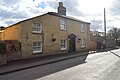
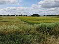
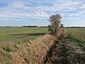
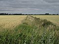
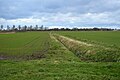
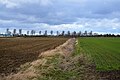
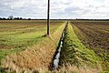
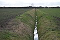
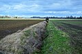
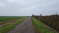
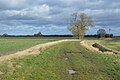
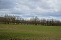
English: Willingham is a medium to large village in Cambridgeshire, England. It is located on the edge of the Fens. Driving north from the village one may observe the characteristic elevated straight roads and black soil.
village in Cambridgeshire, England  | |||||
| Upload media | |||||
| Instance of | |||||
|---|---|---|---|---|---|
| Location | South Cambridgeshire, Cambridgeshire, East of England, England | ||||
 | |||||
Subcategories
This category has the following 4 subcategories, out of 4 total.
Media in category "Willingham, Cambridgeshire"
The following 200 files are in this category, out of 495 total.
(previous page) (next page)-
 38 High Street, Willingham - geograph.org.uk - 5462988.jpg 3,264 × 2,448; 3.67 MB
-
 4-3-2-1 - geograph.org.uk - 4760002.jpg 4,320 × 3,240; 5.66 MB
-
 A February morning on West Fen Road - geograph.org.uk - 4364175.jpg 1,024 × 781; 966 KB
-
 A pair of cottages - geograph.org.uk - 5747324.jpg 640 × 426; 80 KB
-
 A sea of green - geograph.org.uk - 5459276.jpg 640 × 426; 37 KB
-
 A winter morning in the Fens - geograph.org.uk - 4363957.jpg 1,024 × 732; 818 KB
-
 A.R. Aspinall ^ Son - geograph.org.uk - 3095755.jpg 1,600 × 1,200; 582 KB
-
 Agricultural landscape - geograph.org.uk - 5959748.jpg 1,024 × 681; 125 KB
-
 At the end of West Fen Road - geograph.org.uk - 4363937.jpg 1,024 × 732; 899 KB
-
 B1050 - geograph.org.uk - 5421062.jpg 640 × 426; 76 KB
-
 B1050 - geograph.org.uk - 5459273.jpg 640 × 426; 51 KB
-
 B1050 Earith Road - geograph.org.uk - 6064318.jpg 1,024 × 684; 186 KB
-
 B1050 Earith Road, Willingham - geograph.org.uk - 6064314.jpg 1,024 × 684; 197 KB
-
 B1050 Shelford's Road - geograph.org.uk - 6064340.jpg 1,024 × 684; 166 KB
-
 B1050 towards Earith - geograph.org.uk - 6064352.jpg 1,024 × 768; 257 KB
-
 Bales and barn on West Fen Road - geograph.org.uk - 4364195.jpg 1,024 × 731; 1.03 MB
-
 Bales at the drove end - geograph.org.uk - 3393929.jpg 1,200 × 902; 1.57 MB
-
 Bales by West Fen Road - geograph.org.uk - 4364183.jpg 1,024 × 732; 1,015 KB
-
 Balland Field - geograph.org.uk - 5747311.jpg 640 × 426; 61 KB
-
 Bare field - geograph.org.uk - 3164874.jpg 1,600 × 1,200; 1.02 MB
-
 Barn, Long Lane - geograph.org.uk - 5743510.jpg 640 × 426; 64 KB
-
 Barn, New Farm - geograph.org.uk - 5421041.jpg 640 × 380; 47 KB
-
 Barn, New Farm - geograph.org.uk - 5421044.jpg 640 × 426; 59 KB
-
 Barn, New Farm - geograph.org.uk - 5421050.jpg 640 × 426; 53 KB
-
 Barn, New Farm - geograph.org.uk - 5763926.jpg 640 × 331; 33 KB
-
 Barn, New Farm - geograph.org.uk - 5763927.jpg 640 × 426; 42 KB
-
 Barriers on Flat Road, Willingham - geograph.org.uk - 4758917.jpg 4,320 × 3,240; 5.97 MB
-
 Beaumont Engineering, Meadow Road - geograph.org.uk - 4571127.jpg 2,560 × 1,920; 1.5 MB
-
 Belsar's Hill - geograph.org.uk - 5741483.jpg 640 × 426; 63 KB
-
 Belsar's Hill - geograph.org.uk - 6064237.jpg 1,024 × 768; 309 KB
-
 Belsar's Hill earthworks - geograph.org.uk - 2038887.jpg 1,600 × 1,200; 834 KB
-
 Belsar's Hill earthworks - geograph.org.uk - 2563532.jpg 1,600 × 1,200; 841 KB
-
 Belsar's Hill information board - geograph.org.uk - 2038880.jpg 3,648 × 2,736; 2.21 MB
-
 Belsar's Hill, earthwork and ditch (geograph 3394865).jpg 1,200 × 842; 1.44 MB
-
 Belsars Field - geograph.org.uk - 5288130.jpg 640 × 480; 62 KB
-
 Belsars Field - geograph.org.uk - 5288145.jpg 640 × 480; 51 KB
-
 Belsars Field - geograph.org.uk - 5738484.jpg 640 × 426; 59 KB
-
 Belsars Field - geograph.org.uk - 5738504.jpg 640 × 426; 68 KB
-
 Belsars Field - geograph.org.uk - 5738510.jpg 640 × 426; 75 KB
-
 Belsars Field - geograph.org.uk - 5738515.jpg 640 × 426; 56 KB
-
 Belsars Field - geograph.org.uk - 5738519.jpg 640 × 425; 62 KB
-
 Belsars Field - geograph.org.uk - 5738520.jpg 640 × 426; 64 KB
-
 Belsars Field - geograph.org.uk - 5738523.jpg 640 × 426; 79 KB
-
 Berrycroft - geograph.org.uk - 5747301.jpg 640 × 426; 66 KB
-
 Berrycroft - geograph.org.uk - 5747314.jpg 640 × 426; 50 KB
-
 Berrycroft - geograph.org.uk - 5747316.jpg 640 × 426; 80 KB
-
 Berrycroft Stores - geograph.org.uk - 5747303.jpg 640 × 425; 64 KB
-
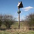 Bird-box on Haven Drove - geograph.org.uk - 3394516.jpg 1,200 × 1,200; 1.74 MB
-
 Boswell bakery - Church Street - geograph.org.uk - 5733370.jpg 640 × 480; 95 KB
-
 Bridle path to Earith - geograph.org.uk - 4363935.jpg 1,024 × 732; 837 KB
-
 Bridle path to Over - geograph.org.uk - 4363963.jpg 1,024 × 732; 920 KB
-
 Bridleway across Mere Holes - geograph.org.uk - 3164812.jpg 1,600 × 1,200; 920 KB
-
 Bridleway across Mere Holes - geograph.org.uk - 3164816.jpg 1,600 × 1,200; 910 KB
-
 Bridleway across Mere Holes - geograph.org.uk - 3164817.jpg 1,600 × 1,200; 954 KB
-
 Bridleway across Mere Holes - geograph.org.uk - 5416360.jpg 1,600 × 1,266; 540 KB
-
 Bridleway from West Fen Road - geograph.org.uk - 3164805.jpg 1,600 × 1,200; 779 KB
-
 Bridleway to Earith - geograph.org.uk - 3164860.jpg 1,600 × 1,200; 917 KB
-
 Bridleway to Earith - geograph.org.uk - 3164866.jpg 1,600 × 1,200; 771 KB
-
 Bridleway to Over from West Fen Road - geograph.org.uk - 4758955.jpg 4,320 × 3,240; 5.88 MB
-
 Bridleway to West Fen Road - geograph.org.uk - 2738761.jpg 1,600 × 1,200; 893 KB
-
 Bridleway to Willingham - geograph.org.uk - 4664790.jpg 2,560 × 1,920; 2.11 MB
-
 Building on West Fen - geograph.org.uk - 2738737.jpg 1,600 × 1,200; 839 KB
-
 Burnt out Car - geograph.org.uk - 5678073.jpg 640 × 480; 125 KB
-
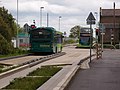 Buses stop - geograph.org.uk - 2943327.jpg 1,600 × 1,200; 400 KB
-
 By Meadow Drove - geograph.org.uk - 5741517.jpg 640 × 426; 56 KB
-
 Cadwin Field - geograph.org.uk - 5738466.jpg 640 × 426; 70 KB
-
 Cadwin Field - geograph.org.uk - 5738473.jpg 640 × 426; 66 KB
-
 Cadwin Field - geograph.org.uk - 5738479.jpg 640 × 426; 52 KB
-
 Cadwin Field - geograph.org.uk - 5738485.jpg 640 × 425; 66 KB
-
 Cadwin Field - geograph.org.uk - 5738491.jpg 640 × 426; 58 KB
-
 Cattle north of Middle Fen Farm - geograph.org.uk - 4757471.jpg 4,320 × 3,240; 5.69 MB
-
 Church St - geograph.org.uk - 5743502.jpg 640 × 426; 70 KB
-
-
 Cmglee Willingham library village sign.jpg 3,072 × 2,048; 1,024 KB
-
 Continuation of Hayden Way, Willingham - geograph.org.uk - 4630709.jpg 3,072 × 1,728; 2.03 MB
-
 Cottage on Church St - geograph.org.uk - 5747289.jpg 640 × 426; 66 KB
-
 Cottage, Rockmill End - geograph.org.uk - 5743496.jpg 640 × 426; 62 KB
-
 Cottenham Engine drain - geograph.org.uk - 4573593.jpg 2,560 × 1,920; 1.75 MB
-
 Cows by Sponge Drove - geograph.org.uk - 4571152.jpg 2,560 × 1,920; 1.82 MB
-
 Crop boundary by West Fen Road - geograph.org.uk - 4571085.jpg 2,560 × 1,920; 1.83 MB
-
 Crossroads, Willingham - geograph.org.uk - 5747331.jpg 640 × 426; 60 KB
-
 Cul de sac off Berrycroft - geograph.org.uk - 5747322.jpg 640 × 426; 73 KB
-
 Disk Harrow beside the Busway - geograph.org.uk - 4015367.jpg 1,024 × 768; 257 KB
-
 Ditch across Mere Holes - geograph.org.uk - 2738781.jpg 1,600 × 1,200; 831 KB
-
 Ditch across Mere Holes - geograph.org.uk - 3164859.jpg 1,600 × 1,200; 843 KB
-
 Ditch by Iram Drove - geograph.org.uk - 5411328.jpg 1,600 × 1,200; 436 KB
-
 Ditch by The Causeway - geograph.org.uk - 2147959.jpg 1,600 × 1,200; 1.11 MB
-
 Ditch off West Fen Road - geograph.org.uk - 2738749.jpg 1,600 × 1,200; 858 KB
-
 Drain beside Iram Drove - geograph.org.uk - 5288144.jpg 640 × 480; 94 KB
-
 Drain, The Irams - geograph.org.uk - 5288149.jpg 640 × 480; 78 KB
-
 Drainage channel - geograph.org.uk - 5741514.jpg 640 × 426; 64 KB
-
 Drainage channel - geograph.org.uk - 5741516.jpg 640 × 426; 67 KB
-
 Drainage ditch - geograph.org.uk - 5738475.jpg 640 × 426; 92 KB
-
 Drainage ditch - geograph.org.uk - 5738476.jpg 640 × 426; 71 KB
-
 Drainage ditch - geograph.org.uk - 5738511.jpg 640 × 426; 75 KB
-
 Drainage ditch - geograph.org.uk - 5741502.jpg 640 × 426; 89 KB
-
 Drainage ditch - geograph.org.uk - 5741509.jpg 640 × 426; 73 KB
-
 Drainage ditch - geograph.org.uk - 5741510.jpg 640 × 425; 75 KB
-
 Drainage ditch - geograph.org.uk - 5741512.jpg 640 × 425; 68 KB
-
 Drainage ditch - geograph.org.uk - 5741520.jpg 640 × 426; 71 KB
-
 Drainage ditch - geograph.org.uk - 5741539.jpg 640 × 426; 68 KB
-
 Drilling The Meadow - geograph.org.uk - 5937277.jpg 1,600 × 1,180; 460 KB
-
 Dry drain, Middle Fen - geograph.org.uk - 5288093.jpg 640 × 480; 67 KB
-
 Earith and the Ouse Washes from the air - geograph.org.uk - 3069064.jpg 768 × 1,024; 212 KB
-
 Earith Road (B1050) - geograph.org.uk - 5288087.jpg 640 × 480; 78 KB
-
 Earith Road (B1050) - geograph.org.uk - 5288097.jpg 640 × 480; 37 KB
-
 Earith Road leaving Willingham - geograph.org.uk - 2149271.jpg 1,600 × 1,200; 1.12 MB
-
 Earith Road past Middle Fen Farm - geograph.org.uk - 5935724.jpg 1,600 × 1,200; 424 KB
-
 Earith Road, Willingham - geograph.org.uk - 5288102.jpg 640 × 480; 63 KB
-
 East of Willingham. - geograph.org.uk - 6010037.jpg 1,600 × 900; 268 KB
-
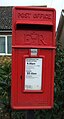
 Elizabeth II postbox on Rampton Road, Willingham - geograph.org.uk - 5290271.jpg 2,848 × 2,136; 1.26 MB
-
 Empty buildings by the busway - geograph.org.uk - 2831761.jpg 1,600 × 1,200; 486 KB
-
 End of West Fen Road - geograph.org.uk - 2738778.jpg 1,600 × 1,200; 746 KB
-
 Engine Drain - geograph.org.uk - 3164829.jpg 1,600 × 1,200; 826 KB
-
 Engine Drain - geograph.org.uk - 3164853.jpg 1,600 × 1,200; 906 KB
-
 Entering Willingham - geograph.org.uk - 5288098.jpg 640 × 480; 79 KB
-
 Entering Willingham - geograph.org.uk - 5288235.jpg 640 × 480; 80 KB
-
 Farm buildings on West Fen Road, Willingham - geograph.org.uk - 4758950.jpg 4,320 × 3,240; 5.52 MB
-
 Farm track off Shelford's Road - geograph.org.uk - 5288077.jpg 640 × 480; 85 KB
-
 Farmland - geograph.org.uk - 5421030.jpg 640 × 426; 52 KB
-
 Farmland by Busway - geograph.org.uk - 5459275.jpg 640 × 426; 54 KB
-
 Farmland near Longstanton - geograph.org.uk - 5289105.jpg 640 × 480; 60 KB
-
 Farmland off Rampton Road - geograph.org.uk - 5288236.jpg 640 × 480; 60 KB
-
 Farmland, New Farm - geograph.org.uk - 5959754.jpg 1,024 × 681; 135 KB
-
 Fen ploughland in April - geograph.org.uk - 3394520.jpg 1,200 × 895; 1.3 MB
-
 Fenland by Old West River - geograph.org.uk - 2563708.jpg 1,600 × 1,200; 790 KB
-
 Fenland ditch and farmland track - geograph.org.uk - 4758963.jpg 4,320 × 3,240; 5.61 MB
-
 Field boundary - geograph.org.uk - 5459270.jpg 640 × 426; 56 KB
-
 Field boundary - geograph.org.uk - 5738495.jpg 640 × 425; 67 KB
-
 Field boundary - geograph.org.uk - 5741490.jpg 640 × 425; 75 KB
-
 Field boundary - geograph.org.uk - 5741519.jpg 640 × 426; 77 KB
-
 Field by busway - geograph.org.uk - 5421053.jpg 640 × 425; 67 KB
-
 Field by Meadow Drove - geograph.org.uk - 5743482.jpg 640 × 426; 60 KB
-
 Field by Over Rd - geograph.org.uk - 5747594.jpg 640 × 426; 45 KB
-
 Field by the busway - geograph.org.uk - 4784320.jpg 1,600 × 1,200; 831 KB
-
 Field by West Fen Road - geograph.org.uk - 4571056.jpg 2,560 × 1,920; 1.89 MB
-
 Field entrance off Haden Way - geograph.org.uk - 5288247.jpg 640 × 480; 77 KB
-
 Field in Middle Fen - geograph.org.uk - 5935726.jpg 1,600 × 1,180; 350 KB
-
 Field in Willingham - geograph.org.uk - 5995639.jpg 1,600 × 1,200; 535 KB
-
 Fields by Meadow Drove - geograph.org.uk - 4571134.jpg 2,560 × 1,920; 1.84 MB
-
 Fields by the busway - geograph.org.uk - 5533781.jpg 1,600 × 1,200; 331 KB
-
 Fields off Stanton Mere way - geograph.org.uk - 3097065.jpg 1,600 × 1,200; 806 KB
-
 First signs of spring on Haven Drove - geograph.org.uk - 3394500.jpg 1,200 × 900; 1.49 MB
-
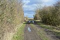
 Flat Bridge - geograph.org.uk - 3195091.jpg 1,600 × 1,200; 1,023 KB
-
 Flat Bridge - geograph.org.uk - 5674554.jpg 3,264 × 1,840; 2.27 MB
-
 Flat farmland - geograph.org.uk - 5421028.jpg 640 × 426; 54 KB
-
 Flat farmland - geograph.org.uk - 6009761.jpg 1,600 × 900; 358 KB
-
 Flat farmland north of Willingham - geograph.org.uk - 5288085.jpg 640 × 480; 57 KB
-
 Flat field - geograph.org.uk - 5743484.jpg 640 × 426; 64 KB
-
 Flat landscape - geograph.org.uk - 5741485.jpg 640 × 426; 61 KB
-
 Flat^ - geograph.org.uk - 5741498.jpg 640 × 426; 71 KB
-
 Fly tipping on West Fen Road, Willingham - geograph.org.uk - 4758957.jpg 4,320 × 3,240; 5.64 MB
-
 Fly-tipping at the end of West Fen Road - geograph.org.uk - 4758959.jpg 4,320 × 3,240; 5.44 MB
-
 Footpath along River Great Ouse - geograph.org.uk - 3194918.jpg 1,600 × 1,200; 808 KB
-
 G Webb Haulage Ltd - geograph.org.uk - 4015589.jpg 1,024 × 768; 158 KB
-
 Garage on George Street, Willingham - geograph.org.uk - 5288105.jpg 640 × 480; 49 KB
-
 Glasshouse - geograph.org.uk - 5421074.jpg 640 × 426; 50 KB
-
 Glasshouses - geograph.org.uk - 5759933.jpg 640 × 426; 34 KB
-
 Glasshouses - geograph.org.uk - 5959751.jpg 1,024 × 681; 119 KB
-
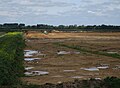
 Gravel extraction spreading at Ouse Fen - geograph.org.uk - 3215061.jpg 1,600 × 1,200; 913 KB
-
 Grazing near Highgate Farm - geograph.org.uk - 5288252.jpg 640 × 480; 68 KB
-
 Grazing off Iram Drove - geograph.org.uk - 5288134.jpg 640 × 480; 43 KB
-
 Grazing on the flood plain - geograph.org.uk - 4198605.jpg 2,997 × 2,248; 2.21 MB
-
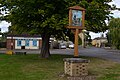
 Green and village sign, Willingham - geograph.org.uk - 3492338.jpg 4,320 × 3,240; 2.87 MB
-
 Green St - geograph.org.uk - 5743497.jpg 640 × 426; 70 KB
-
 Greenhouses - geograph.org.uk - 5459271.jpg 640 × 425; 43 KB
-
 Gym, Highgate Farm - geograph.org.uk - 5747352.jpg 640 × 426; 39 KB
-
 Haden Way - geograph.org.uk - 5288248.jpg 640 × 480; 55 KB
-
 Haden Way - geograph.org.uk - 5747351.jpg 640 × 426; 49 KB
-
 Haden Way, Willingham - geograph.org.uk - 3094360.jpg 1,600 × 1,200; 485 KB
-
 Haden Way, Willingham - geograph.org.uk - 3094364.jpg 1,600 × 1,200; 662 KB
-
 Hail covered road - geograph.org.uk - 5678082.jpg 640 × 480; 104 KB
-
 Hailstones cover the road - geograph.org.uk - 5747340.jpg 640 × 426; 89 KB
-
 Hailstones, Over Rd - geograph.org.uk - 5747338.jpg 640 × 426; 79 KB
-
 Hanson Aggregates quarry - geograph.org.uk - 4664779.jpg 2,560 × 1,965; 1.79 MB
-
 Hanson Aggregates quarry - geograph.org.uk - 4664785.jpg 2,560 × 1,920; 1.94 MB
-
 Hanson Aggregates quarry - geograph.org.uk - 5416357.jpg 1,600 × 1,176; 284 KB
-
 Hanson quarry - geograph.org.uk - 3215071.jpg 1,600 × 1,200; 796 KB
-
 Haven Drove - geograph.org.uk - 5288138.jpg 640 × 480; 104 KB
-
 Haven Drove - geograph.org.uk - 5678070.jpg 640 × 480; 68 KB
-
 Haven Drove - geograph.org.uk - 5738464.jpg 640 × 426; 72 KB
-
 Haven Drove - geograph.org.uk - 5738467.jpg 640 × 426; 111 KB
-
 Haven Drove - geograph.org.uk - 5738469.jpg 640 × 426; 107 KB
-
 Haven Drove - geograph.org.uk - 5738471.jpg 640 × 425; 57 KB
-
 Haven Drove - geograph.org.uk - 5738474.jpg 640 × 426; 67 KB
-
 Haven Drove - geograph.org.uk - 5738487.jpg 640 × 426; 87 KB
-
 Haven Drove - geograph.org.uk - 5738493.jpg 640 × 426; 104 KB
-
 Haven Drove - geograph.org.uk - 5738496.jpg 640 × 426; 98 KB
-
 Haven Drove - geograph.org.uk - 5738506.jpg 640 × 426; 71 KB
-
 Haven Drove - geograph.org.uk - 5741469.jpg 640 × 426; 110 KB
-
 Heading east on Iram Drove - geograph.org.uk - 5288140.jpg 640 × 480; 45 KB
-
 Heading to Earith - geograph.org.uk - 6009753.jpg 1,600 × 900; 366 KB
-
 Hedge by Meadow Drove - geograph.org.uk - 5743487.jpg 640 × 426; 53 KB
-
 Hedgerow off The Causeway - geograph.org.uk - 2038895.jpg 1,600 × 1,200; 911 KB
-
 Hedges on Haven Drove - geograph.org.uk - 3393965.jpg 1,200 × 900; 1.41 MB
-
 Hempsals Fen - geograph.org.uk - 2038926.jpg 1,600 × 1,200; 898 KB
-
 Hempsals Fen - geograph.org.uk - 2039036.jpg 1,600 × 1,200; 791 KB
-
 Hermitage Lock and River Great Ouse - geograph.org.uk - 6064578.jpg 1,024 × 768; 271 KB
-
 Hermitage Marina - geograph.org.uk - 3195167.jpg 1,600 × 1,200; 706 KB
-
 Hermitage Marina - geograph.org.uk - 4664795.jpg 2,560 × 1,920; 1.4 MB


.jpg)


_-_geograph.org.uk_-_5288087.jpg)
_-_geograph.org.uk_-_5288097.jpg)


