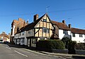
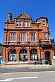
Category:Winslow, Buckinghamshire
Vai alla navigazione
Vai alla ricerca
English: Winslow is a small market town and also a civil parish designated as a town council within Aylesbury Vale district in north Buckinghamshire. It has a population of about 4500.
Nederlands: Winslow is een plaats (market town) in het bestuurlijke gebied Aylesbury Vale, in het Engelse graafschap Buckinghamshire. De plaats telt 4519 inwoners.
Norsk bokmål: Winslow er en markedsby i Buckinghamshire i England. Den har vokst i nyere tid, men har beholdt mye av sitt landlige preg.
Română: Winslow este un oraş în comitatul Buckinghamshire, regiunea South East England, Anglia. Oraşul se află în districtul Aylesbury Vale.
town and civil parish in Buckinghamshire, United Kingdom  | |||||
| Carica un file multimediale | |||||
| Istanza di | |||||
|---|---|---|---|---|---|
| Luogo | Buckinghamshire, Sud Est dell'Inghilterra, Inghilterra | ||||
| Popolazione |
| ||||
| Considerato essere uguale a | Winslow (pagina Wikimedia duplicata, parrocchia civile dell'Inghilterra) | ||||
| sito web ufficiale | |||||
 | |||||
Sottocategorie
Questa categoria contiene le 6 sottocategorie indicate di seguito, su un totale di 6.
L
- St Laurence' Church, Winslow (2 F)
M
W
- Winslow Hall (6 F)
- Winslow railway station (1 F)
- Winslow War Memorial (1 F)
File nella categoria "Winslow, Buckinghamshire"
Questa categoria contiene 161 file, indicati di seguito, su un totale di 161.
-
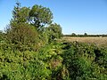
 A path through Magpie Spinney - geograph.org.uk - 4484806.jpg 1 500 × 999; 460 KB
-
 A413 (disused) looking north east - geograph.org.uk - 992356.jpg 640 × 499; 80 KB
-
 A413 nears the B4032 junction - geograph.org.uk - 4873007.jpg 640 × 480; 46 KB
-
 A413 towards Buckingham - geograph.org.uk - 6178993.jpg 1 024 × 684; 363 KB
-
 A413 towards Buckingham - geograph.org.uk - 6421629.jpg 1 024 × 684; 371 KB
-
 Arable field near Winslow - geograph.org.uk - 4485028.jpg 1 500 × 999; 253 KB
-
 Benchmark on The Bell Hotel - geograph.org.uk - 5209910.jpg 683 × 1 024; 234 KB
-
 Bend on A413 - geograph.org.uk - 6178996.jpg 1 024 × 684; 292 KB
-
 Bend on Winslow Road - geograph.org.uk - 5672363.jpg 2 048 × 1 536; 1,3 MB
-
 Bridge - Granborough Road - geograph.org.uk - 2354243.jpg 2 272 × 1 704; 855 KB
-
 Bridge on the Granborough Road - geograph.org.uk - 3540513.jpg 1 600 × 1 068; 443 KB
-
 Brook by the Winslow road - geograph.org.uk - 3154140.jpg 1 600 × 1 068; 680 KB
-
 Buckingham Road, Winslow - geograph.org.uk - 5671842.jpg 2 234 × 1 630; 951 KB
-
 Bungalows by the footpath - geograph.org.uk - 3525070.jpg 1 600 × 1 069; 474 KB
-
 Chubby's Chippy on Lowndes Way - geograph.org.uk - 4484805.jpg 1 500 × 999; 260 KB
-
 Church of St Laurence - geograph.org.uk - 3525105.jpg 1 600 × 1 068; 431 KB
-
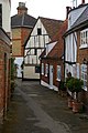
 Church Walk - geograph.org.uk - 3525087.jpg 1 200 × 1 600; 603 KB
-
 Claydon Brook - geograph.org.uk - 3540505.jpg 1 200 × 1 600; 474 KB
-
 Congregational Church, Winslow - geograph.org.uk - 1056448.jpg 640 × 480; 44 KB
-
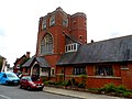 Congregational church, Winslow - geograph.org.uk - 4137154.jpg 4 320 × 3 240; 3,16 MB
-
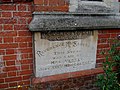 Congregational church, Winslow, foundation stone - geograph.org.uk - 4137156.jpg 4 320 × 3 240; 5,07 MB
-
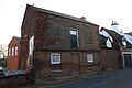
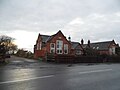 Converted school on Sheep Street, Winslow - geograph.org.uk - 5672358.jpg 2 048 × 1 536; 893 KB
-
 Cottages on the Aylesbury road - geograph.org.uk - 3154171.jpg 1 600 × 1 067; 539 KB
-
 Cross Bucks Way - geograph.org.uk - 2746069.jpg 640 × 480; 127 KB
-
 Cycle route 51 - geograph.org.uk - 3541644.jpg 1 600 × 1 068; 560 KB
-
 Cycle Route towards Mursley - geograph.org.uk - 1773217.jpg 2 272 × 1 704; 733 KB
-
 Disused railway cutting - geograph.org.uk - 3525079.jpg 1 200 × 1 600; 761 KB
-
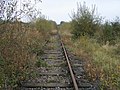 Disused Railway Line - geograph.org.uk - 2746066.jpg 640 × 480; 115 KB
-
 Drive up to Shipton Farm - geograph.org.uk - 3154169.jpg 1 600 × 1 067; 676 KB
-
 East Claydon Road - geograph.org.uk - 6388925.jpg 1 024 × 768; 260 KB
-
 East Claydon Road - geograph.org.uk - 6388932.jpg 1 024 × 768; 263 KB
-
 East Claydon Road to Winslow - geograph.org.uk - 4485023.jpg 1 500 × 999; 159 KB
-
 East Claydon Road to Winslow - geograph.org.uk - 4485045.jpg 1 500 × 999; 168 KB
-
 Elizabeth II postbox on High Street, Winslow - geograph.org.uk - 6276571.jpg 2 531 × 4 606; 2,08 MB
-
 Enamel tobacco advertisements, Winslow - geograph.org.uk - 4610773.jpg 1 160 × 1 762; 510 KB
-
 Entrance to Red Hall Farm - geograph.org.uk - 3541646.jpg 1 600 × 1 068; 602 KB
-
 Field and sheep, Shipton - geograph.org.uk - 3690966.jpg 1 449 × 1 000; 1,25 MB
-
 Fields near Shipton Farm - geograph.org.uk - 3691012.jpg 1 510 × 1 000; 1,52 MB
-
 Fine Chimneys, Winslow - geograph.org.uk - 1056563.jpg 640 × 472; 66 KB
-
 Footbridge near Shipton Bridge - geograph.org.uk - 187799.jpg 480 × 640; 107 KB
-
 Footbridge over disused railway - geograph.org.uk - 934435.jpg 640 × 480; 132 KB
-
 Footpath and national cycle route 51 towards Bletchley - geograph.org.uk - 3541641.jpg 1 200 × 1 600; 723 KB
-
 Footpath to Laker's - geograph.org.uk - 3525072.jpg 1 600 × 1 067; 621 KB
-
 Footpath to Shipton Farm - geograph.org.uk - 3154168.jpg 1 600 × 1 067; 595 KB
-
 Former course of A413, Shipton - geograph.org.uk - 3691029.jpg 1 091 × 1 000; 970 KB
-
 Former Winslow Post Office - geograph.org.uk - 4610756.jpg 1 282 × 1 644; 524 KB
-
 Friends Meeting House Winslow Geograph-2230586-by-Christopher-Hilton.jpg 681 × 1 024; 153 KB
-
 Furze Lane Burial Ground, Winslow - geograph.org.uk - 1773182.jpg 2 272 × 1 704; 688 KB
-
 Granborough Road - geograph.org.uk - 1932701.jpg 640 × 480; 87 KB
-
 Granborough Road towards Winslow - geograph.org.uk - 6275573.jpg 800 × 600; 126 KB
-
 Grey poplars at Shipton Bridge - geograph.org.uk - 433594.jpg 480 × 640; 308 KB
-
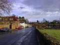
 Greyhound Lane car park, Winslow - geograph.org.uk - 438447.jpg 640 × 480; 90 KB
-
 Hedgerow by Winslow Road - geograph.org.uk - 5672368.jpg 2 009 × 1 506; 969 KB
-
 High Street and George Hotel - geograph.org.uk - 4873041.jpg 640 × 481; 64 KB
-
 High Street at the junction of Station Road, Winslow - geograph.org.uk - 5670921.jpg 2 277 × 1 708; 1,14 MB
-
 High Street in Winslow - geograph.org.uk - 4484802.jpg 1 500 × 999; 125 KB
-
 High Street in Winslow - geograph.org.uk - 4484803.jpg 1 500 × 977; 136 KB
-
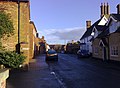
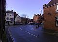
 High Street, Winslow - geograph.org.uk - 438648.jpg 640 × 480; 84 KB
-

-
 Horn Street, looking west - geograph.org.uk - 1056547.jpg 640 × 475; 49 KB
-
 Horn Street, Winslow - geograph.org.uk - 1056533.jpg 640 × 476; 54 KB
-
 Horn Street, Winslow - geograph.org.uk - 1056575.jpg 640 × 478; 73 KB
-
 Horn Street, Winslow - geograph.org.uk - 6275718.jpg 800 × 600; 111 KB
-
 Horne Street, Winslow c.1950 - geograph.org.uk - 3009466.jpg 1 830 × 1 302; 1,68 MB
-
 Hotels, Winslow Market Square - geograph.org.uk - 2230585.jpg 1 024 × 681; 90 KB
-

-
 House on Horn Street, Winslow - geograph.org.uk - 6275584.jpg 800 × 600; 144 KB
-
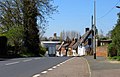
 Houses in Station Road, Winslow - geograph.org.uk - 438508.jpg 640 × 480; 101 KB
-

-
 Lesser celandine in Magpie Spinney - geograph.org.uk - 4484812.jpg 1 500 × 999; 232 KB
-
 Nags Head, Winslow - geograph.org.uk - 289788.jpg 640 × 480; 80 KB
-
 National Cycle Route 51 - geograph.org.uk - 2645389.jpg 4 000 × 3 000; 4,84 MB
-
 National Cycle Route 51 near Winslow - geograph.org.uk - 6275740.jpg 640 × 480; 106 KB
-

-
 Old houses on Horn Street, Winslow - geograph.org.uk - 6275719.jpg 800 × 560; 108 KB
-
 Open land at the back of The Spinney - geograph.org.uk - 4484809.jpg 1 500 × 999; 242 KB
-
 Ordnance Survey Drawings - Winslow, Buckinghamshire (OSD 231).jpg 4 000 × 2 537; 3,05 MB
-
 Ordnance Survey Flush Bracket 1966 - geograph.org.uk - 3255852.jpg 3 264 × 2 448; 1,96 MB
-
 Pasture in front of Red Hall Farm - geograph.org.uk - 3541649.jpg 1 600 × 1 068; 535 KB
-
 Pasture with track to Redfield community - geograph.org.uk - 438663.jpg 640 × 480; 232 KB
-
 Path by the empty lake - geograph.org.uk - 3154215.jpg 1 600 × 1 067; 587 KB
-
 Path up to Tuckey Farm - geograph.org.uk - 5186867.jpg 640 × 486; 64 KB
-
 Picnic area at Shipton Bridge - geograph.org.uk - 992378.jpg 640 × 391; 69 KB
-
 Post Office on High Street, Winslow - geograph.org.uk - 6276572.jpg 5 184 × 3 888; 6,7 MB
-
 Public Footpath - geograph.org.uk - 2354242.jpg 1 704 × 2 272; 1,01 MB
-
 Railway line - geograph.org.uk - 60123.jpg 640 × 480; 176 KB
-

-
 Rosemary Cottage, Shipton - geograph-3690778.jpg 1 332 × 1 000; 1,23 MB
-
 Shaftesbury Court care home, Winslow - geograph.org.uk - 438498.jpg 640 × 480; 116 KB
-
 Sharp Bend, A413 Winslow - geograph.org.uk - 1056392.jpg 640 × 471; 58 KB
-
 Sheep and lambs - geograph.org.uk - 4404155.jpg 640 × 480; 137 KB
-
 Sheep and lambs - geograph.org.uk - 6388937.jpg 1 024 × 768; 263 KB
-
 Sheep Grazing, Winslow - geograph.org.uk - 1056427.jpg 640 × 477; 59 KB
-
 Sheep Street in Winslow - geograph.org.uk - 4484816.jpg 1 500 × 961; 209 KB
-
 Sheep Street in Winslow - geograph.org.uk - 4484818.jpg 1 500 × 976; 172 KB
-
 Sheep Street looking east - geograph.org.uk - 1056379.jpg 640 × 478; 72 KB
-
 Sheep Street looking east - geograph.org.uk - 60122.jpg 640 × 480; 125 KB
-
 Sheep Street Winslow - geograph.org.uk - 3248499.jpg 2 448 × 3 264; 1,54 MB
-
 Sheep Street, Winslow - geograph.org.uk - 1056353.jpg 640 × 480; 46 KB
-
 Sheep Street, Winslow - geograph.org.uk - 1056363.jpg 640 × 473; 74 KB
-
 Sheep Street, Winslow - geograph.org.uk - 6275737.jpg 800 × 600; 206 KB
-
 Shipton Bridge - geograph.org.uk - 187817.jpg 640 × 480; 110 KB
-
 Shipton Bridge - geograph.org.uk - 1934252.jpg 640 × 480; 91 KB
-
 Shipton Bridge Lay By - A413 - geograph.org.uk - 2619500.jpg 4 000 × 3 000; 5,05 MB
-
 Shipton bridge picnic area - geograph.org.uk - 433586.jpg 640 × 480; 123 KB
-
 Shipton Bridge, Winslow - geograph.org.uk - 992350.jpg 640 × 480; 63 KB
-
 Shops and offices in the Market Square - geograph.org.uk - 4485017.jpg 1 500 × 999; 166 KB
-
 Showground, Winslow - geograph.org.uk - 1056415.jpg 640 × 474; 50 KB
-
 Sign for the Bell Hotel, Winslow - geograph.org.uk - 6275727.jpg 527 × 800; 103 KB
-
 Sign for the George, Winslow - geograph.org.uk - 6275723.jpg 800 × 584; 127 KB
-
 Sign for the Nags Head, Winslow - geograph.org.uk - 6275733.jpg 710 × 800; 159 KB
-
 St Laurence church in Winslow - geograph.org.uk - 4484833.jpg 1 500 × 999; 223 KB
-
 St Laurence's church, Winslow - geograph.org.uk - 3619248.jpg 4 320 × 3 240; 5,53 MB
-
 St Laurence's church, Winslow - geograph.org.uk - 4137171.jpg 4 320 × 3 240; 3,9 MB
-
 Staniford House, Winslow - geograph.org.uk - 2208303.jpg 1 024 × 691; 239 KB
-
 Station road, Winslow - geograph.org.uk - 437477.jpg 640 × 480; 93 KB
-
 Stream just north of Winslow, Bucks - geograph.org.uk - 4104953.jpg 1 024 × 683; 257 KB
-
 Stream just north of Winslow, Bucks - geograph.org.uk - 4104963.jpg 1 024 × 683; 219 KB
-

-

-

-

-

-
 The Bell Hotel on Horn Street - geograph.org.uk - 4484839.jpg 1 500 × 999; 166 KB
-
 The Bell Hotel, Sheep Street - geograph.org.uk - 5209935.jpg 1 024 × 683; 146 KB
-
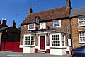
 The Bell Hotel, Winslow - geograph.org.uk - 6275724.jpg 800 × 600; 95 KB
-
 The Claydon Brook - geograph.org.uk - 6275570.jpg 800 × 600; 199 KB
-
 The George on Horn Street - geograph.org.uk - 4485007.jpg 1 500 × 999; 202 KB
-
 The George, Winslow - geograph.org.uk - 3858625.jpg 640 × 428; 125 KB
-
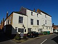 The George, Winslow - geograph.org.uk - 6275720.jpg 800 × 605; 94 KB
-
 The George, Winslow - geograph.org.uk - 6275722.jpg 800 × 600; 123 KB
-
 The Market Square, Winslow, Bucks - geograph.org.uk - 40340.jpg 640 × 427; 102 KB
-
 The Nags Head on Sheep Street - geograph.org.uk - 4484820.jpg 1 500 × 1 007; 200 KB
-
 The Nags Head, Winslow - geograph.org.uk - 6275731.jpg 800 × 600; 104 KB
-
 The Pyghtle - geograph.org.uk - 3690774.jpg 1 333 × 1 000; 1,28 MB
-
 The Swan, Winslow - geograph.org.uk - 904491.jpg 640 × 414; 62 KB
-
 TSB bank in Winslow - geograph.org.uk - 4484828.jpg 999 × 1 500; 211 KB
-
 TSB Bank on Market Square, Winslow - geograph.org.uk - 6276565.jpg 3 854 × 4 311; 3,82 MB
-
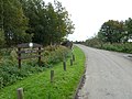
 Verney Road - geograph.org.uk - 1932684.jpg 640 × 480; 72 KB
-
 Verney Road in Winslow - geograph.org.uk - 4484799.jpg 1 500 × 999; 174 KB
-
 Vicarage Road in Winslow - geograph.org.uk - 4484801.jpg 1 500 × 999; 165 KB
-
 Victorian pillar box - geograph.org.uk - 3525103.jpg 1 200 × 1 600; 478 KB
-

-
 Victorian postbox on Market Square, Winslow - geograph.org.uk - 6276563.jpg 2 558 × 4 345; 2,74 MB
-
 War grave in church yard of St Laurence's Winslow - geograph.org.uk - 4137187.jpg 2 738 × 1 952; 1,99 MB
-
 Winslow Baptist Tabernacle - geograph.org.uk - 438634.jpg 640 × 585; 126 KB
-
 Winslow cemetery and church - geograph.org.uk - 3862263.jpg 640 × 480; 132 KB
-
 Winslow Civic Offices - geograph.org.uk - 3525097.jpg 1 600 × 1 067; 365 KB
-
 Winslow disused railway - geograph.org.uk - 934433.jpg 640 × 549; 82 KB
-
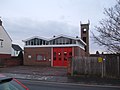 Winslow Fire Station - geograph.org.uk - 1772526.jpg 2 272 × 1 704; 712 KB
-
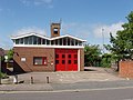 Winslow Fire Station - geograph.org.uk - 438482.jpg 640 × 480; 90 KB
-

-
 Winslow Road (B4032) - geograph.org.uk - 6275746.jpg 800 × 506; 156 KB
-
 Winslow Road - geograph.org.uk - 5673374.jpg 1 930 × 1 362; 623 KB
-
 Winslow Sports Club - geograph.org.uk - 3477508.jpg 3 264 × 2 448; 1,72 MB
-
 Winslow Tabernacle - geograph.org.uk - 4609312.jpg 1 268 × 1 429; 537 KB
-
 Winslow Telephone Exchange - geograph.org.uk - 1611693.jpg 640 × 480; 70 KB
-
 Winslow, A413 Sheep Street - geograph.org.uk - 163539.jpg 640 × 480; 86 KB
-
 Winslow, cattle market - geograph.org.uk - 2230587.jpg 1 024 × 681; 203 KB
-
 Winslow, Church Street - geograph.org.uk - 2230589.jpg 681 × 1 024; 178 KB
-


_looking_north_east_-_geograph.org.uk_-_992356.jpg)


.jpg)


_-_geograph.org.uk_-_438476.jpg)
_-_geograph.org.uk_-_6275746.jpg)


