Category:Winster, Derbyshire
Jump to navigation
Jump to search
village and civil parish in Derbyshire Dales district, Derbyshire, England  | |||||
| Upload media | |||||
| Instance of | |||||
|---|---|---|---|---|---|
| Location | Derbyshire Dales, Derbyshire, East Midlands, England | ||||
| Different from | |||||
| Said to be the same as | Winster (Wikimedia duplicated page, civil parish) | ||||
 | |||||
Subcategories
This category has the following 6 subcategories, out of 6 total.
Media in category "Winster, Derbyshire"
The following 200 files are in this category, out of 322 total.
(previous page) (next page)-
 "The Miners Standard", Winster - geograph.org.uk - 2870829.jpg 4,317 × 2,878; 4.71 MB
-
 "Vernon House", Winster - geograph.org.uk - 2870847.jpg 4,608 × 3,072; 3.48 MB
-
 "Winster Village Shop", Winster - geograph.org.uk - 2870835.jpg 3,070 × 4,094; 2.98 MB
-
 "Yuk" - geograph.org.uk - 1133552.jpg 480 × 640; 57 KB
-
 9 and 10 Wooley's Yard, Winster.jpg 2,816 × 1,880; 2.9 MB
-
 A Derbyshire View - geograph.org.uk - 5002456.jpg 4,000 × 2,992; 4.12 MB
-
 A distinctive tree - geograph.org.uk - 2359519.jpg 713 × 950; 369 KB
-
 A field with sheep - geograph.org.uk - 2682661.jpg 640 × 427; 116 KB
-
 A Squeezer Stile in action - geograph.org.uk - 1183845.jpg 640 × 480; 71 KB
-
 A view south - geograph.org.uk - 2682244.jpg 640 × 427; 86 KB
-
 A Winster gennel-ginnel - geograph.org.uk - 1131727.jpg 640 × 480; 97 KB
-
 Approaching the top, Bonsall Lane - geograph.org.uk - 4866891.jpg 640 × 426; 74 KB
-
 Archway, East Bank - geograph.org.uk - 1138393.jpg 480 × 640; 94 KB
-
 Autumn colour - geograph.org.uk - 3323627.jpg 1,280 × 853; 154 KB
-
 Autumn colour - geograph.org.uk - 3323629.jpg 1,280 × 853; 216 KB
-

-
 Autumnal Scene near Oddo - geograph.org.uk - 2678384.jpg 3,296 × 2,472; 1.05 MB
-
 B5056 - geograph.org.uk - 4866794.jpg 640 × 426; 84 KB
-
 B5056 - geograph.org.uk - 4866795.jpg 640 × 426; 84 KB
-
 B5056 - geograph.org.uk - 4866798.jpg 640 × 426; 87 KB
-
 B5056 - geograph.org.uk - 5017957.jpg 5,184 × 3,456; 1.46 MB
-
 B5056 through Winster - geograph.org.uk - 3701261.jpg 800 × 539; 207 KB
-
 B5056 towards Winster - geograph.org.uk - 3997051.jpg 640 × 480; 58 KB
-
 B5056 towards Winster - geograph.org.uk - 3997063.jpg 640 × 480; 57 KB
-
 B5056, southbound - geograph.org.uk - 4866813.jpg 640 × 426; 44 KB
-
 B5057 Running Through Winster - geograph.org.uk - 6016420.jpg 1,024 × 576; 143 KB
-
 Bales in a narrow field - geograph.org.uk - 4866886.jpg 640 × 426; 66 KB
-
 Bank House on West Bank - geograph.org.uk - 1137257.jpg 640 × 480; 86 KB
-
 Bank House seen from the churchyard - geograph.org.uk - 1135928.jpg 640 × 480; 75 KB
-
 Bank Top - geograph.org.uk - 5009453.jpg 4,780 × 2,355; 1.95 MB
-
 Bank Top Farm - geograph.org.uk - 3157576.jpg 640 × 427; 275 KB
-
 Bank Top Farm - geograph.org.uk - 3312834.jpg 640 × 360; 52 KB
-
 Bank Top Farm - geograph.org.uk - 3921445.jpg 640 × 427; 97 KB
-
 Bank Top Farm - geograph.org.uk - 4866803.jpg 640 × 426; 54 KB
-
 Bank Top Farm - geograph.org.uk - 4866804.jpg 640 × 426; 49 KB
-
 Bank Top Farmhouse - geograph.org.uk - 4866802.jpg 640 × 426; 80 KB
-
 Bank Top Farmhouse, Winster.jpg 3,456 × 2,304; 4.6 MB
-
 Barn by a lane - geograph.org.uk - 2359485.jpg 950 × 483; 291 KB
-
 Barn by the Limestone Way - geograph.org.uk - 4862185.jpg 640 × 426; 78 KB
-
 Below Upper Town - geograph.org.uk - 4272472.jpg 640 × 426; 93 KB
-
 Bonsall Lane - geograph.org.uk - 4866882.jpg 640 × 426; 102 KB
-
 Bonsall Lane - geograph.org.uk - 4866884.jpg 640 × 426; 74 KB
-
 Bonsall Lane - geograph.org.uk - 4866894.jpg 640 × 426; 51 KB
-
 Bonsall Lane - geograph.org.uk - 4875192.jpg 640 × 426; 63 KB
-
 By Bonsall Lane in the summertime - geograph.org.uk - 4076559.jpg 2,428 × 1,942; 2.47 MB
-
 By Chadwick Hill - geograph.org.uk - 4862155.jpg 640 × 426; 70 KB
-
 Byway - geograph.org.uk - 4862153.jpg 640 × 426; 96 KB
-
 Cattle in field at Bank Top Farm - geograph.org.uk - 1230526.jpg 640 × 480; 69 KB
-
 Chadwick Hill - geograph.org.uk - 4862151.jpg 640 × 426; 79 KB
-
 Chadwick Hill - geograph.org.uk - 4862158.jpg 640 × 426; 82 KB
-
 Chadwick Hill - geograph.org.uk - 5009379.jpg 5,183 × 2,627; 2.04 MB
-
 Church of St John, Winster - geograph.org.uk - 6290444.jpg 3,776 × 2,520; 3.22 MB
-
 Cottage on East Bank - geograph.org.uk - 3997066.jpg 640 × 480; 108 KB
-
 Cottages by the B5056 - geograph.org.uk - 4866800.jpg 640 × 426; 80 KB
-
 Cottages on The Flat - geograph.org.uk - 1131417.jpg 640 × 480; 99 KB
-
 Countryside south of Winster - geograph.org.uk - 4076554.jpg 2,592 × 1,944; 2.76 MB
-
 Crossroads south of Winster - geograph.org.uk - 1230542.jpg 640 × 480; 65 KB
-
 Cut bench mark on Winster, Market House - geograph.org.uk - 2554596.jpg 640 × 480; 103 KB
-
 Date stones on The Archway - geograph.org.uk - 1138302.jpg 480 × 640; 104 KB
-
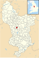 Derbyshire UK parish map highlighting Winster.svg 888 × 1,308; 2.34 MB
-
 Derelict field barn - geograph.org.uk - 4866791.jpg 640 × 426; 73 KB
-
 Dudwood Lane - geograph.org.uk - 4862148.jpg 640 × 426; 102 KB
-
 East Bank, Winster - geograph.org.uk - 2632997.jpg 4,320 × 3,240; 2.86 MB
-
 East Bank, Winster - geograph.org.uk - 3323654.jpg 1,280 × 853; 180 KB
-

-
 Far track, Winstermoor Farm - geograph.org.uk - 3997057.jpg 640 × 480; 79 KB
-
 Farm buildings - geograph.org.uk - 4862169.jpg 640 × 426; 79 KB
-
 Farm buildings by Buckdale Lane - geograph.org.uk - 4866789.jpg 640 × 426; 80 KB
-
 Farm ruin by Bonsall Lane - geograph.org.uk - 4076557.jpg 2,592 × 1,944; 2.1 MB
-
 Field above Winster by the Limestone Way - geograph.org.uk - 2359462.jpg 950 × 713; 466 KB
-
 Field barn - geograph.org.uk - 2652179.jpg 3,648 × 2,736; 4.1 MB
-
 Field barn - geograph.org.uk - 4866811.jpg 640 × 426; 58 KB
-
 Field barn in trees - geograph.org.uk - 4866815.jpg 640 × 426; 71 KB
-
 Field barn, Bonsall Lane - geograph.org.uk - 4875188.jpg 640 × 426; 69 KB
-
 Field barn, Bonsall Lane - geograph.org.uk - 4875193.jpg 640 × 426; 66 KB
-
 Field corner in springtime - geograph.org.uk - 2359210.jpg 950 × 712; 490 KB
-
 Field east of Elton - geograph.org.uk - 2359207.jpg 950 × 459; 270 KB
-
 Field, farm buildings and pub - geograph.org.uk - 2359469.jpg 950 × 565; 352 KB
-
 Fields near Elton - geograph.org.uk - 4862175.jpg 640 × 426; 44 KB
-
 Footpath and Grey Tor - geograph.org.uk - 2678366.jpg 3,296 × 2,472; 1.06 MB
-
 Footpath off Bonsall Lane - geograph.org.uk - 4875190.jpg 640 × 426; 75 KB
-
 Footpath to Winster - geograph.org.uk - 4866786.jpg 640 × 426; 68 KB
-

-
 Former shop doorway, Winster - geograph.org.uk - 3902909.jpg 1,500 × 2,000; 1.12 MB
-
 Former shop in Main Street - geograph.org.uk - 1133973.jpg 640 × 480; 77 KB
-
 Gennel off East Bank, Winster - geograph.org.uk - 2870841.jpg 3,070 × 4,094; 2.75 MB
-
 Grazing off the B5056 - geograph.org.uk - 3997050.jpg 640 × 480; 61 KB
-
 Grazing west of the B5056 - geograph.org.uk - 3997061.jpg 640 × 480; 76 KB
-
 Green Man at the Dower House - geograph.org.uk - 1135488.jpg 480 × 640; 117 KB
-
 Grey Tor - geograph.org.uk - 2359225.jpg 950 × 703; 363 KB
-
 Grey Tor - geograph.org.uk - 2841684.jpg 1,500 × 1,125; 1.37 MB
-
 Grey Tor - geograph.org.uk - 4866787.jpg 640 × 426; 57 KB
-
 Grey Tor - geograph.org.uk - 4866790.jpg 640 × 426; 70 KB
-
 Grey Tor - geograph.org.uk - 4866792.jpg 640 × 426; 59 KB
-
 Grey Tor - geograph.org.uk - 4866797.jpg 640 × 426; 65 KB
-
 Grey Tor - geograph.org.uk - 5017959.jpg 5,184 × 3,456; 1.72 MB
-
 Grey Tor, from track, Limestone Way - geograph.org.uk - 1230516.jpg 640 × 480; 103 KB
-
 Grindstone and bench above West Bank - geograph.org.uk - 1137267.jpg 640 × 480; 109 KB
-
 Harness Room, Winster.jpg 4,000 × 2,992; 5.32 MB
-
 Henry Tomkins, shop sign - geograph.org.uk - 1134008.jpg 640 × 480; 101 KB
-
 Hillside and valley views near Winster - geograph.org.uk - 2359429.jpg 950 × 713; 446 KB
-
 Hillside farmland west of Winster - geograph.org.uk - 2359233.jpg 950 × 701; 404 KB
-
 Hillside footpath near Winster - geograph.org.uk - 2359436.jpg 950 × 704; 386 KB
-
 Hillside southeast of Winster - geograph.org.uk - 2359396.jpg 950 × 691; 442 KB
-
 Hilltop tor - geograph.org.uk - 4875195.jpg 640 × 426; 46 KB
-
 Holmelea - geograph.org.uk - 3330566.jpg 1,280 × 853; 228 KB
-
 Holmelea, Winster.jpg 3,456 × 2,304; 3.47 MB
-
 House dated 1754 - geograph.org.uk - 1138297.jpg 640 × 480; 79 KB
-
 House east of Holmlea, Winster.jpg 2,816 × 1,880; 2.88 MB
-
 House on East Bank Winster - geograph.org.uk - 4493386.jpg 2,816 × 1,880; 2.71 MB
-
 Houses in East Bank - geograph.org.uk - 1130528.jpg 640 × 480; 65 KB
-
 Interesting Winster house - geograph.org.uk - 1133300.jpg 640 × 480; 77 KB
-
 Islington Lane - geograph.org.uk - 3101211.jpg 2,048 × 1,536; 516 KB
-
 Islington Lane - geograph.org.uk - 4866817.jpg 640 × 426; 53 KB
-
 Islington Road - geograph.org.uk - 2841665.jpg 1,500 × 1,125; 2.33 MB
-
 Junction of B5056 and B5057 - geograph.org.uk - 6016410.jpg 1,024 × 576; 117 KB
-
 Ladydale - geograph.org.uk - 1137101.jpg 640 × 480; 104 KB
-
 Lansdowne House and Georgic House, Winster.jpg 2,535 × 1,692; 1.57 MB
-
 Lead Ore House - geograph.org.uk - 2547401.jpg 1,024 × 768; 181 KB
-
 Lead Ore House - geograph.org.uk - 3157579.jpg 427 × 640; 260 KB
-
 Lead Ore House - near Winster - geograph.org.uk - 5797077.jpg 640 × 427; 128 KB
-
 Lead Vault - geograph.org.uk - 4866810.jpg 640 × 426; 55 KB
-
 Lead Vault at Bank Top - geograph.org.uk - 4866809.jpg 640 × 426; 87 KB
-
 Leaving the woods west of Winster - geograph.org.uk - 6290474.jpg 3,776 × 2,520; 3.2 MB
-
 Limestone outcrop near Winster - geograph.org.uk - 2682370.jpg 640 × 427; 91 KB
-
 Limestone Way - geograph.org.uk - 4862161.jpg 640 × 426; 88 KB
-
 Limestone Way - geograph.org.uk - 4862165.jpg 640 × 426; 96 KB
-
 Limestone Way - geograph.org.uk - 4862174.jpg 640 × 426; 98 KB
-
 Limestone Way - geograph.org.uk - 4862178.jpg 640 × 426; 106 KB
-
 Limestone Way - geograph.org.uk - 4862184.jpg 640 × 426; 114 KB
-
 Limestone Way approaching Chadwick Hill - geograph.org.uk - 6286468.jpg 5,184 × 3,456; 6.33 MB
-
 Limestone Way junction west of Luntor Rocks - geograph.org.uk - 3099315.jpg 2,048 × 1,536; 568 KB
-
 Limestone Way south of Winster - geograph.org.uk - 3101198.jpg 2,048 × 1,536; 712 KB
-
 Long upland country lane - geograph.org.uk - 2359512.jpg 529 × 950; 285 KB
-

-
 Looking down on Winster - geograph.org.uk - 2359446.jpg 950 × 741; 422 KB
-

-

-
 Looking down towards Oddo - geograph.org.uk - 1137094.jpg 640 × 480; 141 KB
-

-
 Lots of fields, upland pasture - geograph.org.uk - 2359513.jpg 950 × 513; 301 KB
-
 Main St Winster - geograph.org.uk - 4124052.jpg 640 × 480; 80 KB
-
 Main Street Winster - geograph.org.uk - 1134102.jpg 640 × 480; 69 KB
-
 Main Street, Winster - geograph.org.uk - 2359388.jpg 950 × 659; 397 KB
-
 Main Street, Winster - geograph.org.uk - 5945749.jpg 5,184 × 3,888; 4.21 MB
-
 Market House, Winster - geograph.org.uk - 2632981.jpg 4,033 × 3,218; 2.27 MB
-
 Market House, Winster - geograph.org.uk - 2869748.jpg 2,665 × 2,993; 1.56 MB
-
 Mossy walls - geograph.org.uk - 1137169.jpg 480 × 640; 150 KB
-
 MoT testing station signs - geograph.org.uk - 5640489.jpg 1,280 × 1,280; 454 KB
-
 Old barn below Grey Tor - geograph.org.uk - 2359240.jpg 950 × 668; 415 KB
-
 Old gateway on Wyns Tor above Winster - geograph.org.uk - 2359455.jpg 950 × 614; 350 KB
-
 Old Milestone by the B5056 (geograph 5623727).jpg 997 × 1,361; 237 KB
-
 Old Milestone by the B5056, west of Winster (geograph 5623726).jpg 997 × 1,104; 206 KB
-
 Old pig sties in Winster garden - geograph.org.uk - 1138410.jpg 640 × 480; 130 KB
-
 Old Winster Stone Gateposts - geograph.org.uk - 101756.jpg 640 × 480; 156 KB
-
 On a footpath through a field - geograph.org.uk - 1622811.jpg 640 × 480; 53 KB
-
 On Bonsall Lane - geograph.org.uk - 1622801.jpg 640 × 464; 58 KB
-
 Ore house - geograph.org.uk - 3323560.jpg 1,280 × 853; 207 KB
-
 Overlooking Winster - geograph.org.uk - 2359406.jpg 950 × 713; 429 KB
-
 Pair of Old Gateposts - geograph.org.uk - 3157716.jpg 427 × 640; 269 KB
-
 Palladian houses in Main Street - geograph.org.uk - 1138311.jpg 640 × 480; 75 KB
-
 Pasture off Bonsall Lane - geograph.org.uk - 4866892.jpg 640 × 426; 72 KB
-
 Pasture, Bank Top - geograph.org.uk - 4866823.jpg 640 × 426; 40 KB
-
 Path from Winster - geograph.org.uk - 992522.jpg 640 × 480; 139 KB
-
 Patriotic sheep - geograph.org.uk - 272422.jpg 640 × 480; 116 KB
-
 Pond and Farm Animals, East Bank, Winster - geograph.org.uk - 2678779.jpg 3,296 × 2,472; 1.08 MB
-
 Post Box on East Bank - geograph.org.uk - 3157719.jpg 427 × 640; 244 KB
-

-
 Primitive Methodist Chapel, Winster - geograph.org.uk - 2713533.jpg 4,000 × 3,000; 2.87 MB
-
 Providing for man and beast - geograph.org.uk - 2359475.jpg 950 × 802; 431 KB
-
 Public Footpath from Winster to Westhill, Derbyshire - geograph.org.uk - 5642231.jpg 2,400 × 1,590; 3.01 MB
-
 Road junction above Winster - geograph.org.uk - 2359480.jpg 950 × 647; 334 KB
-
 Road junction at Bank Top - geograph.org.uk - 4866807.jpg 640 × 426; 50 KB
-
 Road junction, B5056 - geograph.org.uk - 4866816.jpg 640 × 426; 61 KB
-
 Roadside barn - geograph.org.uk - 4866819.jpg 640 × 426; 60 KB
-
 Roadside barn south of Winster - geograph.org.uk - 3101200.jpg 2,048 × 1,536; 568 KB
-
-
 Ruin by Bonsall Lane - geograph.org.uk - 4866896.jpg 640 × 426; 71 KB
-
 Ruin by Bonsall Lane - geograph.org.uk - 4866899.jpg 640 × 426; 66 KB
-
 Ruined barn by Bonsall Lane - geograph.org.uk - 4866883.jpg 640 × 426; 83 KB
-
 Ruined barn, Bonsall Lane - geograph.org.uk - 4866893.jpg 640 × 426; 97 KB
-
 Ruined barns, Bonsall Lane - geograph.org.uk - 1622804.jpg 640 × 480; 60 KB
-
 Ruined cottage - geograph.org.uk - 2682267.jpg 640 × 427; 120 KB
-
 Scrub near Winster - geograph.org.uk - 4272464.jpg 800 × 533; 93 KB
-
 Sharp bend, B5056 - geograph.org.uk - 4866799.jpg 640 × 426; 84 KB
-
 Sheep and cattle grazing - geograph.org.uk - 4875189.jpg 640 × 426; 52 KB
-
 Sheep graze near Upper Town Farm - geograph.org.uk - 87790.jpg 640 × 480; 141 KB
-
 Sheep grazing above Winster - geograph.org.uk - 3921436.jpg 640 × 427; 96 KB
-
 Sheep pasture east of Exlowmere Lane - geograph.org.uk - 5598746.jpg 3,367 × 4,297; 3.59 MB
-
 Shothouse Spring - geograph.org.uk - 83767.jpg 640 × 427; 167 KB
-
 Site of Orchard Mine - geograph.org.uk - 1131447.jpg 640 × 480; 102 KB
-
 Site of public water tap - geograph.org.uk - 1137321.jpg 480 × 640; 106 KB
-
 Small barn, Bank Top Farm - geograph.org.uk - 4866805.jpg 640 × 426; 104 KB
-
 Small Tortoiseshell trapped in The Market House, Winster - geograph.org.uk - 2870845.jpg 3,592 × 2,694; 2.08 MB
-
 Smallholding and scarecrow - geograph.org.uk - 1230494.jpg 640 × 480; 149 KB
-

-
 Snowy Fields near Elton, Derbyshire - geograph.org.uk - 5642316.jpg 2,400 × 1,350; 2.3 MB
-

-

-


.jpg)
.jpg)


_-_geograph.org.uk_-_4642220.jpg)
_-_geograph.org.uk_-_4642222.jpg)