Category:Witheridge
Vai alla navigazione
Vai alla ricerca
village in United Kingdom  | |||||
| Carica un file multimediale | |||||
| Istanza di | |||||
|---|---|---|---|---|---|
| Luogo | North Devon, Devon, Sud Ovest dell'Inghilterra, Inghilterra | ||||
 | |||||
Sottocategorie
Questa categoria contiene le 2 sottocategorie indicate di seguito, su un totale di 2.
D
- Drayford (13 F)
File nella categoria "Witheridge"
Questa categoria contiene 200 file, indicati di seguito, su un totale di 580.
(pagina precedente) (pagina successiva)-
 'Lower Down' - geograph.org.uk - 5946081.jpg 1 024 × 724; 177 KB
-
 'Traveller' site at Elworthy Cross - geograph.org.uk - 5947520.jpg 1 024 × 788; 195 KB
-

-
 A plaque on Bradford Bridge on the Little Dart River - geograph.org.uk - 4369116.jpg 3 846 × 2 884; 3,66 MB
-
 A plaque on Drayford Bridge on the Little Dart River - geograph.org.uk - 4368903.jpg 4 000 × 3 000; 4,65 MB
-
 A road junction near Drayford Bridge - geograph.org.uk - 4366005.jpg 4 000 × 3 000; 4,84 MB
-
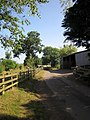
 Access road to Wheadon - geograph.org.uk - 3820798.jpg 1 536 × 1 152; 1,51 MB
-
 Access to West Yeo Moor - geograph.org.uk - 3820807.jpg 1 536 × 1 152; 1,47 MB
-
 Approaching Broadridge Farm - geograph.org.uk - 5081321.jpg 1 920 × 1 280; 935 KB
-
 Approaching Five Crosses - geograph.org.uk - 2413682.jpg 480 × 640; 147 KB
-
 Approaching Witheridge - geograph.org.uk - 3688072.jpg 1 920 × 1 208; 456 KB
-
 Ash tree, Drayford Road - geograph.org.uk - 3674702.jpg 1 920 × 2 560; 1,2 MB
-
 Ash tree, Drayford Road - geograph.org.uk - 3674709.jpg 1 920 × 2 560; 1,09 MB
-
 Assorted fences at Witheridge Mill Cross - geograph.org.uk - 3821115.jpg 1 536 × 1 152; 1,29 MB
-
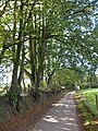
 Avenue to Cannington - geograph.org.uk - 3702370.jpg 1 536 × 1 152; 1,45 MB
-
 B3137 near West Yeo Cross - geograph.org.uk - 3683643.jpg 1 920 × 1 321; 490 KB
-
 B3137 near Woodpark Copse - geograph.org.uk - 3683621.jpg 1 920 × 2 560; 1,2 MB
-
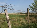 Barbed wire, Witheridge Moor - geograph.org.uk - 2406699.jpg 640 × 480; 93 KB
-
 Bare tree on Dart Raffe Moor - geograph.org.uk - 3820828.jpg 1 536 × 1 152; 1,23 MB
-
 Barn on Rose Moor - geograph.org.uk - 2449440.jpg 640 × 410; 68 KB
-
 Beans by Woodpark Copse - geograph.org.uk - 3683950.jpg 1 920 × 1 372; 855 KB
-
 Beech hedges bounding the road near South Venhay - geograph.org.uk - 3820784.jpg 1 536 × 1 152; 1,32 MB
-
 Bradford Bridge Cross - geograph.org.uk - 5946032.jpg 1 024 × 769; 290 KB
-
 Bradford Bridge on the Little Dart River - geograph.org.uk - 4369107.jpg 4 000 × 3 000; 4,04 MB
-
 Bradford Bridge on the Little Dart River at Bradford Cross - geograph.org.uk - 4369104.jpg 4 000 × 3 000; 5,16 MB
-
 Bradford Moor Plantation - geograph.org.uk - 2435185.jpg 511 × 640; 145 KB
-
 Bridge over the Little Dart River - geograph.org.uk - 3675395.jpg 2 630 × 3 304; 1,5 MB
-
 Buildings on The Square, Witheridge - geograph.org.uk - 2413475.jpg 480 × 640; 66 KB
-
 Bullocks near West Yeo - geograph.org.uk - 3683322.jpg 4 000 × 3 000; 1,55 MB
-
 By Grendon Lane - geograph.org.uk - 574093.jpg 640 × 480; 98 KB
-
 Ceramics studio at Drayford - geograph.org.uk - 3506632.jpg 1 024 × 768; 208 KB
-
 Colleton Hall - geograph.org.uk - 2432055.jpg 640 × 480; 110 KB
-
 Colleton Hall - geograph.org.uk - 5753467.jpg 1 024 × 853; 352 KB
-
 Colleton Hall - geograph.org.uk - 5753473.jpg 1 024 × 830; 213 KB
-
 Column capital in Witheridge church - geograph.org.uk - 3506585.jpg 1 024 × 768; 109 KB
-
 Coombe Ball Hill - geograph.org.uk - 3567881.jpg 640 × 480; 84 KB
-
 Coombe Ball Hill - geograph.org.uk - 3674742.jpg 1 920 × 2 438; 715 KB
-
 Coombe Ball Hill - geograph.org.uk - 3674844.jpg 1 920 × 1 387; 636 KB
-
 Coombe Barn Cottage - geograph.org.uk - 3674724.jpg 1 920 × 1 282; 329 KB
-
 Coombe House Garden - geograph.org.uk - 839424.jpg 480 × 640; 71 KB
-
 Cottage near Bradford Mill - geograph.org.uk - 5945668.jpg 1 024 × 768; 221 KB
-
 Crop at Witheridge - geograph.org.uk - 3688084.jpg 1 920 × 1 440; 667 KB
-
 Cross Park Wood - geograph.org.uk - 2906950.jpg 640 × 360; 296 KB
-
 Crow Lane - geograph.org.uk - 2449362.jpg 640 × 480; 138 KB
-
 Crow Lane - geograph.org.uk - 2449399.jpg 640 × 480; 85 KB
-
 Dart Raffe Cross - geograph.org.uk - 3820835.jpg 1 536 × 1 152; 1,53 MB
-
 Dart Raffe Farm - geograph.org.uk - 3684220.jpg 1 920 × 1 440; 485 KB
-
 Debris, Monkey Moor - geograph.org.uk - 2449475.jpg 640 × 403; 106 KB
-
 Doorpark Copse - geograph.org.uk - 3820842.jpg 1 536 × 1 152; 1,71 MB
-
 Down Cross - geograph.org.uk - 5947505.jpg 1 024 × 762; 307 KB
-
 Down Hill - geograph.org.uk - 5946099.jpg 1 024 × 768; 309 KB
-
 Drayford , Tree Felling - geograph.org.uk - 4404170.jpg 4 288 × 2 848; 6,26 MB
-
 Drayford , Tree Felling - geograph.org.uk - 4404172.jpg 2 848 × 4 288; 5,65 MB
-
 Drayford Bridge on the Little Dart River - geograph.org.uk - 4368892.jpg 4 000 × 3 000; 4,25 MB
-
 Drayford Bridge on the Little Dart River - geograph.org.uk - 4368898.jpg 4 000 × 3 000; 4,79 MB
-
 Drayford Bridge over Little Dart river - geograph.org.uk - 3283878.jpg 1 024 × 1 024; 949 KB
-
 Drayford Bridge over Little Dart River - geograph.org.uk - 3507541.jpg 1 024 × 768; 230 KB
-
 Drayford viewed from a nearby footpath - geograph.org.uk - 4366012.jpg 4 000 × 3 000; 4,24 MB
-
 Edge of field, West Yeo - geograph.org.uk - 3683487.jpg 1 920 × 1 275; 587 KB
-
 Edge of Witheridge Moor - geograph.org.uk - 2406750.jpg 640 × 480; 88 KB
-
 Edge of Witheridge Moor - geograph.org.uk - 2406776.jpg 640 × 480; 137 KB
-
 Elworthy Bridge - geograph.org.uk - 5947526.jpg 1 024 × 780; 240 KB
-
 Elworthy Cross - geograph.org.uk - 3702507.jpg 1 024 × 768; 155 KB
-
 Embayment near Drayford - geograph.org.uk - 3675331.jpg 1 920 × 1 440; 980 KB
-
 Farm buildings at Doorpark Copse - geograph.org.uk - 3821037.jpg 1 536 × 1 152; 1,15 MB
-
 Farm buildings, Cannington - geograph.org.uk - 3567868.jpg 450 × 640; 60 KB
-
 Farm buildings, Coombe House - geograph.org.uk - 3567877.jpg 640 × 480; 78 KB
-
 Farmland east of Witheridge - geograph.org.uk - 5075893.jpg 3 052 × 1 844; 1,28 MB
-
 Farmland north of Witheridge - geograph.org.uk - 5075923.jpg 3 072 × 2 048; 1,34 MB
-
 Farmland, West Yeo - geograph.org.uk - 3683484.jpg 1 920 × 1 217; 628 KB
-
 Feeder near West Yeo - geograph.org.uk - 3683355.jpg 1 920 × 1 325; 503 KB
-

-
 Field at Cannington - geograph.org.uk - 3567824.jpg 640 × 436; 71 KB
-
 Field at Rockhaye - geograph.org.uk - 3687632.jpg 1 920 × 1 440; 516 KB
-
 Field boundary near Dart Raffe Farm - geograph.org.uk - 3684125.jpg 1 920 × 1 310; 637 KB
-
 Field boundary trees - geograph.org.uk - 2435397.jpg 640 × 480; 105 KB
-
 Field boundary, Broadridge Farm - geograph.org.uk - 5081317.jpg 1 920 × 1 280; 1 011 KB
-
 Field by Chapel's Copse - geograph.org.uk - 2432015.jpg 640 × 480; 94 KB
-
 Field by Hollyfield Farm - geograph.org.uk - 2431273.jpg 640 × 418; 61 KB
-
 Field by the Little Dart - geograph.org.uk - 3674877.jpg 1 920 × 1 332; 391 KB
-
 Field by the Little Dart River - geograph.org.uk - 3506617.jpg 1 024 × 768; 119 KB
-
 Field near Beech Farm - geograph.org.uk - 2431307.jpg 640 × 480; 74 KB
-
 Field near Higher Mogworthy Cross - geograph.org.uk - 2432240.jpg 640 × 466; 84 KB
-
 Field near Home Moor - geograph.org.uk - 2432025.jpg 640 × 480; 100 KB
-
 Field near South Grendon - geograph.org.uk - 5081656.jpg 3 072 × 2 048; 1,07 MB
-
 Field near Witheridge - geograph.org.uk - 3687983.jpg 1 871 × 1 214; 319 KB
-
 Field west of Witheridge - geograph.org.uk - 3506614.jpg 1 024 × 768; 180 KB
-
 Field, Elworthy - geograph.org.uk - 2907928.jpg 640 × 360; 195 KB
-
 Field, Wheadon Cross - geograph.org.uk - 5081425.jpg 3 072 × 2 048; 1,42 MB
-
 Field, Wheadon Cross - geograph.org.uk - 5081447.jpg 3 045 × 1 699; 1,45 MB
-
 Field, Wheadon Cross - geograph.org.uk - 5081471.jpg 3 052 × 1 946; 1,48 MB
-
 Five Crosses north of Nomansland - geograph.org.uk - 3695498.jpg 1 536 × 843; 738 KB
-
 Footbridge on Two Moors Way south of Witheridge - geograph.org.uk - 3699706.jpg 1 152 × 1 536; 1,29 MB
-
 Footbridge over Adworthy Brook - geograph.org.uk - 3683171.jpg 1 920 × 2 560; 1,18 MB
-
 Footbridge over Adworthy Brook - geograph.org.uk - 3683251.jpg 2 654 × 3 500; 1,91 MB
-
 Footpath and drive to Coombe House - geograph.org.uk - 3506610.jpg 768 × 1 024; 232 KB
-
 Footpath near West Yeo - geograph.org.uk - 3683500.jpg 1 920 × 1 440; 506 KB
-
 Footpath sign above the Adworthy Brook - geograph.org.uk - 3683259.jpg 1 920 × 2 458; 1,18 MB
-
 Footpath to West Yeo - geograph.org.uk - 3683269.jpg 1 920 × 1 276; 400 KB
-
 Ford at Hilltown Cross - geograph.org.uk - 4189321.jpg 3 872 × 2 592; 4,59 MB
-
 Ford at Lower Tidderson - geograph.org.uk - 4189391.jpg 3 872 × 2 592; 4,83 MB
-
 Ford at Witheridge Mill - geograph.org.uk - 4188820.jpg 3 872 × 2 592; 4,35 MB
-
 Ford near Colleton Hall - geograph.org.uk - 5753477.jpg 1 024 × 768; 309 KB
-
 Ford near Hilltown Cross - geograph.org.uk - 5753834.jpg 1 024 × 830; 365 KB
-
 Fore Street, Witheridge - geograph.org.uk - 3811880.jpg 1 536 × 1 152; 922 KB
-
 Former school, now workshops, Witheridge - geograph.org.uk - 3821166.jpg 1 536 × 1 152; 937 KB
-
 Gate into Doorpark Copse - geograph.org.uk - 3820845.jpg 1 536 × 1 152; 1,41 MB
-
 Gateway with trough, West Yeo - geograph.org.uk - 3683504.jpg 1 920 × 1 305; 433 KB
-
 Gateway, Bradford Moor Hill - geograph.org.uk - 2435131.jpg 508 × 640; 122 KB
-
 Grass field near West Yeo - geograph.org.uk - 3683608.jpg 4 000 × 3 000; 1,27 MB
-
 Grassland near Coombe House - geograph.org.uk - 3702379.jpg 1 536 × 1 152; 1,48 MB
-

-
 Hedgebank by track to Coombe House - geograph.org.uk - 3702373.jpg 1 152 × 1 536; 1,61 MB
-
 Hellinghayes Farm - geograph.org.uk - 3682618.jpg 1 920 × 1 299; 528 KB
-
 Hillside above Little Dart - geograph.org.uk - 3674892.jpg 1 920 × 1 440; 534 KB
-
 Hillside near Witheridge Mill Cross - geograph.org.uk - 3687664.jpg 1 920 × 1 440; 512 KB
-
 Hilltown Cross - geograph.org.uk - 2432034.jpg 640 × 440; 88 KB
-
 Hilltown Cross - geograph.org.uk - 3702536.jpg 1 536 × 1 152; 1,45 MB
-
 Hilltown Cross - geograph.org.uk - 5753837.jpg 1 024 × 768; 202 KB
-
 Hilltown Ford - geograph.org.uk - 2432043.jpg 480 × 640; 134 KB
-
 Hilltown Ford - geograph.org.uk - 4189315.jpg 3 872 × 2 592; 5,12 MB
-
 Hole Bridge - geograph.org.uk - 2435412.jpg 640 × 401; 92 KB
-
 Inscription on Drayford Bridge - geograph.org.uk - 3283888.jpg 1 024 × 768; 804 KB
-
 Lane approaching Bradford Barton - geograph.org.uk - 2435124.jpg 480 × 640; 155 KB
-
 Lane at Wheadon Cross - geograph.org.uk - 5081518.jpg 3 072 × 2 048; 1,27 MB
-
 Lane junction, Landfoot Moor - geograph.org.uk - 2431021.jpg 640 × 480; 132 KB
-
 Lane near South Grendon - geograph.org.uk - 5081533.jpg 3 072 × 2 048; 1,29 MB
-
 Lane near West Yeo - geograph.org.uk - 3683495.jpg 1 920 × 1 283; 455 KB
-
 Lane north of Witheridge - geograph.org.uk - 5081108.jpg 3 072 × 2 048; 1,54 MB
-
 Lane past Beech Farm - geograph.org.uk - 2431290.jpg 480 × 640; 117 KB
-
 Lane past Dart Raffe Farm - geograph.org.uk - 3684427.jpg 1 920 × 2 560; 1 024 KB
-
 Lane past Dart Raffe Farm - geograph.org.uk - 3684807.jpg 1 920 × 1 440; 646 KB
-
 Lane to Crowdhole Cross - geograph.org.uk - 2435108.jpg 526 × 640; 89 KB
-
 Lane to Doorpark Farm - geograph.org.uk - 3684198.jpg 1 920 × 1 293; 562 KB
-
 Lane to Drayford - geograph.org.uk - 3674857.jpg 1 920 × 2 560; 1,03 MB
-
 Lane to Drayford - geograph.org.uk - 3675340.jpg 3 707 × 2 753; 2,19 MB
-
 Lane to Newland Cross - geograph.org.uk - 2449461.jpg 640 × 480; 135 KB
-
 Lane to Queen Dart Cross - geograph.org.uk - 2449297.jpg 640 × 478; 118 KB
-
 Lane to Witheridge - geograph.org.uk - 3684821.jpg 1 920 × 1 279; 380 KB
-
 Lane to Witheridge - geograph.org.uk - 3685264.jpg 1 920 × 1 322; 679 KB
-
 Lane to Witheridge - geograph.org.uk - 3687458.jpg 1 600 × 1 171; 540 KB
-
 Lane to Witheridge - geograph.org.uk - 3687959.jpg 1 920 × 2 560; 1,2 MB
-
 Lane to Witheridge - geograph.org.uk - 5081077.jpg 3 072 × 2 048; 1,23 MB
-
 Lane to Witheridge Mill - geograph.org.uk - 3687949.jpg 1 920 × 1 440; 832 KB
-
 Lane to Witheridge Moor Cross (East) - geograph.org.uk - 2406720.jpg 640 × 480; 99 KB
-
 Large barn near Coombe, west of Witheridge - geograph.org.uk - 3702417.jpg 1 152 × 1 536; 1,19 MB
-
 Light industrial unit, Witheridge - geograph.org.uk - 3702447.jpg 1 536 × 1 152; 1,03 MB
-
 Little Dart River - geograph.org.uk - 3675426.jpg 1 920 × 2 560; 1,26 MB
-
 Little Dart River - geograph.org.uk - 3687658.jpg 1 920 × 2 560; 1,15 MB
-
 Little Dart River at Bradford Mill - geograph.org.uk - 5946048.jpg 768 × 1 024; 343 KB
-
 Little Dart river from Drayford Bridge - geograph.org.uk - 3283881.jpg 1 024 × 768; 720 KB
-
 Little Dart river from Drayford Bridge - geograph.org.uk - 3283882.jpg 1 024 × 768; 709 KB
-
 Little Dart River from Witheridge Mill bridge - geograph.org.uk - 3821123.jpg 1 152 × 1 536; 1,45 MB
-
 Little Dart valley - geograph.org.uk - 2449077.jpg 640 × 442; 96 KB
-
 Little Dart valley - geograph.org.uk - 3684817.jpg 1 920 × 1 457; 649 KB
-
 Little Dart valley - geograph.org.uk - 3684831.jpg 1 920 × 1 291; 475 KB
-
 Little Dart Valley - geograph.org.uk - 5753444.jpg 1 024 × 791; 159 KB
-
 Little Dart valley at Ford Down - geograph.org.uk - 2449321.jpg 640 × 404; 79 KB
-
 Lone tree in a field,and trees lining an avenue, Witheridge - geograph.org.uk - 3702428.jpg 1 536 × 1 152; 1,04 MB
-
 Looking down the Little Dart River from Bradford Bridge - geograph.org.uk - 4369134.jpg 4 000 × 3 000; 5,47 MB
-
 Looking down the Little Dart River from Drayford Bridge - geograph.org.uk - 4368911.jpg 4 000 × 3 000; 4,55 MB
-
 Looking down the Little Dart River from New Bridge - geograph.org.uk - 4369064.jpg 4 000 × 3 000; 5,21 MB
-
 Looking down the Little Dart River from Queen Dart Bridge - geograph.org.uk - 4369155.jpg 4 000 × 3 000; 4,54 MB
-

-
 Looking up the Little Dart River from Bradford Bridge - geograph.org.uk - 4369131.jpg 4 000 × 3 000; 5,04 MB
-
 Looking up the Little Dart River from Drayford Bridge - geograph.org.uk - 4368910.jpg 4 000 × 3 000; 4,09 MB
-
 Looking up the Little Dart River from New Bridge - geograph.org.uk - 4369065.jpg 4 000 × 3 000; 4,29 MB
-
 Looking up the Little Dart River from Queen Dart Bridge - geograph.org.uk - 4369157.jpg 4 000 × 3 000; 5,85 MB
-
 Looking up the Little Dart River from Witheridge Mill Bridge - geograph.org.uk - 4369095.jpg 4 000 × 3 000; 4,55 MB
-
 Maize near South Coombe - geograph.org.uk - 5081087.jpg 1 920 × 1 280; 897 KB
-
 Malson and Wilson Cross - geograph.org.uk - 573718.jpg 640 × 480; 107 KB
-
 Malson Lane - geograph.org.uk - 565959.jpg 480 × 640; 111 KB
-
 Meadow by the Adworthy Brook - geograph.org.uk - 3675440.jpg 1 920 × 1 440; 448 KB
-
 Meadow in the Little Dart valley - geograph.org.uk - 2435175.jpg 640 × 430; 72 KB
-
 Meeting of paths south of Witheridge - geograph.org.uk - 3699717.jpg 1 536 × 1 152; 1,74 MB
-
 Mid Devon , Grassy Field - geograph.org.uk - 5613266.jpg 6 000 × 4 000; 7,81 MB
-
 Minor road on Landfoot Moor - geograph.org.uk - 5677367.jpg 1 024 × 768; 292 KB
-
 Minor road to Tidderson - geograph.org.uk - 5754764.jpg 1 024 × 768; 255 KB
-
 Modern housing estate, Witheridge - geograph.org.uk - 3702455.jpg 1 536 × 1 152; 1,08 MB
-
 Monkey Moor - geograph.org.uk - 2449469.jpg 640 × 428; 119 KB
-
 Mowing the grass, West Yeo - geograph.org.uk - 3683314.jpg 1 920 × 1 237; 622 KB
-
 Muck spreading - geograph.org.uk - 2907932.jpg 640 × 393; 258 KB
-
 Muddy track to Bradford Farm - geograph.org.uk - 5945666.jpg 1 024 × 774; 215 KB
-
 Near Dart Raffe Farm - geograph.org.uk - 3684184.jpg 1 920 × 1 440; 929 KB
-
 Near Newland Cross - geograph.org.uk - 2449445.jpg 640 × 443; 97 KB
-
 Newland Cross - geograph.org.uk - 5947511.jpg 1 024 × 768; 310 KB
-
 Newland Farm - geograph.org.uk - 2449081.jpg 640 × 414; 84 KB
-
 Newsagents in Witheridge - geograph.org.uk - 3506595.jpg 1 024 × 768; 124 KB
-
 North Coombe Farm - geograph.org.uk - 2435098.jpg 640 × 432; 71 KB
-
 North Devon , Basils Patch - geograph.org.uk - 5304500.jpg 6 000 × 4 000; 6,44 MB
-
 North Devon , Bradford Barton - geograph.org.uk - 5304516.jpg 6 000 × 4 000; 6,66 MB
-
 North Devon , Bradford Barton - geograph.org.uk - 5304520.jpg 6 000 × 4 000; 6,9 MB
-
 North Devon , Bradford Bridge Cross - geograph.org.uk - 5304537.jpg 6 000 × 4 000; 5,69 MB
-
 North Devon , Bradford Cross - geograph.org.uk - 5304526.jpg 6 000 × 4 000; 5,94 MB
-
 North Devon , Bradford Mill - geograph.org.uk - 5304535.jpg 6 000 × 4 000; 7,4 MB
-
 North Devon , Bradford Moor Hill - geograph.org.uk - 5304522.jpg 6 000 × 4 000; 7,07 MB
-
 North Devon , Bradford Moor Hill - geograph.org.uk - 5304543.jpg 6 000 × 4 000; 6,57 MB
-
 North Devon , Campbellhayes Hill - geograph.org.uk - 5308011.jpg 6 000 × 4 000; 6,83 MB
-
 North Devon , Cannington Farm Entrance - geograph.org.uk - 2960835.jpg 4 288 × 2 848; 6,22 MB
-
 North Devon , Charnaford Farm - geograph.org.uk - 5305534.jpg 6 000 × 4 000; 5,14 MB


_-_geograph.org.uk_-_2406720.jpg)


