Category:Wollenberg (Höhenland)
Jump to navigation
Jump to search
| Object location | | View all coordinates using: OpenStreetMap |
|---|
village in Brandenburg state, Germany _2018_NW.jpg) | |||||
| Upload media | |||||
| Instance of |
| ||||
|---|---|---|---|---|---|
| Location | Höhenland, Märkisch-Oderland District, Brandenburg, Germany | ||||
 | |||||
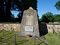
English: The village Wollenberg belongs to Höhenland municipality, Märkisch-Oderland district, Brandenburg state, Germany
Deutsch: Das Dorf Wollenberg gehört zur Gemeinde Höhenland, Landkreis Märkisch-Oderland, Land Brandenburg, Deutschland.
Français : Le village de Wollenberg fait partie de la commune de Höhenland, arrondissement de Märkisch-Oderland, état fédéral de Brandebourg, Allemagne
Subcategories
This category has the following 2 subcategories, out of 2 total.
B
- Bunker Wollenberg (12 F)
D
- Dorfkirche Wollenberg (Höhenland) (1 P, 6 F)
Media in category "Wollenberg (Höhenland)"
This category contains only the following file.
-
 Gefallenendenkmal Wollenberg (Höhenland) 2018 SW.jpg 4,864 × 3,648; 7.16 MB
_2018_SW.jpg)