Category:Woolley, West Yorkshire
Aller à la navigation
Aller à la recherche
village britannique  | |||||
| Téléverser des médias | |||||
| Nature de l’élément | |||||
|---|---|---|---|---|---|
| Lieu | cité de Wakefield, Yorkshire de l'Ouest, Yorkshire-et-Humber, Angleterre | ||||
 | |||||
English: Woolley is a village and civil parish in the City of Wakefield in West Yorkshire, England. It has a population of 575. Until 1974 it formed part of Wakefield Rural District.
Sous-catégories
Cette catégorie comprend 9 sous-catégories, dont les 9 ci-dessous.
Média dans la catégorie « Woolley, West Yorkshire »
Cette catégorie comprend 187 fichiers, dont les 187 ci-dessous.
-
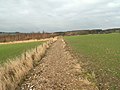
 A cornfield at the side of the Dearne Way - geograph.org.uk - 517867.jpg 640 × 480 ; 99 kio
-
 A cottage on Back Lane, Woolley - geograph.org.uk - 3993534.jpg 2 592 × 1 944 ; 2,44 Mio
-
 A footpath in Jobson Wood - geograph.org.uk - 655065.jpg 640 × 480 ; 127 kio
-
 A New Footpath to Haigh via Moorhouse Lane - geograph.org.uk - 1143180.jpg 640 × 480 ; 82 kio
-
 A Popular Place - geograph.org.uk - 1155708.jpg 640 × 477 ; 71 kio
-
 A Railway Cottage - geograph.org.uk - 397439.jpg 640 × 480 ; 87 kio
-
 A61 towards Barnsley - geograph.org.uk - 2637728.jpg 1 600 × 1 200 ; 582 kio
-
 All is safely gathered in - geograph.org.uk - 1997282.jpg 2 560 × 1 920 ; 1,4 Mio
-
 Almost a footpath - geograph.org.uk - 2007897.jpg 2 560 × 1 920 ; 1,59 Mio
-
 Antique chair^ - geograph.org.uk - 627925.jpg 640 × 347 ; 49 kio
-
 Area of rough grass beside M1 - geograph.org.uk - 6077922.jpg 1 600 × 924 ; 487 kio
-
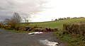
 Back Lane, Woolley - geograph.org.uk - 2637691.jpg 1 600 × 1 200 ; 417 kio
-
 Barnsley Boundary Walk along Wheatley Wood - geograph.org.uk - 3687023.jpg 1 600 × 1 200 ; 888 kio
-
 Beech Farm, High Street - geograph.org.uk - 2800288.jpg 3 072 × 2 304 ; 1,08 Mio
-
 Birds of a feather etc - geograph.org.uk - 617996.jpg 640 × 338 ; 67 kio
-
 Bleak winter day on Woolley Edge - geograph.org.uk - 1210290.jpg 640 × 427 ; 109 kio
-
 Boardwalk on the northern edge of Seckar Wood - geograph.org.uk - 5250352.jpg 1 024 × 768 ; 204 kio
-
 Bramley Lane off Woolley Low Moor Lane - geograph.org.uk - 3269639.jpg 800 × 600 ; 145 kio
-
 Bridleway north of Peter Spring - geograph.org.uk - 3687046.jpg 1 600 × 1 200 ; 850 kio
-
 Bridleway through Peter Spring Wood - geograph.org.uk - 3988111.jpg 2 372 × 1 898 ; 2,81 Mio
-
 Bridleway to Intake Lane - geograph.org.uk - 415716.jpg 640 × 480 ; 92 kio
-
 Bridleway to Mollyhurst Lane - geograph.org.uk - 415192.jpg 640 × 480 ; 81 kio
-
 Bridleway to Mollyhurst Lane - geograph.org.uk - 471856.jpg 640 × 480 ; 105 kio
-
 Bridleway to Woolley Village - geograph.org.uk - 415729.jpg 640 × 480 ; 88 kio
-
 Bus shelter by Woolley village green - geograph.org.uk - 3987978.jpg 2 488 × 1 866 ; 1,51 Mio
-
 Bus stop at Haigh Roundabout - geograph.org.uk - 3987840.jpg 2 550 × 1 822 ; 1,78 Mio
-
 Car park, hotel and woodland - geograph.org.uk - 2009262.jpg 1 024 × 768 ; 114 kio
-
 Church Farm Barns - geograph.org.uk - 417394.jpg 640 × 472 ; 65 kio
-
 Church Street, Woolley - geograph.org.uk - 2637703.jpg 1 600 × 1 200 ; 553 kio
-
 Club House, Woolley Golf Club - geograph.org.uk - 905204.jpg 640 × 480 ; 77 kio
-
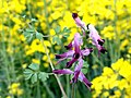 Common Fumitory (Papaveraceae) - geograph.org.uk - 417345.jpg 640 × 480 ; 67 kio
-
 Common Lane meets Intake Lane - geograph.org.uk - 4204943.jpg 640 × 480 ; 86 kio
-
 Communications From Gipsy Lane to Intake Lane - geograph.org.uk - 415066.jpg 640 × 480 ; 50 kio
-
 Composed by the City bard^ - geograph.org.uk - 518684.jpg 640 × 531 ; 95 kio
-
 Corn Field - geograph.org.uk - 1997258.jpg 2 560 × 1 920 ; 1,55 Mio
-
 Cut Bench Mark (close-up) - geograph.org.uk - 2348209.jpg 1 024 × 681 ; 252 kio
-
 Cut benchmark - gatepost by Gipsy lane - geograph.org.uk - 2800232.jpg 3 072 × 2 304 ; 1,33 Mio
-
 Cut benchmark on a gatepost beside Gipsy Lane - geograph.org.uk - 2800216.jpg 3 072 × 2 304 ; 1,36 Mio
-
 Dead tree in snow - geograph.org.uk - 1209731.jpg 640 × 426 ; 46 kio
-
 Ear to Ear - geograph.org.uk - 471869.jpg 640 × 480 ; 139 kio
-
 Ecotricity Electric Vehicle Charging Point, Woolley Edge services - geograph.org.uk - 5225714.jpg 4 608 × 3 456 ; 4,41 Mio
-
 Emley Moor Transmitter Mast from Woolley Edge - geograph.org.uk - 5021883.jpg 1 600 × 1 200 ; 254 kio
-
 Entering Haigh - geograph.org.uk - 3049483.jpg 1 936 × 2 592 ; 2,82 Mio
-
 Entering Woolley via Back Lane - geograph.org.uk - 3993568.jpg 2 489 × 1 867 ; 1,77 Mio
-
 Evening Falls on Woolley Edge - geograph.org.uk - 427252.jpg 640 × 480 ; 103 kio
-
 Exit road from Woolley Edge Services, southbound - geograph.org.uk - 6077952.jpg 1 322 × 1 600 ; 1,1 Mio
-
 Exit route from Travelodge, Woolley Edge Services - geograph.org.uk - 5248583.jpg 4 608 × 3 456 ; 5,52 Mio
-
 Exit to Bramley Lane for Travelodge Guests ^ Staff - geograph.org.uk - 5248556.jpg 4 608 × 3 456 ; 5,01 Mio
-
 Farmland at the western edge of Seckar Wood - geograph.org.uk - 5250358.jpg 1 024 × 768 ; 174 kio
-
 Farmland near Wooley. - geograph.org.uk - 2798515.jpg 640 × 331 ; 33 kio
-
 Farmland off the A61 - geograph.org.uk - 2637724.jpg 1 600 × 1 200 ; 441 kio
-
 Farmland off Warren Lane - geograph.org.uk - 3670264.jpg 640 × 480 ; 63 kio
-
 Farmland off Woolley Edge Lane - geograph.org.uk - 2637685.jpg 1 600 × 1 200 ; 601 kio
-
 Female Common Blue Butterfly - geograph.org.uk - 2007887.jpg 1 900 × 1 370 ; 430 kio
-
 Field by the M1 at Haigh - geograph.org.uk - 3987833.jpg 2 592 × 1 944 ; 1,35 Mio
-
 Field near the M1, Haigh - geograph.org.uk - 2348221.jpg 1 024 × 681 ; 172 kio
-
 Footbridge and stile at the north corner of Seckar Wood - geograph.org.uk - 3334980.jpg 2 048 × 1 536 ; 512 kio
-
 Footpath off Haigh Lane - geograph.org.uk - 2637679.jpg 1 600 × 1 200 ; 344 kio
-
 Footpath sign , Back Lane, Woolley - geograph.org.uk - 3993542.jpg 1 944 × 2 592 ; 2,93 Mio
-
 Footpath towards Wheatley Wood - geograph.org.uk - 3687037.jpg 1 600 × 1 200 ; 862 kio
-
 Former coal miners' cottages on Haigh Lane - geograph.org.uk - 3987842.jpg 2 552 × 1 823 ; 1,32 Mio
-

-
 Frosty farmland near Haigh. - geograph.org.uk - 2798505.jpg 640 × 320 ; 31 kio
-
 Fuel Forecourt, Woolley Edge Services - geograph.org.uk - 5879903.jpg 800 × 533 ; 565 kio
-
 Gate to farmland Woolley - geograph.org.uk - 1017031.jpg 640 × 480 ; 80 kio
-
 Gates to Woolley Hall - geograph.org.uk - 438358.jpg 640 × 480 ; 120 kio
-
 Gipsy Lane - fallen gatepost with cut benchmark - geograph.org.uk - 2800223.jpg 3 072 × 2 304 ; 1,45 Mio
-

-
 Haigh Lane Bridge - geograph.org.uk - 1652312.jpg 640 × 480 ; 135 kio
-
 Haigh Lane Haigh - geograph.org.uk - 1155646.jpg 640 × 465 ; 83 kio
-
 Haigh Lane towards the M1 - geograph.org.uk - 2637681.jpg 1 600 × 1 200 ; 784 kio
-
 Haigh Lane, Haigh - geograph.org.uk - 113052.jpg 640 × 480 ; 110 kio
-
 Haigh Millennium Stone - geograph.org.uk - 1652306.jpg 640 × 395 ; 76 kio
-
 Hawtop Lane at the junction with Gipsy Lane - geograph.org.uk - 1421167.jpg 640 × 480 ; 100 kio
-
 Hawtop Lane near Woolley - geograph.org.uk - 3987969.jpg 1 942 × 2 428 ; 1,91 Mio
-
 Haymaking at Woolley Edge - geograph.org.uk - 3098895.jpg 640 × 426 ; 63 kio
-
 Industrial remains in Totty Spring Wood - geograph.org.uk - 3335006.jpg 2 048 × 1 536 ; 519 kio
-
 Jobson Wood From Moorhouse Lane - geograph.org.uk - 1155674.jpg 640 × 471 ; 73 kio
-
 Late Harvest - geograph.org.uk - 1023883.jpg 640 × 469 ; 107 kio
-
 Little Spring from Woodhouse Lane - geograph.org.uk - 417382.jpg 640 × 480 ; 84 kio
-
 Looking west from Woolley Edge - geograph.org.uk - 4655714.jpg 3 888 × 5 184 ; 5,71 Mio
-
 Looks like Spring - geograph.org.uk - 370841.jpg 640 × 480 ; 99 kio
-
 Low Bridge, Haigh Lane - geograph.org.uk - 2348205.jpg 1 024 × 681 ; 203 kio
-
 Lowland heath at Shroggs Hill, Seckar Wood - geograph.org.uk - 5250361.jpg 1 024 × 768 ; 165 kio
-
 M1 approaching Barmley Lane Bridge - geograph.org.uk - 2842722.jpg 640 × 419 ; 52 kio
-
 M1 motorway north - geograph.org.uk - 627907.jpg 640 × 372 ; 74 kio
-
 M1 Motorway Passing Driver Location A286.7 - geograph.org.uk - 4842333.jpg 640 × 480 ; 407 kio
-
 M1 passing under Bramley Lane Bridge - geograph.org.uk - 3427979.jpg 640 × 433 ; 43 kio
-
 Main track through lowland heath at Shroggs Hill - geograph.org.uk - 5250363.jpg 1 024 × 768 ; 152 kio
-
 Middle Field Lane - geograph.org.uk - 2637687.jpg 1 600 × 1 200 ; 523 kio
-
 Middle Field Lane - geograph.org.uk - 364036.jpg 640 × 480 ; 120 kio
-
 Moorhouse Lane - geograph.org.uk - 2800198.jpg 3 072 × 2 304 ; 1,09 Mio
-
 Moorhouse Lane, Haigh - geograph.org.uk - 1652309.jpg 640 × 480 ; 99 kio
-
 Near Moor Farm - geograph.org.uk - 1155662.jpg 640 × 480 ; 103 kio
-
 New Road - geograph.org.uk - 2800264.jpg 3 072 × 2 304 ; 1,07 Mio
-
 Northbound M1, Bramley Lane Bridge - geograph.org.uk - 4842310.jpg 640 × 480 ; 357 kio
-
 Orange Tip butterfly on bramble leaf - geograph.org.uk - 415202.jpg 640 × 481 ; 72 kio
-
 Ordnance Survey Flush Bracket S9248 - geograph.org.uk - 2808131.jpg 4 000 × 3 000 ; 3,91 Mio
-
 Parking and fuel services at Woolley Edge Service Station - geograph.org.uk - 3890186.jpg 1 600 × 1 207 ; 200 kio
-
 Parson Lane Woolley - geograph.org.uk - 471845.jpg 480 × 640 ; 125 kio
-
 Path heading south from Woodhouse Lane - geograph.org.uk - 3988133.jpg 1 944 × 2 592 ; 2,74 Mio
-
 Petrol filling station Woolley Edge Services - geograph.org.uk - 5248597.jpg 4 608 × 3 456 ; 4,09 Mio
-
 Petrol Station, Woolley Edge Services - geograph.org.uk - 2324022.jpg 1 024 × 681 ; 139 kio
-
 Plaque on the old girls and infants school in Woolley - geograph.org.uk - 3991838.jpg 2 537 × 1 812 ; 1,67 Mio
-
 Ploughed field, Windhill Gate - geograph.org.uk - 3670261.jpg 640 × 480 ; 54 kio
-
 Ready for harvesting - geograph.org.uk - 1997271.jpg 2 560 × 1 920 ; 1,28 Mio
-
 Reclaimed Land - geograph.org.uk - 1143209.jpg 640 × 480 ; 78 kio
-
 Rising from the barley - geograph.org.uk - 3988147.jpg 2 538 × 1 904 ; 1,44 Mio
-
 River Dearne Flood Plain - geograph.org.uk - 5264029.jpg 4 608 × 3 456 ; 3,4 Mio
-
 Road junction in Woolley - geograph.org.uk - 3987988.jpg 2 355 × 1 884 ; 2,47 Mio
-
 Road to Woolley Edge Service Station as it crosses the M1 - geograph.org.uk - 5021916.jpg 1 600 × 1 190 ; 339 kio
-
 Roadside memorial on Wooley edge lane. - geograph.org.uk - 2798511.jpg 480 × 640 ; 68 kio
-
 Ruined pumphouse, Seckar Wood - geograph.org.uk - 5250368.jpg 1 024 × 768 ; 214 kio
-
 Seckar Lane - geograph.org.uk - 5250318.jpg 1 024 × 768 ; 234 kio
-
 Shroggs Hill Plantation - geograph.org.uk - 2637712.jpg 1 600 × 1 200 ; 846 kio
-
 Signs at exit from Woolley Edge Services - geograph.org.uk - 5248175.jpg 4 608 × 3 456 ; 5,71 Mio
-
 Silver birch on Shroggs Hill lowland heath (eastern end) - geograph.org.uk - 5250366.jpg 1 024 × 768 ; 127 kio
-
 Small Wooded Area, near Beacon Hill - geograph.org.uk - 113037.jpg 640 × 480 ; 143 kio
-
 South Yorkshire motorways - geograph.org.uk - 847300.jpg 640 × 567 ; 135 kio
-
 Speckled Wood Butterfly - geograph.org.uk - 471859.jpg 640 × 480 ; 77 kio
-
 Telecoms mast near Woolley - geograph.org.uk - 617991.jpg 640 × 479 ; 157 kio
-
 The Bridleway - geograph.org.uk - 471853.jpg 640 × 480 ; 88 kio
-
 The Calder Valley from Woolley Edge. - geograph.org.uk - 518681.jpg 608 × 506 ; 100 kio
-
 The Green - geograph.org.uk - 919281.jpg 640 × 480 ; 74 kio
-
 The M1 from Bramley Lane - geograph.org.uk - 3269641.jpg 800 × 600 ; 80 kio
-
 The M1 Motorway - geograph.org.uk - 397434.jpg 640 × 480 ; 96 kio
-
 The River Dearne - geograph.org.uk - 2217249.jpg 2 560 × 1 920 ; 1,95 Mio
-
 The River Dearne near Darton - geograph.org.uk - 5264253.jpg 4 608 × 3 456 ; 3,78 Mio
-
 The River Dearne near Haigh - geograph.org.uk - 3987837.jpg 1 944 × 2 592 ; 3,28 Mio
-
 The River Dearne north of Darton - geograph.org.uk - 4604448.jpg 3 888 × 5 184 ; 6,34 Mio
-
 The slip road to Woolley Edge Service Station - geograph.org.uk - 3890196.jpg 1 600 × 1 200 ; 270 kio
-
-
 The trig point on Beacon Hill - geograph.org.uk - 2800204.jpg 3 072 × 2 304 ; 1,19 Mio
-
 The war memorial in Woolley - geograph.org.uk - 3993550.jpg 1 770 × 2 477 ; 2,23 Mio
-
 This sign has definitely been planted - geograph.org.uk - 416879.jpg 640 × 480 ; 82 kio
-
 Towards Savin Royd Wood - geograph.org.uk - 113034.jpg 640 × 480 ; 145 kio
-
 Track beside Shroggs Hill Plantation - geograph.org.uk - 2637708.jpg 1 600 × 1 200 ; 826 kio
-
 Traffic Calming, Haigh Lane - geograph.org.uk - 2348218.jpg 1 024 × 681 ; 181 kio
-
 Travelodge, Woolley Services - geograph.org.uk - 2687678.jpg 640 × 427 ; 223 kio
-
 Tree in a barleyfield - north of Wheatley Wood - geograph.org.uk - 3988139.jpg 1 850 × 2 590 ; 1,89 Mio
-
 Tree-lined Lane, Woolley Edge - geograph.org.uk - 113036.jpg 480 × 640 ; 141 kio
-
 Trees along Seckar Dike - geograph.org.uk - 3333226.jpg 1 024 × 768 ; 177 kio
-
 Trees at Woolley Edge Services - M1 south-bound - geograph.org.uk - 3911798.jpg 1 500 × 1 125 ; 1,38 Mio
-
 Trees growing alongside motorway services building - geograph.org.uk - 6077865.jpg 2 000 × 1 500 ; 3,2 Mio
-
 Truck Stop, Woolley Edge Services - geograph.org.uk - 2324029.jpg 1 024 × 681 ; 146 kio
-
 Under construction - geograph.org.uk - 2007876.jpg 2 560 × 1 920 ; 1,1 Mio
-
 Ventilation shaft at Woolley Edge Services - geograph.org.uk - 5248214.jpg 4 608 × 3 456 ; 6,72 Mio
-
 View from Woolley Edge Lane - geograph.org.uk - 2637672.jpg 1 600 × 1 200 ; 439 kio
-
 View from Woolley Edge services - geograph.org.uk - 5225719.jpg 4 608 × 3 456 ; 5,63 Mio
-
 View from Woolley Edge, Wakefield - geograph.org.uk - 5021865.jpg 1 600 × 1 200 ; 424 kio
-
 View of Woolley from Gipsy Lane - geograph.org.uk - 3987973.jpg 2 508 × 1 792 ; 1,39 Mio
-
 Village Green, Woolley - geograph.org.uk - 2637705.jpg 1 600 × 1 200 ; 711 kio
-
 War memorial in Woolley. - geograph.org.uk - 5926746.jpg 1 024 × 683 ; 267 kio
-
 Warren Lane - geograph.org.uk - 3670267.jpg 640 × 480 ; 78 kio
-
 Warren Lane - geograph.org.uk - 471842.jpg 640 × 480 ; 113 kio
-
 Warren Lane to the A61 - geograph.org.uk - 430865.jpg 640 × 480 ; 88 kio
-
 Warren Lane to Wheatley Wood - geograph.org.uk - 471840.jpg 640 × 480 ; 73 kio
-
 Water Lane Woolley - geograph.org.uk - 617993.jpg 640 × 480 ; 65 kio
-
 Water tower just off Intake Lane - geograph.org.uk - 2800211.jpg 3 072 × 2 304 ; 1,18 Mio
-
 Waymarked path in Seckar Wood - geograph.org.uk - 5250326.jpg 1 024 × 768 ; 243 kio
-
 Wheatley Wood Old Mine Shaft - geograph.org.uk - 364033.jpg 640 × 480 ; 145 kio
-
 Wheatley wood. - geograph.org.uk - 2798512.jpg 480 × 640 ; 109 kio
-
 Windhill Lane - geograph.org.uk - 3670262.jpg 640 × 480 ; 33 kio
-
 Woodhouse Lane - geograph.org.uk - 1312584.jpg 640 × 480 ; 75 kio
-
 Woodhouse Lane Looking To Wheatley Wood - geograph.org.uk - 1292912.jpg 640 × 480 ; 88 kio
-
 Woodhouse Lane To Warren Lane Footpath - geograph.org.uk - 1292928.jpg 640 × 480 ; 116 kio
-
 Woodhouse Lane to Woolley Village - geograph.org.uk - 430871.jpg 640 × 480 ; 93 kio
-
 Woodhouse Lane Woolley - geograph.org.uk - 627920.jpg 640 × 480 ; 97 kio
-
 Woodland, Woolley Edge - geograph.org.uk - 2324033.jpg 1 024 × 681 ; 161 kio
-
 Woolley Church - geograph.org.uk - 2637697.jpg 1 600 × 1 200 ; 555 kio
-
 Woolley Church Tower from Woolley Edge Lane - geograph.org.uk - 1386602.jpg 640 × 480 ; 88 kio
-
 Woolley church yard - geograph.org.uk - 42801.jpg 640 × 360 ; 85 kio
-
 Woolley Churchyard - geograph.org.uk - 919278.jpg 640 × 480 ; 99 kio
-
 Woolley Edge Lane - geograph.org.uk - 1386611.jpg 640 × 480 ; 76 kio
-
 Woolley Edge Lane - geograph.org.uk - 2637674.jpg 1 600 × 1 200 ; 829 kio
-
 Woolley Edge Lane - geograph.org.uk - 404635.jpg 640 × 480 ; 70 kio
-
 Woolley Edge Lane Looking To Emley Moor Mast - geograph.org.uk - 1292959.jpg 640 × 480 ; 83 kio
-
 Woolley Edge Lane Looking To High House Farm - geograph.org.uk - 1386596.jpg 640 × 480 ; 82 kio
-
 Woolley Edge Services Lorry Park - geograph.org.uk - 5879910.jpg 800 × 533 ; 452 kio
-
 Woolley Edge Services, slip road to M1 - geograph.org.uk - 2161363.jpg 640 × 480 ; 75 kio
-
 Woolley Green - geograph.org.uk - 617998.jpg 640 × 474 ; 122 kio
-
 Woolley Hall gates - geograph.org.uk - 2800257.jpg 3 072 × 2 304 ; 1,4 Mio
-
 Woolley Moor - Old coal mine workings - geograph.org.uk - 235104.jpg 640 × 480 ; 145 kio
-
 Woolley Moor Farm - geograph.org.uk - 435288.jpg 640 × 474 ; 93 kio
-
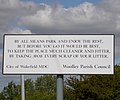
 Woolley War Memorial - geograph.org.uk - 415721.jpg 640 × 480 ; 134 kio
-
 Back Lane, Woolley - geograph.org.uk - 113044.jpg 640 × 480 ; 122 kio
-
 Back Lane, Woolley - geograph.org.uk - 113046.jpg 640 × 480 ; 174 kio


_-_geograph.org.uk_-_417345.jpg)


_-_geograph.org.uk_-_2348209.jpg)


_-_geograph.org.uk_-_5250366.jpg)


