Category:Woolstaston
Aller à la navigation
Aller à la recherche
village britannique  | |||||
| Téléverser des médias | |||||
| Nature de l’élément | |||||
|---|---|---|---|---|---|
| Lieu | Shropshire, Midlands de l'Ouest, Angleterre | ||||
 | |||||
Sous-catégories
Cette catégorie comprend 3 sous-catégories, dont les 3 ci-dessous.
B
- Bowdler's House (2 F)
H
- Woolstaston Hall (1 F)
Média dans la catégorie « Woolstaston »
Cette catégorie comprend 32 fichiers, dont les 32 ci-dessous.
-
 A cattle grid at Womberton - geograph.org.uk - 1217719.jpg 600 × 450 ; 268 kio
-
 Barn conversions, Walkmills Farm - geograph.org.uk - 3966847.jpg 979 × 734 ; 350 kio
-
 Bluebell wood in the valley - geograph.org.uk - 3966853.jpg 816 × 612 ; 389 kio
-
 Castle Hill Farm, Leebotwood, Shropshire - geograph.org.uk - 3146806.jpg 4 592 × 3 056 ; 4,96 Mio
-
 Crossing Betchcott Brook - geograph.org.uk - 5063100.jpg 800 × 534 ; 295 kio
-
 Down the Bridlepath - geograph.org.uk - 399451.jpg 640 × 427 ; 71 kio
-
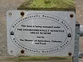 Environmentaly Sensitive Area - geograph.org.uk - 443514.jpg 640 × 480 ; 80 kio
-
 Exercise paddock at Woolstaston - geograph.org.uk - 1810856.jpg 819 × 614 ; 189 kio
-
 Farm track from The Villa to the road - geograph.org.uk - 672056.jpg 640 × 480 ; 57 kio
-
 Field, Leebotwood - geograph.org.uk - 5223007.jpg 1 024 × 683 ; 334 kio
-
 Field, Upper House - geograph.org.uk - 5063094.jpg 800 × 534 ; 205 kio
-
 Footbridge over the Betchcott Brook - geograph.org.uk - 1810851.jpg 640 × 480 ; 200 kio
-
 Footbridge over the Betchcott Brook - geograph.org.uk - 1810942.jpg 640 × 480 ; 182 kio
-
 Footpath back into Walkmills - geograph.org.uk - 3966849.jpg 1 142 × 857 ; 373 kio
-
 Footpath past Blackpool Coppice - geograph.org.uk - 3966850.jpg 979 × 734 ; 369 kio
-
 Footpath to Smethcott - geograph.org.uk - 1810938.jpg 922 × 691 ; 195 kio
-
 Footpath towards the church - geograph.org.uk - 3966870.jpg 979 × 734 ; 296 kio
-
 Former farm buildings, Woolstaston.jpg 640 × 480 ; 95 kio
-
 Good to see that nothing changes - geograph.org.uk - 2478162.jpg 480 × 640 ; 122 kio
-
 Highfield Farm from the footpath at the back - geograph.org.uk - 3966866.jpg 1 142 × 857 ; 306 kio
-
 Is it too late for renovation^ - geograph.org.uk - 2477375.jpg 640 × 480 ; 102 kio
-
 Lane to Woolstaston - geograph.org.uk - 672059.jpg 640 × 480 ; 88 kio
-
 Leebotwood, Large field used for sheep grazing - geograph.org.uk - 5761302.jpg 3 886 × 2 592 ; 2,53 Mio
-
 Old post box - geograph.org.uk - 443511.jpg 480 × 640 ; 81 kio
-
 Rectory Farmhouse, Woolstaston.jpg 922 × 691 ; 169 kio
-
 Signpost near Woolstaston - geograph.org.uk - 672058.jpg 640 × 480 ; 83 kio
-
 Signpost, Upper House - geograph.org.uk - 5063091.jpg 800 × 534 ; 261 kio
-
 This way to Woolstaston - geograph.org.uk - 672053.jpg 640 × 480 ; 107 kio
-
 Womerton - geograph.org.uk - 407033.jpg 640 × 480 ; 101 kio
-
 Woolstaston - geograph.org.uk - 443507.jpg 640 × 480 ; 99 kio
-
 Woolstaston - geograph.org.uk - 443510.jpg 640 × 480 ; 95 kio
-
 Gated lane on a wet afternoon. - geograph.org.uk - 651171.jpg 640 × 480 ; 102 kio


