Category:Zeche Teutoburgia
Jump to navigation
Jump to search
| Object location | | View all coordinates using: OpenStreetMap |
|---|
former coal mine in Herne, Germany  | |||||
| Upload media | |||||
| Instance of | |||||
|---|---|---|---|---|---|
| Location | Herne, Arnsberg Government Region, North Rhine-Westphalia, Germany | ||||
 | |||||
Subcategories
This category has the following 5 subcategories, out of 5 total.
K
- Kunstwald Zeche Teutoburgia (16 F)
M
- Maschinenhalle Teutoburgia (9 F)
S
Z
- Zeche Teutoburgia - Schacht 1 (17 F)
- Zeche Teutoburgia - Schacht 2 (10 F)
Media in category "Zeche Teutoburgia"
The following 8 files are in this category, out of 8 total.
-
 Castrop-Rauxel LSG Castroper Holz - Bladenhorst SW.jpg 4,608 × 3,456; 6.77 MB
-
 Schachtgerüst Teutoburgia in Herne (1).JPG 3,080 × 5,472; 7.1 MB
-
 Schachtgerüst Teutoburgia in Herne (2).JPG 3,648 × 4,864; 5.43 MB
-
 Schachtgerüst Teutoburgia in Herne (3).JPG 5,472 × 3,080; 4.12 MB
-
 Schachtgerüst und Maschinenhalle Teutoburgia in Herne.JPG 5,472 × 3,080; 9.27 MB
-
 Sodingen-DE-WAN-paleo carte postale-C10.jpg 3,232 × 2,172; 2.54 MB
-
 Sodingen-DE-WAN-paleo carte postale-NB 10.jpg 3,297 × 2,139; 2.06 MB
-
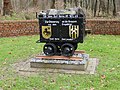 Zechenlore Teutoburgia (1).JPG 4,864 × 3,648; 9.09 MB

.JPG)
.JPG)
.JPG)


.JPG)