Category:Ziemia chełmska
Перейти до навігації
Перейти до пошуку
Use the appropriate category for maps showing all or a large part of Ziemia chełmska. See subcategories for smaller areas:
| If the map shows | Category to use |
|---|---|
| Ziemia chełmska on a recently created map | [[:Category:Maps of Ziemia chełmska]] or its subcategories |
| Ziemia chełmska on a map created more than 70 years ago | [[:Category:Old maps of Ziemia chełmska]] or its subcategories |
| the history of Ziemia chełmska on a recently created map | [[:Category:Maps of the history of Ziemia chełmska]] or its subcategories |
| the history of Ziemia chełmska on a map created more than 70 years ago | [[:Category:Old maps of the history of Ziemia chełmska]] or its subcategories |
Файли в категорії «Ziemia chełmska»
Показано 37 файлів цієї категорії (із 37).
-
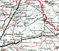
 Bukowa na mapie kwatermistrzostwa.jpg 780 × 1188; 210 КБ
-

-

-
 Felicjan Szumborski.jpg 1625 × 1996; 143 КБ
-
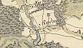
 Gdola i Zalin na mapie topograficznej Królestwa Polskiego z 1839 r..jpg 718 × 584; 258 КБ
-
 Gdola i Zalin na mapie topograficznej Królestwa Polskiego z 1839.jpg 801 × 480; 156 КБ
-
 Gmina Bukowa na mapie administracyjnej Rzeczypospolitej z 1937 r..jpg 1595 × 1508; 588 КБ
-
 Gmina Swierze na mapie administracyjnej Rzeczypospolitej z 1937 r..jpg 1521 × 1321; 479 КБ
-
 Ilowa i Rudnia na mapie Rosji Zachodniej z 1915 roku.jpg 967 × 588; 175 КБ
-
 Ilowa Rudnia okolo 1887.jpg 1553 × 846; 354 КБ
-
 Ilowa Rudnia Westgalizien.jpg 858 × 497; 94 КБ
-

-
 Iłowa na mapie topograficznej Krolestwa Polskiego 1839. (2)jpg.jpg 639 × 404; 94 КБ
-
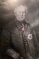
 Jakub Susza, unicki biskup chelmski.jpg 1032 × 1390; 345 КБ
-
 Jan Teraszkiewicz.jpg 1104 × 1656; 373 КБ
-
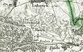
 Lesniczowka na mapie topograficznej Królestwa Polskiego z 1839 r..jpg 689 × 399; 173 КБ
-
-
 Lukowek Josephnische landesaufnahme.jpg 1066 × 446; 103 КБ
-
 Maksymilian Ryłło.jpg 352 × 511; 125 КБ
-
 Ruda na mapie Rosji Zachodniej, 1915 r..jpg 992 × 560; 169 КБ
-
 Ruda na mapie topograficznej Krolestwa Polskiego 1839 (2).jpg 780 × 341; 96 КБ
-
 Ruda Westgalizien.jpg 908 × 442; 90 КБ
-
 Rudka na mapie topograficznej Krolestwa Polskiego 1839 (2).jpg 864 × 486; 132 КБ
-
 Uhrusk i okolice na mapie Galicji Zachodniej, 1808 r..jpg 637 × 322; 73 КБ
-
 Uhrusk na mapie Rosji Zachodniej, 1915 r..jpg 951 × 707; 214 КБ
-
 Uhrusk na mapie topograficznej Krolestwa Polskiego 1839.jpg 700 × 461; 101 КБ
-
 Wola Uhruska na mapie Reymanna, XIX w..jpg 798 × 472; 111 КБ
-
 Wola Uhruska na mapie Rzeczypospolitej z 1772 r..jpg 430 × 249; 38 КБ
-
 Wola Uhruska na mapie topograficznej Królestwa Polskiego, 1839 r..jpg 693 × 440; 100 КБ
-
 Wola Uhruska na mapie Wojskowego Instytutu Geograficznego z 1933 r..jpg 1322 × 907; 317 КБ
-

-

-
 Ziemia chełmska na mapie Rzeczypospolitej z 1739 r..jpg 690 × 439; 94 КБ
-
 Ziemia chełmska na mapie Rzeczypospolitej z 1772 r..jpg 2830 × 2560; 2,37 МБ
-
 Ziemia chełmska na mapie Rzeczypospolitej z ok. 1680 r..jpg 785 × 501; 114 КБ
-
 Łukówek na mapie Rosji Zachodniej, 1915 r..jpg 1065 × 580; 185 КБ
-
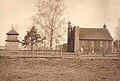 Давня церква у селі Добромишль, фото 1915-1917 рр.jpg 667 × 451; 215 КБ

_che%C5%82mski_w_zaborze_austriackim_-_mapa_Galicji_Zachodniej,_1803_r..jpg)


jpg.jpg)


.jpg)

.jpg)


_na_mapie_Rzeczypospolitej_z_1700_r..jpg)
_na_mapie_Tabula_nova_totius_Regni_Poloniae,_Amsterdam_1690.jpg)


