Category:Eyre Peninsula
(Redirected from Eyre Peninsula)
peninsula in South Australia | |||||
| Upload media | |||||
| Instance of | |||||
|---|---|---|---|---|---|
| Location | South Australia, AUS | ||||
| Elevation above sea level |
| ||||
 | |||||
Subcategories
This category has the following 30 subcategories, out of 30 total.
2
B
C
- Caralue Bluff (2 F)
- Cultana Training Area (7 F)
E
F
G
I
- Iron Monarch Open Cut (18 F)
J
L
M
- Minerals of Whyalla (3 F)
- Mount Millar Wind Farm (2 F)
- Murphy's Haystacks (15 F)
P
- Pildappa Rock (3 F)
S
T
W
- Wangary (4 F)
- Wudinna District Council (1 F)
Media in category "Eyre Peninsula"
The following 73 files are in this category, out of 73 total.
-
26 Eyre Hwy 02.JPG 1,600 × 1,200; 191 KB
-
Bailla Hill Road, Eyre Peninsula, 2017 (01).jpg 4,928 × 3,264; 5.65 MB
-
Coffin Bay lime sands line location.png 982 × 783; 75 KB
-
Coffin Bay lime sands line mini map.png 179 × 134; 20 KB
-
County of Way, South Australia.png 674 × 738; 61 KB
-
Cowell-aerial-view-1214.jpg 2,048 × 1,536; 1.58 MB
-
Cowell-aerial-view-1215.jpg 2,048 × 1,536; 1.58 MB
-
Diagram -- Ceduna-Kevin track and signal changes 1962.jpg 2,052 × 1,142; 207 KB
-
Eyre Peninsula Satellite NASA.jpg 1,713 × 1,478; 693 KB
-
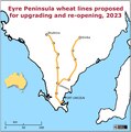
Eyre Peninsula wheat lines proposed for upgrading and re-opening, 2023.tif 1,110 × 1,116; 3.55 MB
-
From Adelaide to Streaky Bay around the Eyre Peninsula (13113007495).jpg 5,616 × 3,744; 22.45 MB
-
From Adelaide to Streaky Bay around the Eyre Peninsula (13113274194).jpg 4,876 × 3,251; 14.07 MB
-
Gnarly Old Tree - South Australia.jpg 4,688 × 3,456; 13.15 MB
-
Iron Knob Hill, Eyre Peninsula(GN01822).jpg 3,264 × 2,448; 915 KB
-
Lake MacDonnell (Kevin) gypsum mine 2019 (LocationSAMapViewer CC BY).jpg 3,318 × 2,479; 6.65 MB
-
Lake MacDonnell-Thevenard gypsum line location.png 741 × 589; 55 KB
-
Lake MacDonnell-Thevenard gypsum line mini map.png 291 × 238; 71 KB
-
Map of rocket launching sites used by Southern Launch in South Australia.tif 1,543 × 1,634; 9.62 MB
-
Middleback Range-Whyalla iron ore line location.png 740 × 592; 56 KB
-
Middleback Range-Whyalla iron ore line mini map.png 173 × 152; 16 KB
-
Middleback Range-Whyalla railway route.tif 1,652 × 1,450; 9.14 MB
-
Mining gypsum at Kevin (Lake MacDonnell), Eyre Peninsula SA.jpg 2,778 × 1,562; 853 KB
-
Mount Hill, South Australia.jpg 2,048 × 1,360; 940 KB
-
Murphy’s Hay Stacks, Eyre Peninsula, SA.jpg 4,096 × 940; 1.02 MB
-
Route of the Whyalla–Port Augusta railway line.jpg 1,653 × 2,083; 3.08 MB
-
SA Govt major development -- Central Eyre Iron Project.jpg 5,100 × 6,600; 4.42 MB
-
Satellite map of Eyre Peninsula with all railway lines.tif 5,600 × 4,514; 96.44 MB
-
SESouthAutraliaHighways.png 1,305 × 1,080; 311 KB
-
South Australia banner.jpg 6,300 × 900; 913 KB
-
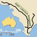
South Australian Railways Port Lincoln Division mini map.png 169 × 169; 24 KB
-
Spencer-Gulf-shoals-between-Whyalla-and-Cowell-aerial-view-1212.jpg 2,048 × 1,536; 1.51 MB
-
SpencerGulf TaylorIsland2.jpg 562 × 568; 119 KB
-
Staying Still 100 - Mount Westall Morning.jpg 5,120 × 1,495; 4.37 MB
-
Staying Still 101 - Rockpool Joy.jpg 3,253 × 3,000; 8.29 MB
-
Staying Still 102 - Amazing Morning.jpg 4,954 × 1,138; 6.02 MB
-
Staying Still 103 - Harem.jpg 5,120 × 1,001; 5.6 MB
-
Staying Still 70 - Flowerscape 1.jpg 5,120 × 2,783; 12.93 MB
-
Staying Still 71 - Flowerscape 2.jpg 2,911 × 2,781; 10.3 MB
-
Staying Still 74 - A Soft Wind Rises.jpg 2,596 × 2,911; 10.62 MB
-
Staying Still 75 - At Lipson Cove 1.jpg 2,712 × 3,000; 5.46 MB
-
Staying Still 76 - At Lipson Cove 2.jpg 1,763 × 5,120; 7.62 MB
-
Staying Still 77 - Angels Singing And All That.jpg 4,326 × 2,797; 13.66 MB
-
Staying Still 78 - Threshold.jpg 4,890 × 1,793; 12.16 MB
-
Staying Still 79 - Beyond The Gate 1.jpg 3,000 × 3,000; 8.36 MB
-
Staying Still 80 - Beyond The Gate 2.jpg 4,599 × 2,757; 16.92 MB
-
Staying Still 81 - Beyond The Gate 3.jpg 3,000 × 3,000; 7.25 MB
-
Staying Still 82 - Beyond The Gate 4.jpg 3,037 × 3,000; 3.91 MB
-
Staying Still 83 - Beyond The Gate 5.jpg 5,120 × 2,140; 10.03 MB
-
Staying Still 84 - Beyond The Gate 6.jpg 3,012 × 3,000; 11.95 MB
-
Staying Still 86 - Isthmus.jpg 3,000 × 3,000; 10.24 MB
-
Staying Still 87 - Strange Petrified Mudflat Place.jpg 3,000 × 3,000; 10.66 MB
-
Staying Still 88 - Nostalgia.jpg 5,120 × 1,523; 7.8 MB
-
Staying Still 89 - Crab In A Crevice.jpg 4,894 × 3,000; 7.14 MB
-
Staying Still 90 - Coles Point 1.jpg 5,120 × 1,744; 6.85 MB
-
Staying Still 91 - Coles Point 2.jpg 1,995 × 3,000; 5.65 MB
-
Staying Still 93 - Cliff Crawl.jpg 5,120 × 2,765; 9.85 MB
-
Staying Still 94 - Osprey Nest.jpg 1,138 × 5,120; 5.37 MB
-
Staying Still 95 - Bright Green Flowers.jpg 4,359 × 2,816; 14.83 MB
-
Staying Still 97 - Turquoise & Terracotta.jpg 4,928 × 2,656; 15.6 MB
-
Staying Still 98 - Painted Backdrop.jpg 5,120 × 2,720; 11.67 MB
-
Staying Still 99 - Cape Bauer Breeze.jpg 1,707 × 2,915; 7.54 MB
-
Sunset at Lone Pine - South Australia (Explored).jpg 5,184 × 2,003; 5.46 MB
-
TED-02 Drone Photo.png 1,780 × 941; 1.9 MB
-
Theakstones Crevasse(GN05715).jpg 2,448 × 3,264; 627 KB
-
Waves at Lone Pine - South Australia.jpg 5,184 × 2,112; 3.82 MB
-
West Coast Pioneers (or Eyre Peninsula Pioneers) - Royal Geographical negatives(GN02497).jpg 2,448 × 3,264; 1.19 MB
-
Whyalla-Port Augusta steel products line location.png 738 × 590; 55 KB
-
Whyalla-to-Cowell-aerial-view-1212.jpg 2,048 × 1,536; 1.6 MB
-
Yalata, South Australia -- aerial looking north-east.jpg 2,778 × 1,562; 3.09 MB


