Fichtestraße (Ruhland)
Jump to navigation
Jump to search
| Object location | | View all coordinates using: OpenStreetMap |
|---|
von der August-Bebel-Straße zum Birkenweg
[edit]
vom Birkenweg zur August-Bebel-Straße
[edit]-
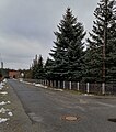
 vom Birkenweg
 -
 bei Mündung Parzellenstraße
rechts in Parzellenstraße
hinten links August-Bebel-Straße westwärts
hinten rechts August-Bebel-Straße ostwärts

