File:Ingushetia topographic map de.png
Jump to navigation
Jump to search
No higher resolution available.
Ingushetia_topographic_map_de.png (263 × 349 pixels, file size: 150 KB, MIME type: image/png)
Captions
Captions
Add a one-line explanation of what this file represents
Summary
[edit]
| Description |
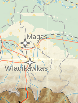
English: Topographic map of Ingushetia.
Deutsch: Topografische Karte Inguschetiens. |
| Date | |
| Source | Own work by uploader, derivate of File:Georgia topographic map-de.svg |
| Author | Don-kun |

|
This map image could be re-created using vector graphics as an SVG file. This has several advantages; see Commons:Media for cleanup for more information. If an SVG form of this image is available, please upload it and afterwards replace this template with
{{vector version available|new image name}}.
It is recommended to name the SVG file “Ingushetia topographic map de.svg”—then the template Vector version available (or Vva) does not need the new image name parameter. |
Licensing
[edit]
I, the copyright holder of this work, hereby publish it under the following licenses:
This file is licensed under the Creative Commons Attribution-Share Alike 3.0 Unported license.
- You are free:
- to share – to copy, distribute and transmit the work
- to remix – to adapt the work
- Under the following conditions:
- attribution – You must give appropriate credit, provide a link to the license, and indicate if changes were made. You may do so in any reasonable manner, but not in any way that suggests the licensor endorses you or your use.
- share alike – If you remix, transform, or build upon the material, you must distribute your contributions under the same or compatible license as the original.

|
Permission is granted to copy, distribute and/or modify this document under the terms of the GNU Free Documentation License, Version 1.2 or any later version published by the Free Software Foundation; with no Invariant Sections, no Front-Cover Texts, and no Back-Cover Texts. A copy of the license is included in the section entitled GNU Free Documentation License. |
You may select the license of your choice.
File history
Click on a date/time to view the file as it appeared at that time.
| Date/Time | Thumbnail | Dimensions | User | Comment | |
|---|---|---|---|---|---|
| current | 15:44, 29 June 2024 | | 263 × 349 (150 KB) | Aslan Merzho (talk | contribs) | Reverted to version as of 09:09, 26 June 2024 (UTC) |
| 17:52, 28 June 2024 |  | 1,500 × 1,133 (767 KB) | 𝐺ℎ𝑖𝑙𝑔ℎ𝑜 (talk | contribs) | Reverted to version as of 21:07, 25 June 2024 (UTC) | |
| 09:09, 26 June 2024 |  | 263 × 349 (150 KB) | Flandria12 (talk | contribs) | Актальная карта, вандализм. Reverted to version as of 21:02, 14 June 2024 (UTC) | |
| 21:07, 25 June 2024 |  | 1,500 × 1,133 (767 KB) | 𝐺ℎ𝑖𝑙𝑔ℎ𝑜 (talk | contribs) | Reverted to version as of 22:51, 10 June 2024 (UTC) | |
| 21:02, 14 June 2024 |  | 263 × 349 (150 KB) | Aslan Merzho (talk | contribs) | Reverted to version as of 22:30, 8 April 2023 (UTC) | |
| 22:51, 10 June 2024 |  | 1,500 × 1,133 (767 KB) | 𝐺ℎ𝑖𝑙𝑔ℎ𝑜 (talk | contribs) | Reverted to version as of 05:56, 14 January 2020 (UTC) | |
| 22:30, 8 April 2023 |  | 263 × 349 (150 KB) | Merjuev Salovdi (talk | contribs) | Reverted to version as of 19:50, 13 January 2020 (UTC)richtige Grenzen | |
| 05:56, 14 January 2020 |  | 1,500 × 1,133 (767 KB) | Don-kun (talk | contribs) | Reverted to version as of 11:27, 20 February 2014 (UTC) version by Takhirgeran Umar didnt highlight ingushetia, but geogia | |
| 19:50, 13 January 2020 |  | 263 × 349 (150 KB) | Takhirgeran Umar (talk | contribs) | clarification | |
| 11:27, 20 February 2014 |  | 1,500 × 1,133 (767 KB) | Don-kun (talk | contribs) | cor Magas |
You cannot overwrite this file.
File usage on Commons
There are no pages that use this file.
File usage on other wikis
The following other wikis use this file: