File:"Overhanging Mangrove Trees".jpg
Jump to navigation
Jump to search

Size of this preview: 800 × 600 pixels. Other resolutions: 320 × 240 pixels | 640 × 480 pixels | 1,024 × 768 pixels | 1,280 × 960 pixels | 2,560 × 1,920 pixels | 3,648 × 2,736 pixels.
Original file (3,648 × 2,736 pixels, file size: 2.15 MB, MIME type: image/jpeg)
Captions
Captions
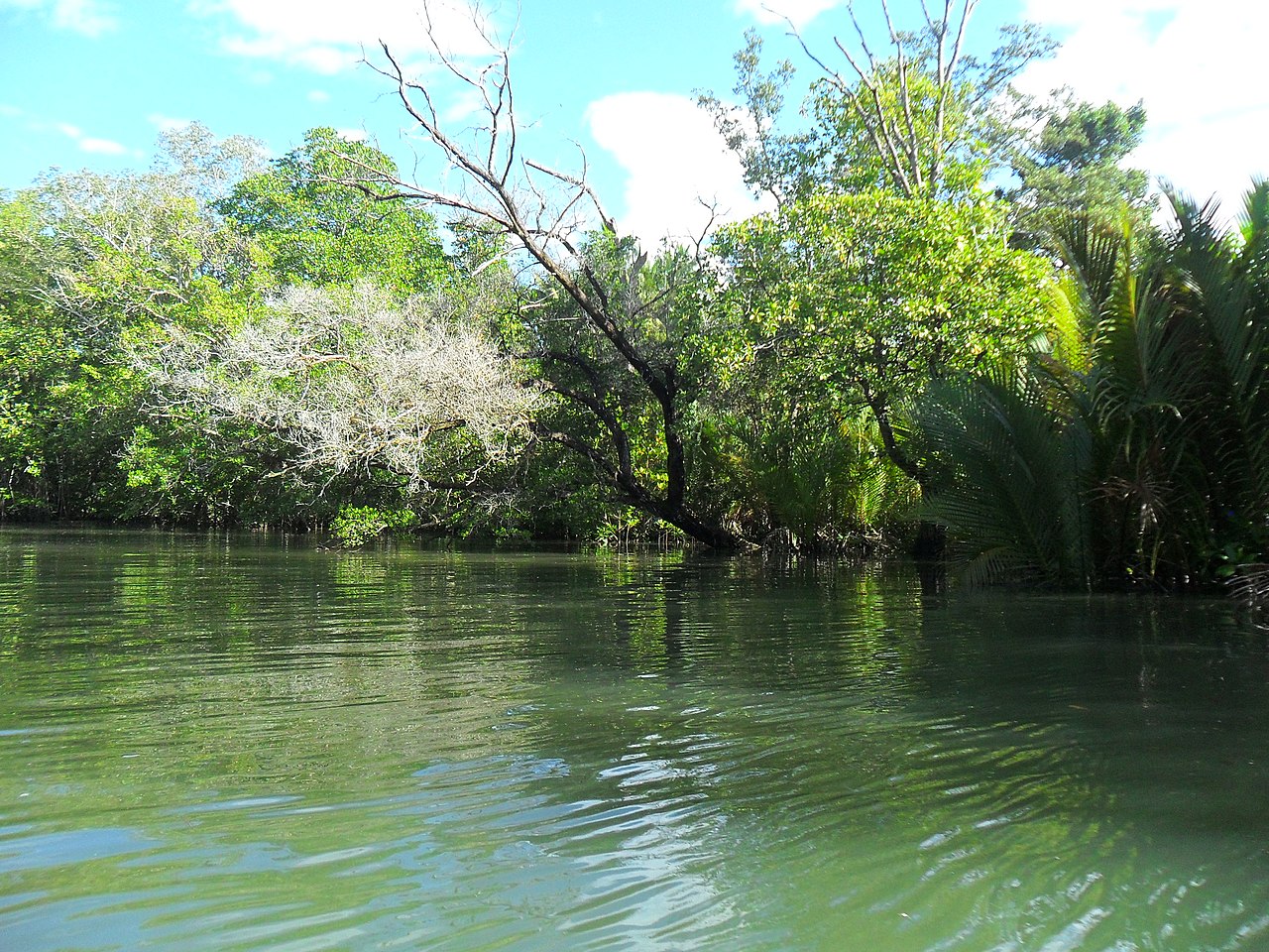
Overhanging mangrove trees is located at Piso Point with a maze inlets river formation which allows the Japanese hid their Suicide Boats to initiate camouflage attack against their enemies.
Summary
[edit]
| Description |
English: Piso Point is where overhanging mangrove trees (of different species) located where during World War II, when Japanese invaded the Southern Philippines, they occupied Davao City and Piso Point. Piso Point was strategically located at the south with many overhanging mangrove trees and the maze inlets river formation which allows the Japanese hid their Suicide Boats to initiate camouflage attack against their enemies. |
| Date | 20:41:02 |
| Source | Own work |
| Author | Nurz CA |
| Camera location | | View this and other nearby images on: OpenStreetMap |
|---|
Pagatpat Tanawanan Adventure Park (PTAP) could led you for an hour of adventure to this historical places at Barangay Piso, Banaybanay, 8208 Davao Oriental.
Licensing
[edit]
I, the copyright holder of this work, hereby publish it under the following license:
This file is licensed under the Creative Commons Attribution-Share Alike 4.0 International license.
- You are free:
- to share – to copy, distribute and transmit the work
- to remix – to adapt the work
- Under the following conditions:
- attribution – You must give appropriate credit, provide a link to the license, and indicate if changes were made. You may do so in any reasonable manner, but not in any way that suggests the licensor endorses you or your use.
- share alike – If you remix, transform, or build upon the material, you must distribute your contributions under the same or compatible license as the original.
This image was uploaded as part of Wiki Loves Earth 2021.
|
 |
File history
Click on a date/time to view the file as it appeared at that time.
| Date/Time | Thumbnail | Dimensions | User | Comment | |
|---|---|---|---|---|---|
| current | 03:51, 23 June 2021 | | 3,648 × 2,736 (2.15 MB) | Nurz ca (talk | contribs) | Uploaded own work with UploadWizard |
You cannot overwrite this file.
File usage on Commons
There are no pages that use this file.
File usage on other wikis
The following other wikis use this file:
- Usage on bcl.wikipedia.org
- Usage on en.wikipedia.org