File:"Skalka" Rydultowy fot 4.JPG
Jump to navigation
Jump to search
Size of this preview: 800 × 600 pixels. Other resolutions: 320 × 240 pixels | 640 × 480 pixels | 1,024 × 768 pixels | 1,280 × 960 pixels | 2,560 × 1,920 pixels | 3,072 × 2,304 pixels.
Original file (3,072 × 2,304 pixels, file size: 1.82 MB, MIME type: image/jpeg)
Captions
Captions
Add a one-line explanation of what this file represents
Summary
[edit]
| Description |
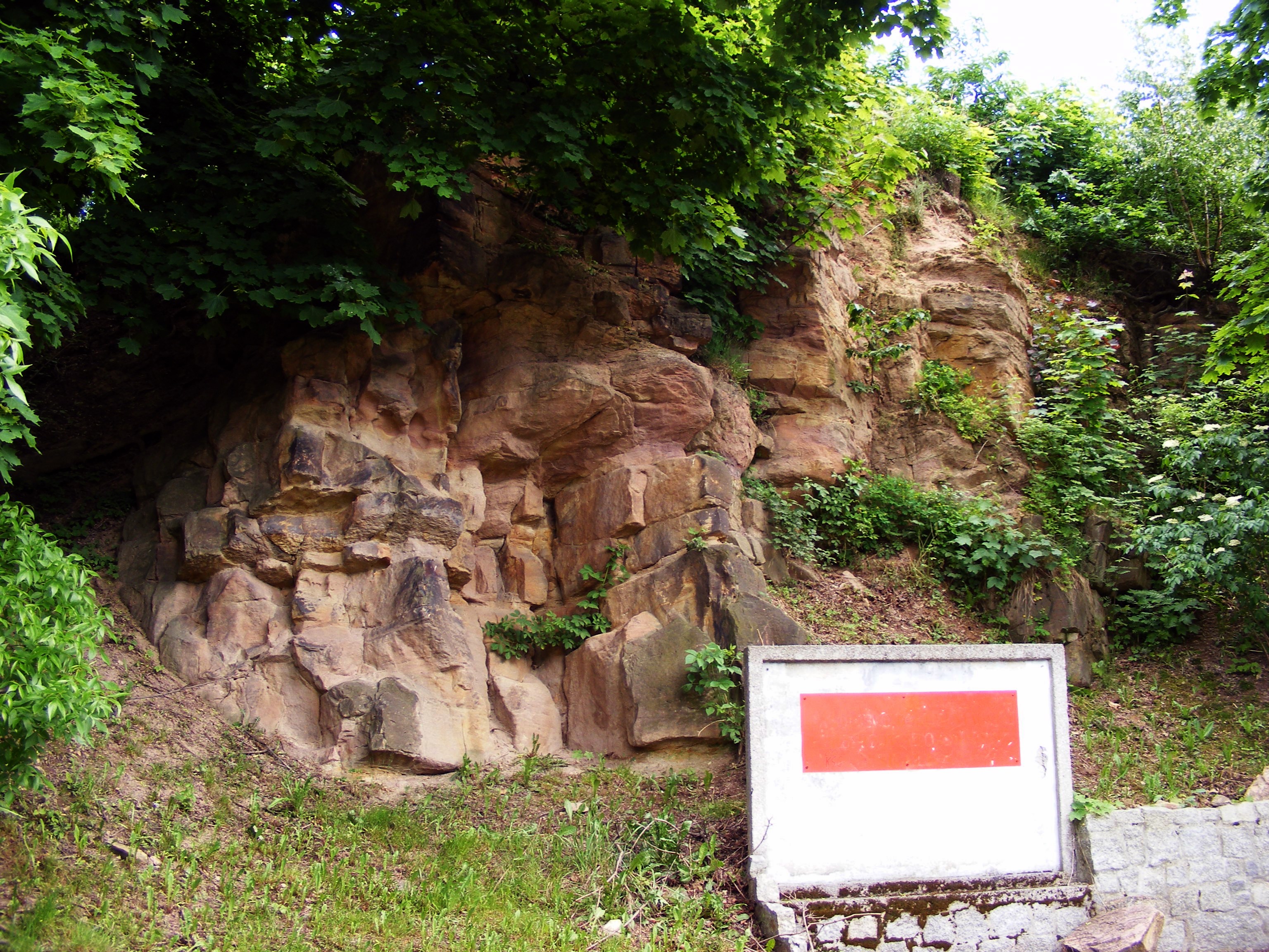
Polski: „Skałka" – pomnik przyrody nieożywionej, obejmuje wychodnię karbońskich piaskowców paralitycznych należących do warstw porębskich i tworzy duże odsłonięcie w zboczu wzgórza. Odsłonięcie, zajmujące powierzchnię 0,0456 ha, ma plan owalny o długości ok. 80 m oraz wysokości skarpy 6-8 m. Częściowo jest porośnięte i obsypane, szczególnie w kierunku zachodnim. Najlepiej odsłonięty profil, o miąższości 4,5 m oraz długości odsłonięcia ok.10 m, znajduje się w części wschodniej. Dalej w kierunku zachodnim występuje kilka odosobnionych mniejszych odsłonięć w szczytowej części skarpy o miąższości do 2 m. Rada Miasta Rydułtowy uchwałą nr XXXVII/325/02 z dnia 25 stycznia 2002r. objęła ochroną prawną, w drodze uznania za stanowisko dokumentacyjne przyrody nieożywionej /tekst źródłowy: www.rydultowy.pl/.
|
||
| Date | |||
| Source | Own work | ||
| Author | Michał Urbasik |
| Camera location | | View this and other nearby images on: OpenStreetMap |
|---|
Licensing
[edit]
I, the copyright holder of this work, hereby publish it under the following license:
This file is licensed under the Creative Commons Attribution-Share Alike 3.0 Poland license.
- You are free:
- to share – to copy, distribute and transmit the work
- to remix – to adapt the work
- Under the following conditions:
- attribution – You must give appropriate credit, provide a link to the license, and indicate if changes were made. You may do so in any reasonable manner, but not in any way that suggests the licensor endorses you or your use.
- share alike – If you remix, transform, or build upon the material, you must distribute your contributions under the same or compatible license as the original.

This image was uploaded as part of Wiki Loves Earth 2015.
|
 |
File history
Click on a date/time to view the file as it appeared at that time.
| Date/Time | Thumbnail | Dimensions | User | Comment | |
|---|---|---|---|---|---|
| current | 17:49, 31 May 2015 | | 3,072 × 2,304 (1.82 MB) | Mstkrft (talk | contribs) | User created page with UploadWizard |
You cannot overwrite this file.
File usage on Commons
There are no pages that use this file.