File:Çankırı districts.png
跳至導覽
跳至搜尋

預覽大小:776 × 600 像素。 其他解析度:311 × 240 像素 | 621 × 480 像素 | 994 × 768 像素 | 1,056 × 816 像素。
原始檔案 (1,056 × 816 像素,檔案大小:37 KB,MIME 類型:image/png)
說明
說明
添加單行說明來描述出檔案所代表的內容
摘要
[編輯]
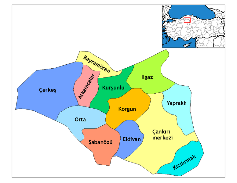
| 描述 | Map of the districts of Çankırı province in Turkey. Created by Rarelibra 19:28, 1 December 2006 (UTC) for public domain use, using MapInfo Professional v8.5 and various mapping resources. Edited by One Homo Sapiens Corrected text where İ,Ş,ı,ğ,or ş occurs in name. Source: [statoids-com]. Increased font size and enhanced color differences among adjacent districts. |
| 日期 | 2007年3月31日 (原始上傳日期) |
| 來源 | No machine-readable source provided. Own work assumed (based on copyright claims). |
| 作者 | No machine-readable author provided. Denizz~commonswiki assumed (based on copyright claims). |
授權條款
[編輯]
| 我,此作品的版權所有人,釋出此作品至公共領域。此授權條款在全世界均適用。 這可能在某些國家不合法,如果是的話: 我授予任何人有權利使用此作品於任何用途,除受法律約束外,不受任何限制。 |
檔案歷史
點選日期/時間以檢視該時間的檔案版本。
| 日期/時間 | 縮圖 | 尺寸 | 使用者 | 備註 | |
|---|---|---|---|---|---|
| 目前 | 2008年12月28日 (日) 21:46 | | 1,056 × 816(37 KB) | One Homo Sapiens(留言 | 貢獻) | Corrected text where İ,Ş,ı,ğ,or ş occurs in name. Source: [statoids-com]. Increased font size and enhanced color differences among adjacent districts. |
| 2007年3月31日 (六) 07:14 |  | 1,056 × 816(30 KB) | Denizz~commonswiki(留言 | 貢獻) | == Summary == Map of the districts of Cankiri province in Turkey. Created by Rarelibra 19:28, 1 December 2006 (UTC) for public domain use, using MapInfo Professional v8.5 and various mapping resources. == Licensing == {{PD-self}} <!-- |
無法覆蓋此檔案。
檔案用途
下列2個頁面有用到此檔案:
全域檔案使用狀況
以下其他 wiki 使用了這個檔案:
- ar.wikipedia.org 的使用狀況
- ast.wikipedia.org 的使用狀況
- ba.wikipedia.org 的使用狀況
- ca.wikipedia.org 的使用狀況
- cs.wikipedia.org 的使用狀況
- de.wikipedia.org 的使用狀況
- diq.wikipedia.org 的使用狀況
- en.wikipedia.org 的使用狀況
- Çankırı Province
- Wikipedia:Reference desk/Archives/Science/2009 December 25
- Districts of Turkey
- Governor of Çankırı
- List of populated places in Çankırı Province
- Orta District
- Atkaracalar District
- Bayramören District
- Çankırı District
- Çerkeş District
- Eldivan District
- Ilgaz District
- Kızılırmak District
- Korgun District
- Kurşunlu District
- Şabanözü District
- Yapraklı District
- eo.wikipedia.org 的使用狀況
- es.wikipedia.org 的使用狀況
- eu.wikipedia.org 的使用狀況
- fa.wikipedia.org 的使用狀況
檢視此檔案的更多全域使用狀況。