File:Łabiszyn (gmina) location map.png
Jump to navigation
Jump to search
Size of this preview: 544 × 599 pixels. Other resolutions: 218 × 240 pixels | 436 × 480 pixels | 740 × 815 pixels.
Original file (740 × 815 pixels, file size: 111 KB, MIME type: image/png)
Captions
Captions
Add a one-line explanation of what this file represents
| Description |
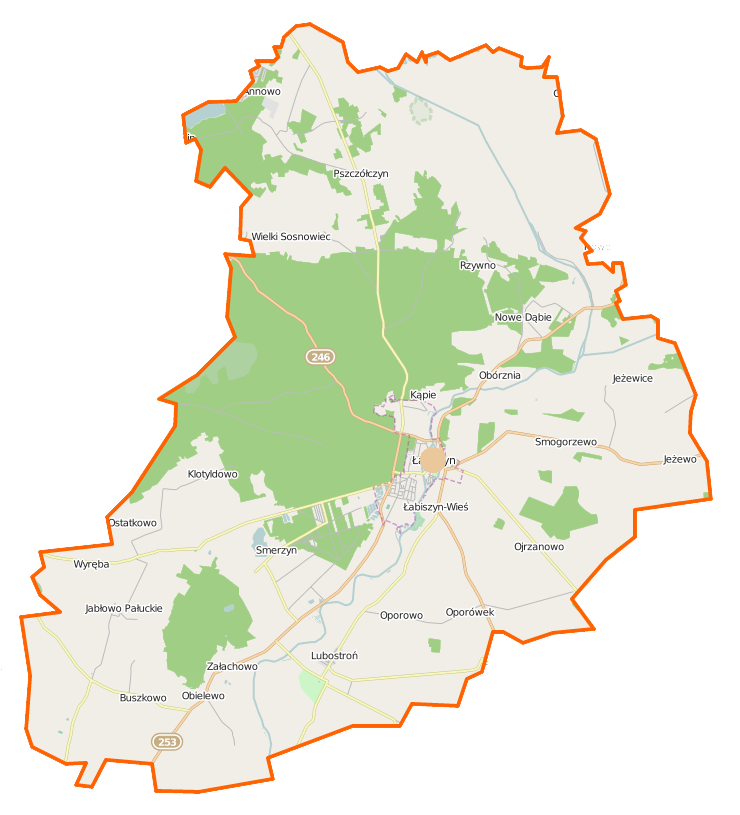
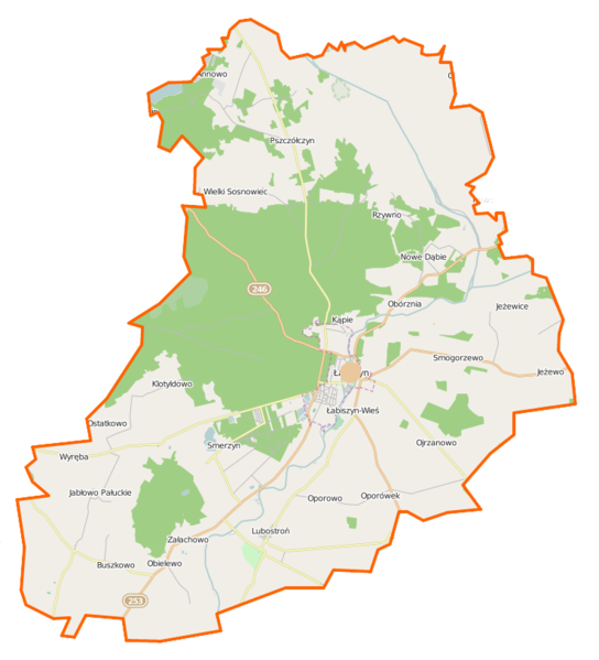
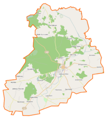
Polski: Mapa gminy Łabiszyn, Polska
English: Map of Gmina Łabiszyn, Poland |
|||||||||
| Date | ||||||||||
| Source | You may find a page on the OpenStreetMap wiki page for Łabiszyn (gmina) | |||||||||
| Creator |
OpenStreetMap contributors OpenStreetMap contributors |
|||||||||
| Permission (Reusing this file) |
OpenStreetMap data is available under the Open Database License (details). Map tiles are licensed under the Creative Commons Attribution-ShareAlike 2.0 license (CC-BY-SA 2.0).
This file is licensed under the Creative Commons Attribution-Share Alike 2.0 Generic license.
|
|||||||||
| Geotemporal data | ||||||||||
| Bounding box |
|
|||||||||
| Georeferencing | If inappropriate please set warp_status = skip to hide. | |||||||||
File history
Click on a date/time to view the file as it appeared at that time.
| Date/Time | Thumbnail | Dimensions | User | Comment | |
|---|---|---|---|---|---|
| current | 09:04, 22 November 2014 | | 740 × 815 (111 KB) | VanWiel (talk | contribs) | {{OpenStreetMap | name = Łabiszyn (gmina) | location = Łabiszyn (gmina) | description = {{pl|Mapa gminy Łabiszyn, Polska}} {{en|Map of Gmina Łabiszyn, Poland}} | top = 53.0476 | bottom = 52.8791... |
You cannot overwrite this file.
File usage on Commons
There are no pages that use this file.
File usage on other wikis
The following other wikis use this file:
- Usage on de.wikipedia.org
- Usage on fr.wikipedia.org
- Modèle:Géolocalisation/Łabiszyn (gmina)
- Modèle:Géolocalisation/Łabiszyn (gmina)/Documentation
- Buszkowo (Łabiszyn)
- Jabłówko (Couïavie-Poméranie)
- Jabłowo Pałuckie
- Jeżewice (Couïavie-Poméranie)
- Jeżewo (Łabiszyn)
- Łabiszyn-Wieś
- Lubostroń
- Nowe Dąbie
- Obielewo
- Obórznia
- Ojrzanowo
- Oporówek (Łabiszyn)
- Oporowo (Couïavie-Poméranie)
- Ostatkowo
- Wielki Sosnowiec
- Władysławowo (Łabiszyn)
- Załachowo
- Usage on nl.wikipedia.org
- Usage on pl.wikipedia.org
- Pałac w Lubostroniu
- Lubostroń
- Łabiszyn
- Łabiszyn (gmina)
- Jabłowo Pałuckie
- Łabiszyn-Wieś
- Nowe Dąbie
- Obielewo
- Obórznia
- Ojrzanowo
- Ostatkowo
- Wielki Sosnowiec
- Załachowo
- Jabłówko (województwo kujawsko-pomorskie)
- Jeżewice (województwo kujawsko-pomorskie)
- Oporowo (województwo kujawsko-pomorskie)
- Władysławowo (powiat żniński)
- Buszkowo (powiat żniński)
- Jeżewo (powiat żniński)
- Oporówek (powiat żniński)
- Smogorzewo (powiat żniński)
- Annowo (gmina Łabiszyn)
- Klotyldowo
- Pszczółczyn (województwo kujawsko-pomorskie)
- Rzywno
- Smerzyn
- Zdziersk
- Antoniewo (powiat żniński)
- Kąpie (województwo kujawsko-pomorskie)
View more global usage of this file.
_location_map.png)
_location_map.png&oldid=931942575)