File:Śniadowo (gmina) location map.png
Jump to navigation
Jump to search

Size of this preview: 441 × 599 pixels. Other resolutions: 176 × 240 pixels | 353 × 480 pixels | 733 × 996 pixels.
Original file (733 × 996 pixels, file size: 176 KB, MIME type: image/png)
Captions
Captions
Add a one-line explanation of what this file represents
| Description |
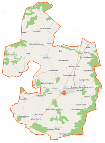
Polski: Mapa gminy Śniadowo, Polska
English: Map of Gmina Śniadowo, Poland |
|||||||||
| Date | ||||||||||
| Source | You may find a page on the OpenStreetMap wiki page for Śniadowo (gmina) | |||||||||
| Creator |
OpenStreetMap contributors OpenStreetMap contributors |
|||||||||
| Permission (Reusing this file) |
OpenStreetMap data is available under the Open Database License (details). Map tiles are licensed under the Creative Commons Attribution-ShareAlike 2.0 license (CC-BY-SA 2.0).
This file is licensed under the Creative Commons Attribution-Share Alike 2.0 Generic license.
|
|||||||||
| Geotemporal data | ||||||||||
| Bounding box |
|
|||||||||
| Georeferencing | If inappropriate please set warp_status = skip to hide. | |||||||||
File history
Click on a date/time to view the file as it appeared at that time.
| Date/Time | Thumbnail | Dimensions | User | Comment | |
|---|---|---|---|---|---|
| current | 14:38, 18 September 2014 | | 733 × 996 (176 KB) | VanWiel (talk | contribs) | {{Information |Description= |Source= |Date= |Author= |Permission= |other_versions= }} |
| 06:39, 2 June 2014 |  | 742 × 1,000 (391 KB) | VanWiel (talk | contribs) | {{OpenStreetMap | name = Śniadowo (gmina) | location = Śniadowo (gmina) | description = {{pl|Mapa gminy Śniadowo, Polska}} {{en|Map of Gmina Śniadowo, Poland}} | top = 53.1599 | left = 21.8491... |
You cannot overwrite this file.
File usage on Commons
There are no pages that use this file.
File usage on other wikis
The following other wikis use this file:
- Usage on pl.wikipedia.org
- Dębowo (powiat łomżyński)
- Śniadowo (gmina)
- Brulin
- Chomentowo
- Duchny Młode
- Jakać-Borki
- Jakać Dworna
- Jakać Młoda
- Jastrząbka Młoda
- Jemielite-Wypychy
- Kołaczki
- Konopki Młode
- Osobne
- Ratowo-Piotrowo
- Sierzputy-Marki
- Sierzputy Zagajne
- Szabły Młode
- Stara Jakać
- Stare Duchny
- Stare Jemielite
- Stare Konopki
- Stare Ratowo
- Stare Szabły
- Uśnik
- Uśnik-Dwór
- Uśnik-Kolonia
- Wszerzecz
- Wszerzecz-Kolonia
- Zalesie-Poczynki
- Zalesie-Wypychy
- Koziki (województwo podlaskie)
- Młynik (województwo podlaskie)
- Stara Jastrząbka (województwo podlaskie)
- Strzeszewo (województwo podlaskie)
- Szczepankowo (województwo podlaskie)
- Śniadowo (województwo podlaskie)
- Zagroby (województwo podlaskie)
- Grabowo (powiat łomżyński)
- Mężenin (powiat łomżyński)
- Olszewo (powiat łomżyński)
- Wierzbowo (powiat łomżyński)
- Żebry (powiat łomżyński)
- Truszki (gmina Śniadowo)
- Jakać Borowa
- Bagno (powiat łomżyński)
- Doły (powiat łomżyński)
- Koryta (województwo podlaskie)
- Śniadowo-Stara Stacja
- Żebry-Kolonia (województwo podlaskie)
- Pomnik Mikołaja II w Olszewie
View more global usage of this file.
_location_map.png)
_location_map.png&oldid=505068302)