File:Żagań (gmina wiejska) location map.png

Original file (1,417 × 2,544 pixels, file size: 478 KB, MIME type: image/png)
Captions
Captions
Summary
[edit]_location_map.png&action=edit§ion=1)
| Description |
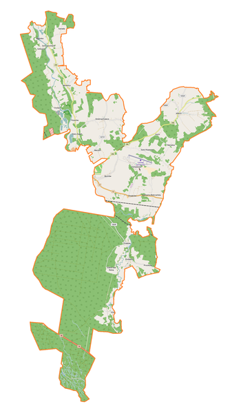
English: Location map |
| Date | |
| Source | Own work |
| Author | Smat |
| Description |
Polski: Mapa gminy wiejskiej Żagań, Polska
English: Map of Żagań (gmina wiejska), Poland |
|||||||||
| Date | ||||||||||
| Source | You may find a page on the OpenStreetMap wiki page for Żagań (gmina wiejska) | |||||||||
| Creator |
OpenStreetMap contributors OpenStreetMap contributors |
|||||||||
| Permission (Reusing this file) |
OpenStreetMap data is available under the Open Database License (details). Map tiles are licensed under the Creative Commons Attribution-ShareAlike 2.0 license (CC-BY-SA 2.0).
This file is licensed under the Creative Commons Attribution-Share Alike 2.0 Generic license.
|
|||||||||
| Geotemporal data | ||||||||||
| Bounding box |
|
|||||||||
| Georeferencing | If inappropriate please set warp_status = skip to hide. | |||||||||
Licensing
[edit]_location_map.png&action=edit§ion=2)
| This work contains information from OpenStreetMap, which is made available under the Open Database License (ODbL).
The ODbL does not require any particular license for maps produced from ODbL data. Prior to 1 August 2020, map tiles produced by the OpenStreetMap Foundation were licensed under the CC-BY-SA-2.0 license. Maps produced by other people may be subject to other licences. |
File history
Click on a date/time to view the file as it appeared at that time.
| Date/Time | Thumbnail | Dimensions | User | Comment | |
|---|---|---|---|---|---|
| current | 18:54, 17 August 2017 | | 1,417 × 2,544 (478 KB) | Smat (talk | contribs) | User created page with UploadWizard |
You cannot overwrite this file.
File usage on Commons
There are no pages that use this file.
File usage on other wikis
The following other wikis use this file:
- Usage on pl.wikipedia.org
- Bożnów
- Bukowina Bobrzańska
- Chrobrów
- Dzietrzychowice
- Gorzupia Dolna
- Kocin (województwo lubuskie)
- Miodnica
- Rudawica
- Stary Żagań
- Stara Kopernia
- Tomaszowo
- Gorzupia (województwo lubuskie)
- Gryżyce (województwo lubuskie)
- Jelenin (województwo lubuskie)
- Łozy (województwo lubuskie)
- Marysin (województwo lubuskie)
- Pożarów (województwo lubuskie)
- Pruszków (województwo lubuskie)
- Trzebów (powiat żagański)
- Dybów (województwo lubuskie)
- Nieradza
- Dobre nad Kwisą
- Wilczyce (Bukowina Bobrzańska)
- Machów (Bożnów)
- Niemcza (Gorzupia)
- Bukowina Bobrzańska (przystanek kolejowy)
- Łozy (przystanek kolejowy)
- Dobre nad Kwisą (przystanek kolejowy)
- Trzebów (przystanek kolejowy)
- Chotków (przystanek kolejowy)
- Jelenin Żagański
- Stara Kopernia (przystanek kolejowy)
- Biestrzykowice (przystanek kolejowy w województwie lubuskim)
- Lotnisko Żagań-Tomaszowo
- Moduł:Mapa/dane/Żagań (gmina wiejska)
- Kościół św. Augustyna w Chrobrowie
- Parafia św. Mikołaja w Jeleninie
- Parafia Wniebowzięcia Najświętszej Maryi Panny w Rudawicy
- Parafia Zwiastowania Najświętszej Maryi Panny w Bożnowie
- Parafia św. Jana Chrzciciela w Dzietrzychowicach
- Parafia św. Jadwigi Królowej w Tomaszowie (diecezja zielonogórsko-gorzowska)
- Kościół św. Mikołaja w Jeleninie
- Usage on pl.wikibooks.org
_location_map.png&oldid=607603042)