File:Żarnów (gmina) location map.png

Original file (2,316 × 1,712 pixels, file size: 644 KB, MIME type: image/png)
Captions
Captions
Summary
[edit]_location_map.png&action=edit§ion=1)
| Description |
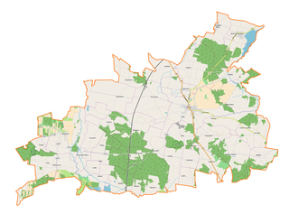
English: Location map |
| Date | |
| Source | Own work |
| Author | Smat |
| Description |
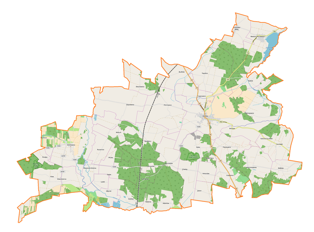
Polski: Mapa gminy Żarnów, Polska
English: Map of Żarnów (gmina), Poland |
|||||||||
| Date | ||||||||||
| Source | You may find a page on the OpenStreetMap wiki page for Żarnów (gmina) | |||||||||
| Creator |
OpenStreetMap contributors OpenStreetMap contributors |
|||||||||
| Permission (Reusing this file) |
OpenStreetMap data is available under the Open Database License (details). Map tiles are licensed under the Creative Commons Attribution-ShareAlike 2.0 license (CC-BY-SA 2.0).
This file is licensed under the Creative Commons Attribution-Share Alike 2.0 Generic license.
|
|||||||||
| Geotemporal data | ||||||||||
| Bounding box |
|
|||||||||
| Georeferencing | If inappropriate please set warp_status = skip to hide. | |||||||||
Licensing
[edit]_location_map.png&action=edit§ion=2)
| This work contains information from OpenStreetMap, which is made available under the Open Database License (ODbL).
The ODbL does not require any particular license for maps produced from ODbL data. Prior to 1 August 2020, map tiles produced by the OpenStreetMap Foundation were licensed under the CC-BY-SA-2.0 license. Maps produced by other people may be subject to other licences. |
File history
Click on a date/time to view the file as it appeared at that time.
| Date/Time | Thumbnail | Dimensions | User | Comment | |
|---|---|---|---|---|---|
| current | 15:41, 17 November 2017 | | 2,316 × 1,712 (644 KB) | Smat (talk | contribs) | User created page with UploadWizard |
You cannot overwrite this file.
File usage on Commons
There are no pages that use this file.
File usage on other wikis
The following other wikis use this file:
- Usage on pl.wikipedia.org
- Żarnów
- Afryka (województwo łódzkie)
- Dłużniewice
- Grębenice
- Jasion
- Klew
- Klew-Kolonia
- Malków
- Miedzna Murowana
- Niemojowice
- Paszkowice
- Pilichowice
- Ruszenice
- Ruszenice-Kolonia
- Siedlów
- Skórkowice
- Skumros
- Soczówki
- Straszowa Wola
- Widuch
- Zdyszewice
- Budków (powiat opoczyński)
- Chełsty (województwo łódzkie)
- Ławki (województwo łódzkie)
- Marcinków (województwo łódzkie)
- Myślibórz (województwo łódzkie)
- Nadole (województwo łódzkie)
- Nowa Góra (województwo łódzkie)
- Poręba (województwo łódzkie)
- Tomaszów (powiat opoczyński)
- Topolice (województwo łódzkie)
- Trojanowice (województwo łódzkie)
- Wierzchowisko (województwo łódzkie)
- Bronów (powiat opoczyński)
- Dąbie (powiat opoczyński)
- Malenie (powiat opoczyński)
- Młynek (powiat opoczyński)
- Adamów (gmina Żarnów)
- Antoniów (gmina Żarnów)
- Sielec (gmina Żarnów)
- Rezerwat przyrody Diabla Góra
- Tresta-Wesoła
- Niemojowice-Kolonia
- Łysa Góra (Paszkowice)
- Diabla Góra (Wzgórza Opoczyńskie)
- Kamieniec (województwo łódzkie)
- Odrowąż (Budków)
- Rezerwat przyrody Jodły Sieleckie
- Parafia św. Mikołaja w Żarnowie
- Parafia Miłosierdzia Bożego w Chełstach
View more global usage of this file.
_location_map.png)
_location_map.png&oldid=607603047)