File:Братська могила 1040 радянських воїнів DSC 0874 stitch.jpg
![File:Братська могила 1040 радянських воїнів DSC 0874 stitch.jpg](https://upload.wikimedia.org/wikipedia/commons/thumb/7/72/%D0%91%D1%80%D0%B0%D1%82%D1%81%D1%8C%D0%BA%D0%B0_%D0%BC%D0%BE%D0%B3%D0%B8%D0%BB%D0%B0_1040_%D1%80%D0%B0%D0%B4%D1%8F%D0%BD%D1%81%D1%8C%D0%BA%D0%B8%D1%85_%D0%B2%D0%BE%D1%97%D0%BD%D1%96%D0%B2_DSC_0874_stitch.jpg/800px-%D0%91%D1%80%D0%B0%D1%82%D1%81%D1%8C%D0%BA%D0%B0_%D0%BC%D0%BE%D0%B3%D0%B8%D0%BB%D0%B0_1040_%D1%80%D0%B0%D0%B4%D1%8F%D0%BD%D1%81%D1%8C%D0%BA%D0%B8%D1%85_%D0%B2%D0%BE%D1%97%D0%BD%D1%96%D0%B2_DSC_0874_stitch.jpg?20221031203849)
Original file (10,056 × 4,867 pixels, file size: 48.05 MB, MIME type: image/jpeg)
Captions
Captions
Summary
[edit]DescriptionБратська могила 1040 радянських воїнів DSC 0874 stitch.jpg |
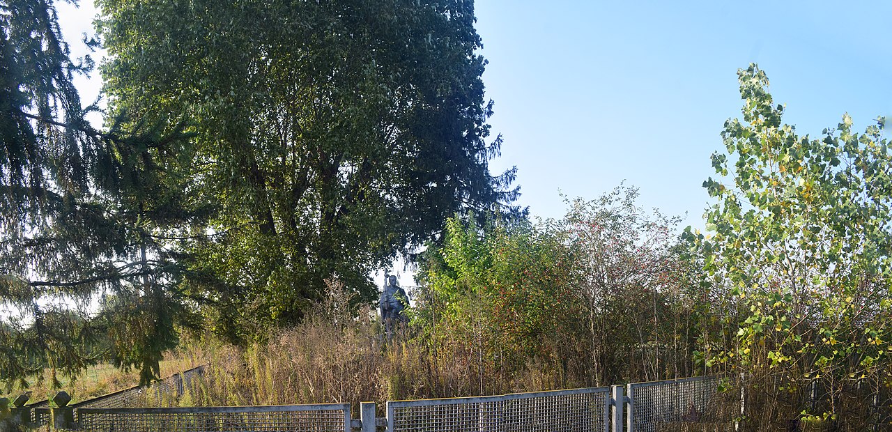
Українська: Братська могила 1040 радянських воїнів, де похований Герой Радянського Союзу М. О. Карабейніков у 1943 році, Нижча Дубечня,
|
||
Date | |||
Source | Own work | ||
Author | Сарапулов |
Camera location | 50° 40′ 47.4″ N, 30° 38′ 21.29″ E ![]() | View this and other nearby images on: OpenStreetMap | ![]() |
---|
Licensing
[edit]![w:en:Creative Commons](https://upload.wikimedia.org/wikipedia/commons/thumb/7/79/CC_some_rights_reserved.svg/90px-CC_some_rights_reserved.svg.png)
![attribution](https://upload.wikimedia.org/wikipedia/commons/thumb/1/11/Cc-by_new_white.svg/24px-Cc-by_new_white.svg.png)
![share alike](https://upload.wikimedia.org/wikipedia/commons/thumb/d/df/Cc-sa_white.svg/24px-Cc-sa_white.svg.png)
- You are free:
- to share – to copy, distribute and transmit the work
- to remix – to adapt the work
- Under the following conditions:
- attribution – You must give appropriate credit, provide a link to the license, and indicate if changes were made. You may do so in any reasonable manner, but not in any way that suggests the licensor endorses you or your use.
- share alike – If you remix, transform, or build upon the material, you must distribute your contributions under the same or compatible license as the original.
![]() |
This image was uploaded as part of Wiki Loves Monuments 2022.
Afrikaans ∙ Alemannisch ∙ azərbaycanca ∙ Bahasa Indonesia ∙ Bahasa Melayu ∙ Bikol Central ∙ bosanski ∙ brezhoneg ∙ català ∙ čeština ∙ Cymraeg ∙ dansk ∙ davvisámegiella ∙ Deutsch ∙ eesti ∙ English ∙ español ∙ Esperanto ∙ euskara ∙ français ∙ Frysk ∙ Gaeilge ∙ galego ∙ hrvatski ∙ Ido ∙ italiano ∙ latviešu ∙ Lëtzebuergesch ∙ Malagasy ∙ magyar ∙ Malti ∙ Nederlands ∙ norsk ∙ norsk nynorsk ∙ norsk bokmål ∙ polski ∙ português ∙ português do Brasil ∙ română ∙ shqip ∙ sicilianu ∙ slovenčina ∙ slovenščina ∙ suomi ∙ svenska ∙ Tagalog ∙ Türkçe ∙ Yorùbá ∙ Zazaki ∙ Ελληνικά ∙ беларуская ∙ беларуская (тарашкевіца) ∙ български ∙ кыргызча ∙ македонски ∙ русский ∙ српски / srpski ∙ українська ∙ ქართული ∙ հայերեն ∙ नेपाली ∙ हिन्दी ∙ বাংলা ∙ മലയാളം ∙ ไทย ∙ 한국어 ∙ +/− |
![]() |
File history
Click on a date/time to view the file as it appeared at that time.
Date/Time | Thumbnail | Dimensions | User | Comment | |
---|---|---|---|---|---|
current | 20:38, 31 October 2022 | ![]() | 10,056 × 4,867 (48.05 MB) | Сарапулов (talk | contribs) | Uploaded own work with UploadWizard |
You cannot overwrite this file.
File usage on Commons
The following page uses this file:
Metadata
This file contains additional information such as Exif metadata which may have been added by the digital camera, scanner, or software program used to create or digitize it. If the file has been modified from its original state, some details such as the timestamp may not fully reflect those of the original file. The timestamp is only as accurate as the clock in the camera, and it may be completely wrong.
Date and time of data generation | 16:58, 26 September 2020 |
---|---|
Latitude | 50° 40′ 47.4″ N |
Longitude | 30° 38′ 21.29″ E |
Altitude | 77 meters above sea level |
Horizontal resolution | 300 dpi |
Vertical resolution | 300 dpi |
Software used | Microsoft ICE v2.0.3.0 |
File change date and time | 16:58, 26 September 2020 |
Date and time of digitizing | 16:58, 26 September 2020 |
DateTime subseconds | 20 |
DateTimeOriginal subseconds | 20 |
DateTimeDigitized subseconds | 20 |
Color space | sRGB |
GPS time (atomic clock) | 13:58:26.72 |
Satellites used for measurement | 09 |
Geodetic survey data used | WGS-84 |
GPS date | 26 September 2020 |
GPS tag version | 2.3.0.0 |
Structured data
Items portrayed in this file
depicts
50°40'47.399"N, 30°38'21.289"E
image/jpeg
26 September 2020
- Cultural heritage monuments in Ukraine with known IDs
- Cultural heritage monuments in Ukraine missing SDC location of creation
- Wiki Loves Monuments in Ukraine 2022 - Quantity
- Files with coordinates missing SDC location of creation
- CC-BY-SA-4.0
- Self-published work
- Images from Wiki Loves Monuments 2022
- Images from Wiki Loves Monuments 2022 in Ukraine
- Images from Wiki Loves Monuments missing SDC location of creation
- Uploaded via Campaign:wlm-ua