File:Денежкин Камень. Солнцеворот-2017, вид из села Всеволодо-Благодатское.jpg
Jump to navigation
Jump to search
Size of this preview: 800 × 600 pixels. Other resolutions: 320 × 240 pixels | 640 × 480 pixels | 1,024 × 768 pixels | 1,280 × 960 pixels | 2,048 × 1,536 pixels.
Original file (2,048 × 1,536 pixels, file size: 133 KB, MIME type: image/jpeg)
Captions
Captions
Add a one-line explanation of what this file represents
Summary
[edit]
| Description |
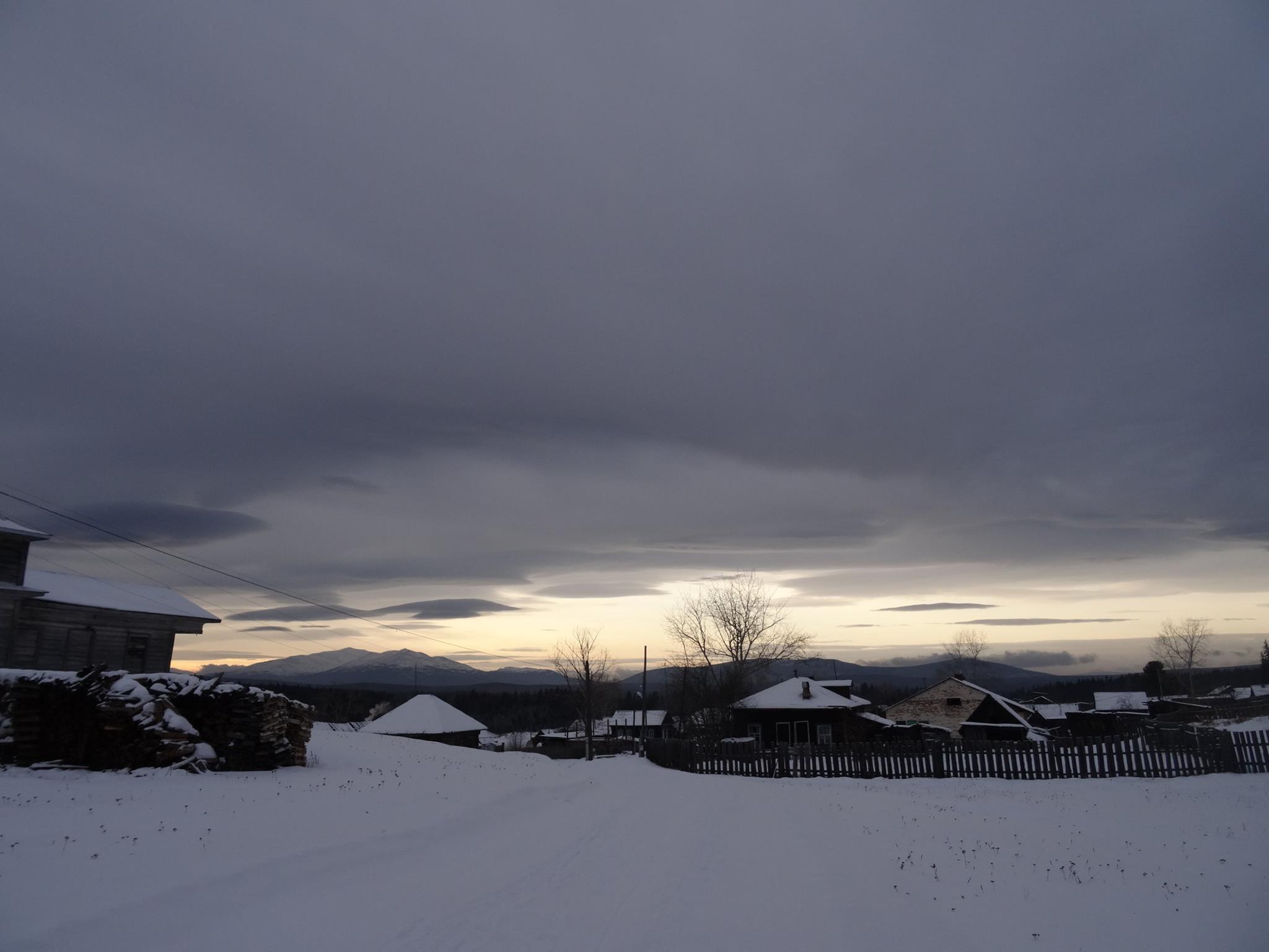
Русский: Денежкин Камень: Территория вытянута в меридиональном направлении и находится примерно в 40 км на северо-запад от г. Североуральска. Географические координаты: Центр: lat - 60о30'29,71", lon - 59о29'35,60" Север: lat - 60о47'24,30", lon - 59о35'0,10" Восток: lat - 60о26'51,17", lon - 59о42'32,68" Юг: lat - 60о19'15,99", lon - 59о32'45,14" Запад: lat - 60о22'56,30", lon - 59о12'6,02", Североуральск, Свердловская область
|
|||
| Date | ||||
| Source | Own work | |||
| Author | Владимирова Надежда Алексеевна |
Licensing
[edit]
I, the copyright holder of this work, hereby publish it under the following license:
This file is licensed under the Creative Commons Attribution-Share Alike 4.0 International license.
- You are free:
- to share – to copy, distribute and transmit the work
- to remix – to adapt the work
- Under the following conditions:
- attribution – You must give appropriate credit, provide a link to the license, and indicate if changes were made. You may do so in any reasonable manner, but not in any way that suggests the licensor endorses you or your use.
- share alike – If you remix, transform, or build upon the material, you must distribute your contributions under the same or compatible license as the original.
This image was uploaded as part of Wiki Loves Earth 2018.
|
 |
File history
Click on a date/time to view the file as it appeared at that time.
| Date/Time | Thumbnail | Dimensions | User | Comment | |
|---|---|---|---|---|---|
| current | 10:43, 30 May 2018 | | 2,048 × 1,536 (133 KB) | Nadiopt (talk | contribs) | User created page with UploadWizard |
You cannot overwrite this file.
File usage on Commons
There are no pages that use this file.