File:Завалівське лісництво - Лісове урочище «Горожанка» (OpenStreetMap).jpg
Jump to navigation
Jump to search

Size of this preview: 800 × 552 pixels. Other resolutions: 320 × 221 pixels | 640 × 441 pixels | 908 × 626 pixels.
Original file (908 × 626 pixels, file size: 129 KB, MIME type: image/jpeg)
Captions
Captions
Add a one-line explanation of what this file represents
Summary[edit]
.jpg&action=edit§ion=1)
| Description |
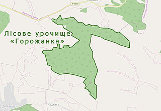
Українська: Лісове урочище ««Горожанка» у Завалівському лісництві Тернопільського обласного управління лісового та мисливського господарства, Монастириський район. |
|
| Date | ||
| Source | https://www.openstreetmap.org | |
| Author |
| |
| Attribution (required by the license) | The maps created by Mykola Vasylechko from OpenStreetMap. Мапа створена Миколою Василечком з мап сервісу OpenStreetMap. / |
|
| Camera location | | View this and other nearby images on: OpenStreetMap |
|---|
.jpg¶ms=049.162222_N_0024.954444_E_globe:Earth_type:camera__&language=en)
File history
Click on a date/time to view the file as it appeared at that time.
| Date/Time | Thumbnail | Dimensions | User | Comment | |
|---|---|---|---|---|---|
| current | 17:46, 28 September 2019 | | 908 × 626 (129 KB) | Микола Василечко (talk | contribs) | User created page with UploadWizard |
You cannot overwrite this file.
File usage on Commons
There are no pages that use this file.
.jpg&oldid=512223913)