File:Карта Малой Азии.png

Original file (8,500 × 4,137 pixels, file size: 3.76 MB, MIME type: image/png)
Captions
Captions
Summary
[edit]| Description |
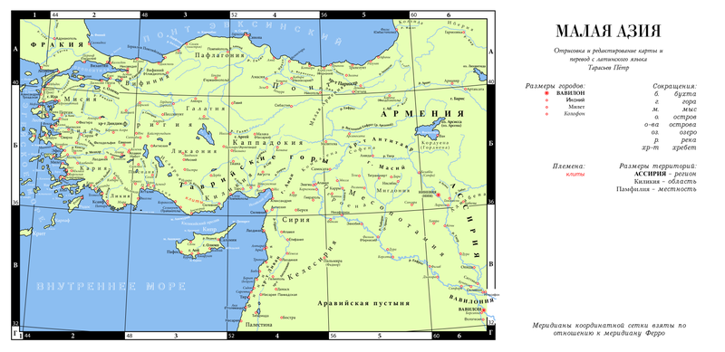
Русский: Карта античной Малой Азии вне времени с русскими названиями городов, озёр, гор, рек |
||||||||||||||||
| Date | |||||||||||||||||
| Source |
|
||||||||||||||||
| Author | Пётр Тарасьев | ||||||||||||||||
| Other versions | |||||||||||||||||

Licensing
[edit]
| This file is made available under the Creative Commons CC0 1.0 Universal Public Domain Dedication. | |
| The person who associated a work with this deed has dedicated the work to the public domain by waiving all of their rights to the work worldwide under copyright law, including all related and neighboring rights, to the extent allowed by law. You can copy, modify, distribute and perform the work, even for commercial purposes, all without asking permission.
|
File history
Click on a date/time to view the file as it appeared at that time.
| Date/Time | Thumbnail | Dimensions | User | Comment | |
|---|---|---|---|---|---|
| current | 15:42, 21 February 2022 | | 8,500 × 4,137 (3.76 MB) | Пётр Тарасьев (talk | contribs) | Снова убрал источник |
| 15:39, 21 February 2022 |  | 8,500 × 4,137 (3.84 MB) | Пётр Тарасьев (talk | contribs) | Убрал недочёт, связанный с присутствием лишнего слоя | |
| 14:15, 6 February 2022 |  | 8,500 × 4,137 (3.77 MB) | Пётр Тарасьев (talk | contribs) | убрал источник в описание | |
| 16:54, 9 January 2022 |  | 8,500 × 4,137 (3.85 MB) | Пётр Тарасьев (talk | contribs) | Uploaded own work with UploadWizard |
You cannot overwrite this file.
File usage on Commons
The following 2 pages use this file:
File usage on other wikis
The following other wikis use this file:
- Usage on ru.wikipedia.org
Metadata
- Maps of Cappadocia
- Isauria
- Old maps of Cyprus
- Maps of Caria
- Maps of Lydia
- Maps of Lycia
- Maps of Syria
- Coelesyria
- Maps of Commagene
- Old maps of Mesopotamia
- Maps of Corduene
- Maps of Osrhoene
- Maps of Phrygia
- Maps of Galatia
- Maps of Sophene
- Old maps of Armenia
- Kızılırmak River
- Sakarya River
- Ceyhan River
- Orontes River
- Khabur River
- Putzgers Historischer Schul-Atlas
- Maps of rivers of Asia
- Maps of Adiabene
- 19th-century maps of the Eastern Mediterranean
- Maps of Turkey
- Ancient regions of Anatolia
- Maps of Anatolia
- Maps of Bithynia
- Maps of the Eastern Mediterranean