File:Карта Петрограда 1916.jpg

Original file (5,940 × 7,740 pixels, file size: 12.36 MB, MIME type: image/jpeg)
Captions
Captions
| Description |
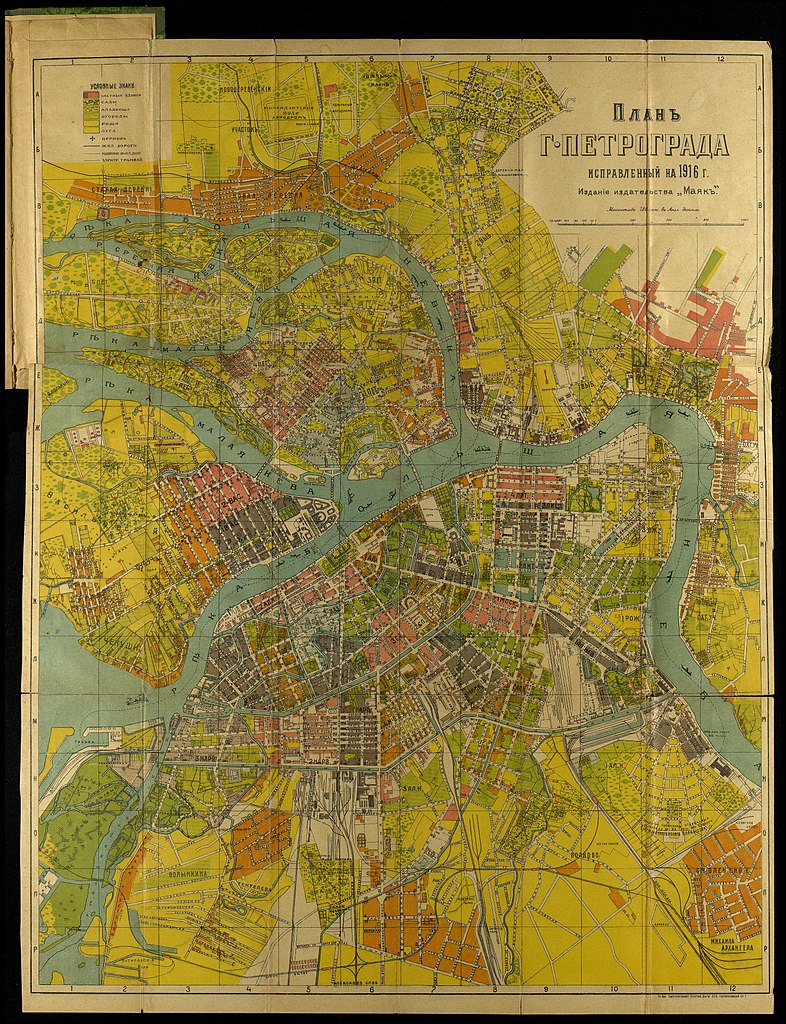
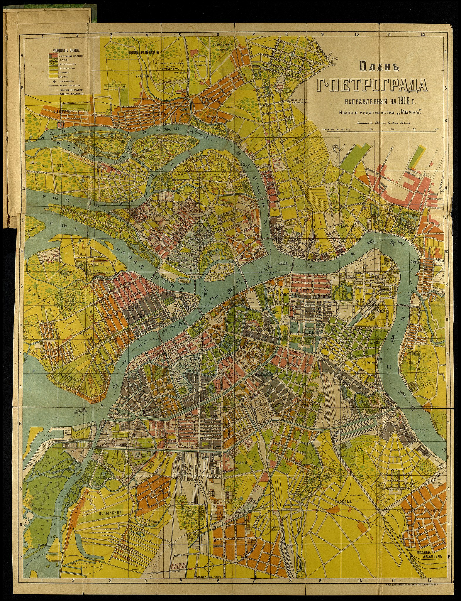
Русский: Карта Петрограда по состоянию на 1916 год, Издательство Маяк English: Map of Petrograd, 1916 |
|||||||||
| Date | ||||||||||
| Source | Россия. Отдельные местности. Петроград. План города Петрограда, исправленный на 1916 год : На плане обозначены номера домов. Новый план-маршрут трамваев : 25-е издание. - [Пг., 1916]. - 16 с. текста, 2 л. план. - На обл. загл. : Новый план города Петрограда. http://elib.shpl.ru/ru/nodes/18931-petrograd-plan-goroda-petrograda-ispravlennyy-na-1916-god-na-plane-oboznacheny-nomera-domov-novyy-plan-marshrut-tramvaev-25-e-izdanie-pg-1916 | |||||||||
| Creator |
Издательство "Маяк" |
|||||||||
| Geotemporal data | ||||||||||
| Bounding box |
|
|||||||||
| Georeferencing | ||||||||||
| Other versions | ||||||||||
_%D0%A4%D1%80%D0%B0%D0%BD%D1%86%D1%83%D0%B7%D1%81%D0%BA%D0%B8%D0%B9_%D0%BA%D0%BE%D0%B2%D1%88.jpg)
| I, the copyright holder of this work, release this work into the public domain. This applies worldwide. In some countries this may not be legally possible; if so: I grant anyone the right to use this work for any purpose, without any conditions, unless such conditions are required by law. |
|
This work is in the public domain in its country of origin and other countries and areas where the copyright term is the author's life plus 70 years or fewer.
| |
| This file has been identified as being free of known restrictions under copyright law, including all related and neighboring rights. | |
File history
Click on a date/time to view the file as it appeared at that time.
| Date/Time | Thumbnail | Dimensions | User | Comment | |
|---|---|---|---|---|---|
| current | 18:51, 14 October 2017 | | 5,940 × 7,740 (12.36 MB) | Mnavi (talk | contribs) | huge resolution |
| 11:28, 30 January 2013 |  | 2,068 × 2,725 (5.89 MB) | Slick-o-bot (talk | contribs) | Bot: convert to a non-interlaced jpeg (see bug #17645) | |
| 19:16, 7 December 2008 |  | 2,068 × 2,725 (5.48 MB) | George Shuklin (talk | contribs) | {{Information |Description={{ru|Карта Петрограда по состоянию на 1916 год, Издательство Маяк}}{{en|Map of Petrograd, 1916}} |Source=Государственный музей политической исто� |
You cannot overwrite this file.
File usage on Commons
The following 2 pages use this file:
File usage on other wikis
The following other wikis use this file:
- Usage on de.wikipedia.org
- Usage on ru.wikipedia.org