File:Катая.svg
Jump to navigation
Jump to search

Size of this PNG preview of this SVG file: 557 × 599 pixels. Other resolutions: 223 × 240 pixels | 446 × 480 pixels | 714 × 768 pixels | 952 × 1,024 pixels | 1,904 × 2,048 pixels | 1,134 × 1,220 pixels.
Original file (SVG file, nominally 1,134 × 1,220 pixels, file size: 31 KB)
Captions
Captions
Add a one-line explanation of what this file represents
Summary[edit]
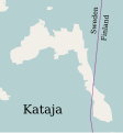
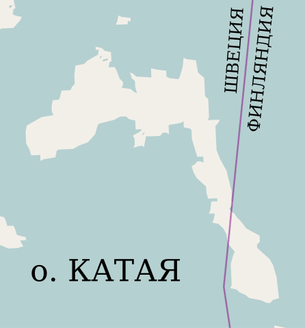
Русский: Остров Катая
| Description |
This map was created from OpenStreetMap project data, collected by the community. This map may be incomplete, and may contain errors. Don't rely solely on it for navigation. |
| Date | (see file history) |
| Source | openstreetmap.org |
| Creator |
OpenStreetMap contributors |
| Permission (Reusing this file) |
OpenStreetMap data and maps are licensed under the Creative Commons Attribution-ShareAlike 2.0 license (CC-BY-SA 2.0). This file is licensed under the Creative Commons Attribution-Share Alike 2.0 Generic license.
|
| Georeferencing | If inappropriate please set warp_status = skip to hide. |
Other versions[edit]
-
 English
 -
 македонски
 -
 svenska


derivative works[edit]
Derivative works of this file:
File history
Click on a date/time to view the file as it appeared at that time.
| Date/Time | Thumbnail | Dimensions | User | Comment | |
|---|---|---|---|---|---|
| current | 15:41, 11 December 2010 | | 1,134 × 1,220 (31 KB) | Insider (talk | contribs) | == Summary == {{ru|1=Остров Катая}} {{OpenStreetMap}} Category:Islands of Finland Category:Islands of Sweden Category:Islands of the Baltic Sea Category:International islands |
You cannot overwrite this file.
File usage
The following 3 pages use this file:
Global file usage
The following other wikis use this file:
- Usage on az.wikipedia.org
- Usage on be.wikipedia.org
- Usage on kk.wikipedia.org
- Usage on ru.wikipedia.org
- Usage on sv.wikipedia.org