File:Озеро Лиман на закате.jpg
Original file (2,773 × 1,841 pixels, file size: 2.16 MB, MIME type: image/jpeg)
Captions
Captions
Summary
[edit]
| Description |
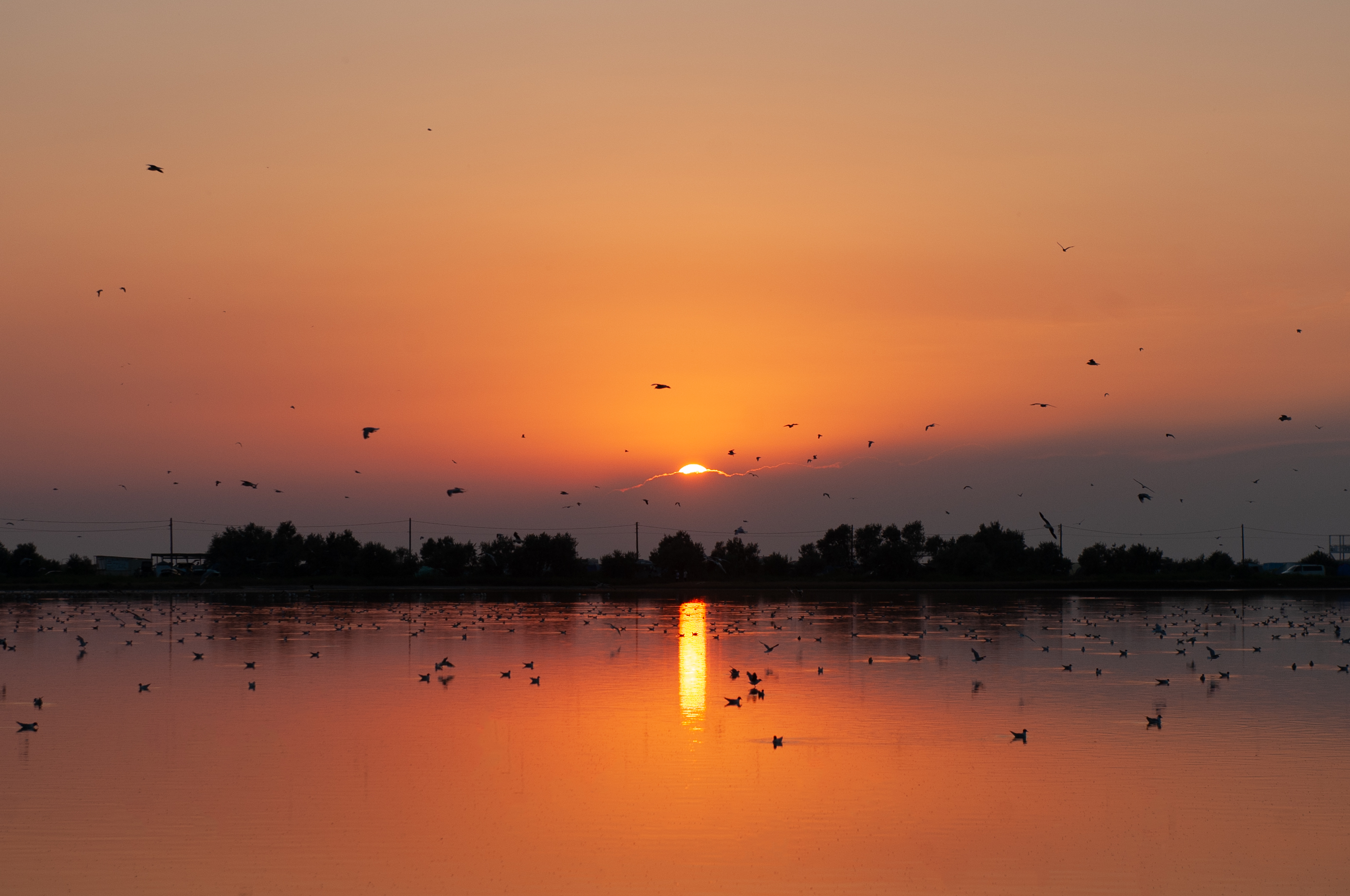
Русский: Фото сделано на западном побережье Крыма (село Оленевка, озеро Лиман). Меня привлек цвет закатного неба. Мне посчастливилось поймать момент буквально за минуту до захода солнца. Птицы охотились на различных насекомых (например: ногохвостка водяная), водоплавающих (рыб), обитавших в этом месте. Озере Лима́н или Караджа́ — солёное озеро, расположенное на юго-западе Черноморского района и Тарханкутского полуострова; 5-е по площади в районе. Площадь водного зеркала — 1,36 км². Тип общей минерализации — солёное. Происхождение — лиманное. Группа гидрологического режима — бессточное. Входит в Тарханкутскую группу озёр. Длина — 1,6 км. Ширина средняя — 0,9 км, наибольшая — 1,2 км. Глубина средняя — 1 м, наибольшая — 2 м, площадь водосборного бассейна — 66,6 км². Высота над уровнем моря — −0,4 м. Озеро используется в рекреации: летом является локальным центром виндсёрфинга. Ближайший населённый пункт — село Оленевка, расположенное вокруг озера. Озеро отделено от Караджинской бухты узкой пересыпью. Образовалось в результате затопления морем приустьевых частей балок и отшнуровывания их от моря песчано-ракушечными пересыпями. Пересыпь озера к настоящему времени геологически полностью не сложилась, сохранились понижения, прорываемые во время волнения моря. Дно озера покрыто 5-35-сантиметровым слоем высокоминерализованной грязи. English: The photo was taken on the western coast of Crimea (the village of Olenivka, Lake Lıman). The sunset sky blossoms me. I was lucky enough to catch the moment just a minute before sunset. Birds preyed on various insects (for example: water springtail), waterfowl (fish) that lived in this place. Lake Liman or Karadzha is a salt lake located in the southwest of the Black Sea region and the Tarkhankut Peninsula; 5th by area in the region. The area of the water mirror is 1.36 km². The type of general mineralization is salty. Origin - firth. Hydrological regime group - drainless. It is part of the Tarkhankut group of lakes. Length — 1.6 km. The average width is 0.9 km, the largest is 1.2 km. The average depth is 1 m, the largest is 2 m, the catchment area is 66.6 km2. The height above sea level is -0.4 m . The lake is used for recreation: in summer it is a local windsurfing center. The nearest settlement is the village of Olenevka, located around the lake. The lake is separated from the Karadzhinskaya Bay by a narrow embankment. It was formed as a result of the flooding by the sea of the estuary parts of the beams and their detachment from the sea by sand-shell embankments. The overflow of the lake has not fully developed geologically by now, the depressions that were broken during sea waves have been preserved. The bottom of the lake is covered with a 5-35-centimeter layer of highly mineralized mud. The average annual precipitation is less than 350 mm . The main source is the surface and underground waters of the Black Sea Artesian basin. The water level varies significantly depending on the season. |
| Date | 19.07.2021 20:20 |
| Source | Own work |
| Author | Варенников Денис |
| Camera location | | View this and other nearby images on: OpenStreetMap |
|---|
Licensing
[edit]
- You are free:
- to share – to copy, distribute and transmit the work
- to remix – to adapt the work
- Under the following conditions:
- attribution – You must give appropriate credit, provide a link to the license, and indicate if changes were made. You may do so in any reasonable manner, but not in any way that suggests the licensor endorses you or your use.
This image was uploaded as part of Russian Science Photo Competition 2022.
|
File history
Click on a date/time to view the file as it appeared at that time.
| Date/Time | Thumbnail | Dimensions | User | Comment | |
|---|---|---|---|---|---|
| current | 19:47, 30 May 2022 | | 2,773 × 1,841 (2.16 MB) | Варенников Денис (talk | contribs) | Uploaded own work with UploadWizard |
You cannot overwrite this file.
File usage on Commons
There are no pages that use this file.