File:План г. Калуги. 1782 год.jpg
Jump to navigation
Jump to search

Size of this preview: 800 × 553 pixels. Other resolutions: 320 × 221 pixels | 640 × 443 pixels | 1,024 × 708 pixels | 1,294 × 895 pixels.
Original file (1,294 × 895 pixels, file size: 385 KB, MIME type: image/jpeg)
Captions
Captions
Add a one-line explanation of what this file represents
Summary[edit]
| Description |
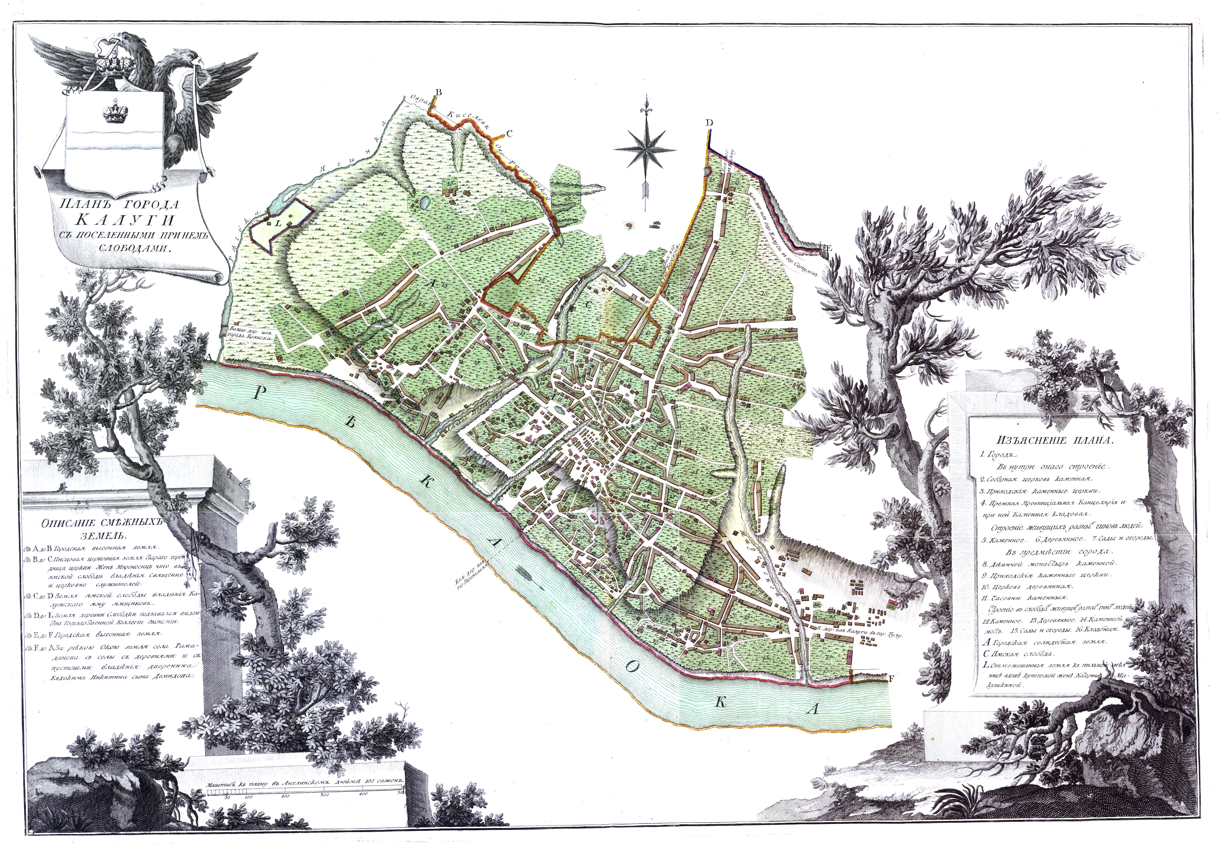
Русский: Генеральный план Калужского уезда. На врезке - описание смежных уездов. Масштаб - в английском дюйме 2 версты. Из книги: Атлас Калужского Наместничества, состоящего из двенадцати городов и уездов. Атлас был составлен во времена правления великой государыни императрицы Екатерины Алексеевны в 1782 году, и издан в Санкт-Петербурге |
| Date | |
| Source | http://www.etomesto.ru/map/base/40/kaluga1782.jpg |
| Author | http://www.etomesto.ru/map/base/40/kaluga1782.jpg |
Licensing[edit]
This file is licensed under the Creative Commons Attribution-Share Alike 4.0 International license.
- You are free:
- to share – to copy, distribute and transmit the work
- to remix – to adapt the work
- Under the following conditions:
- attribution – You must give appropriate credit, provide a link to the license, and indicate if changes were made. You may do so in any reasonable manner, but not in any way that suggests the licensor endorses you or your use.
- share alike – If you remix, transform, or build upon the material, you must distribute your contributions under the same or compatible license as the original.
File history
Click on a date/time to view the file as it appeared at that time.
| Date/Time | Thumbnail | Dimensions | User | Comment | |
|---|---|---|---|---|---|
| current | 05:42, 29 October 2021 | | 1,294 × 895 (385 KB) | Tatyanakorneeva (talk | contribs) | Uploaded a work by http://www.etomesto.ru/map/base/40/kaluga1782.jpg from http://www.etomesto.ru/map/base/40/kaluga1782.jpg with UploadWizard |
You cannot overwrite this file.
File usage on Commons
There are no pages that use this file.
File usage on other wikis
The following other wikis use this file:
- Usage on uk.wikipedia.org