File:Поглед на Врбен 2.jpg
Jump to navigation
Jump to search

Size of this preview: 800 × 600 pixels. Other resolutions: 320 × 240 pixels | 640 × 480 pixels | 1,024 × 768 pixels | 1,280 × 960 pixels | 2,560 × 1,920 pixels | 4,032 × 3,024 pixels.
Original file (4,032 × 3,024 pixels, file size: 4.79 MB, MIME type: image/jpeg)
Captions
Captions
Add a one-line explanation of what this file represents
Summary[edit]
| Description |
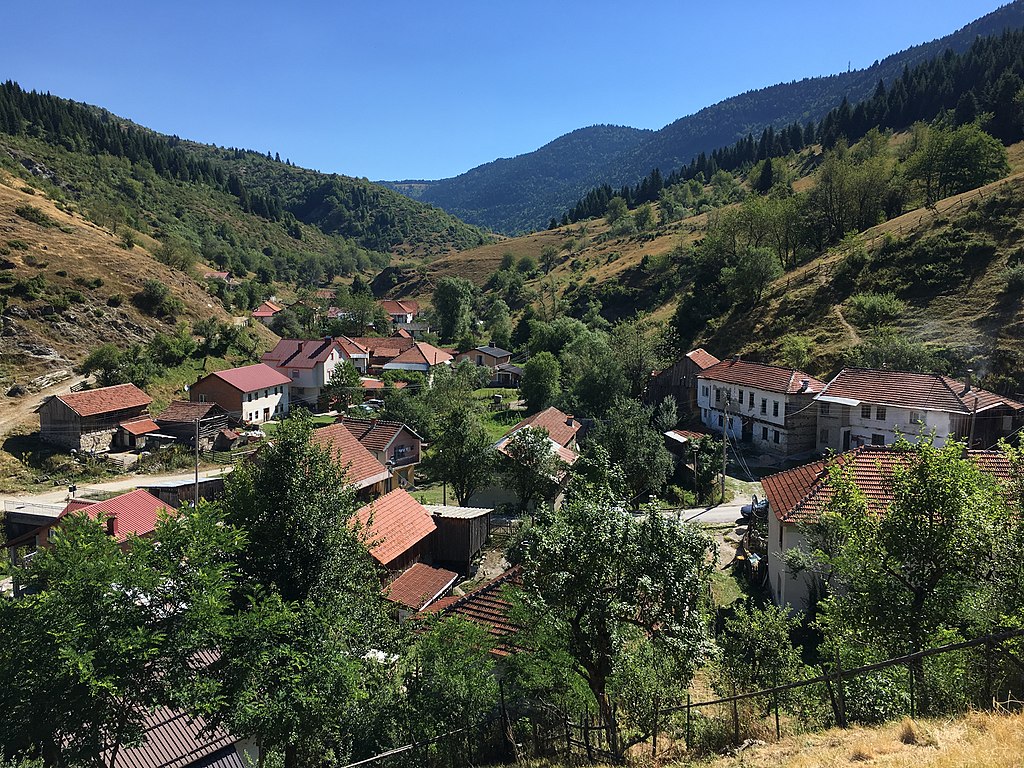
Македонски: Поглед на селото Врбен
English: View of the village of Vrben |
| Date | |
| Source | Own work |
| Author | Kiril Simeonovski |
| Camera location | | View this and other nearby images on: OpenStreetMap |
|---|

|
This photo was taken during Wikiexpeditions 2017 set up by Shared Knowledge.
You can see all photographs in category Macedonian Wikiexpeditions 2017.
|
Licensing[edit]
I, the copyright holder of this work, hereby publish it under the following license:
This file is licensed under the Creative Commons Attribution-Share Alike 4.0 International license.
- You are free:
- to share – to copy, distribute and transmit the work
- to remix – to adapt the work
- Under the following conditions:
- attribution – You must give appropriate credit, provide a link to the license, and indicate if changes were made. You may do so in any reasonable manner, but not in any way that suggests the licensor endorses you or your use.
- share alike – If you remix, transform, or build upon the material, you must distribute your contributions under the same or compatible license as the original.

|
This image has been assessed under the valued image criteria and is considered the most valued image on Commons within the scope: Vrben (village of Vrben with the southern slopes of Šar Mountains in the background). You can see its nomination here. |
File history
Click on a date/time to view the file as it appeared at that time.
| Date/Time | Thumbnail | Dimensions | User | Comment | |
|---|---|---|---|---|---|
| current | 13:33, 5 October 2017 | | 4,032 × 3,024 (4.79 MB) | Kiril Simeonovski (talk | contribs) | User created page with UploadWizard |
You cannot overwrite this file.
File usage
The following 3 pages use this file:
Global file usage
The following other wikis use this file:
- Usage on arz.wikipedia.org
- Usage on ceb.wikipedia.org
- Usage on cs.wikipedia.org
- Usage on en.wikipedia.org
- Usage on fr.wikipedia.org
- Usage on mk.wikipedia.org
- Usage on sh.wikipedia.org
- Usage on sq.wikipedia.org
- Usage on sr.wikipedia.org
- Usage on sv.wikipedia.org
- Usage on www.wikidata.org
- Usage on zh-min-nan.wikipedia.org