File:ضريح لوليوس.png
Jump to navigation
Jump to search

Size of this preview: 800 × 450 pixels. Other resolutions: 320 × 180 pixels | 640 × 360 pixels | 1,024 × 576 pixels | 1,280 × 720 pixels | 1,920 × 1,080 pixels.
Original file (1,920 × 1,080 pixels, file size: 3.06 MB, MIME type: image/png)
Captions
Captions
Add a one-line explanation of what this file represents
Summary
[edit]
| Description |
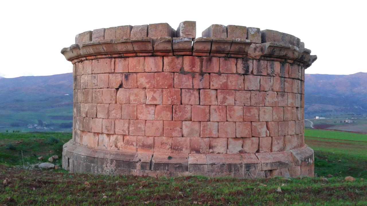
العربية: يقع ضريح لوليوس في جبل شواية بالمكان المسمى "الهري" في بلدية بني حميدان على بعد حوالي 25 كلم شمال غرب قسنطينة بالجزائر، غير بعيد عن المدينة الأثرية "تيدس" له شكل أسطواني، بني من حجارة منحوتة وشيدّ من طرف "ك" لوليوس إبريكيس " حاكم روما آنذاك تخليدا لعائلته. |
| Date | |
| Source | Own work |
| Author | Nouçeiba |
| Object location | | View this and other nearby images on: OpenStreetMap |
|---|
| Camera location | | View this and other nearby images on: OpenStreetMap |
|---|
Licensing
[edit]
I, the copyright holder of this work, hereby publish it under the following license:
This file is licensed under the Creative Commons Attribution-Share Alike 4.0 International license.
- You are free:
- to share – to copy, distribute and transmit the work
- to remix – to adapt the work
- Under the following conditions:
- attribution – You must give appropriate credit, provide a link to the license, and indicate if changes were made. You may do so in any reasonable manner, but not in any way that suggests the licensor endorses you or your use.
- share alike – If you remix, transform, or build upon the material, you must distribute your contributions under the same or compatible license as the original.

|
This image was uploaded as part of Wiki Loves Monuments 2019.
|
 |
File history
Click on a date/time to view the file as it appeared at that time.
| Date/Time | Thumbnail | Dimensions | User | Comment | |
|---|---|---|---|---|---|
| current | 13:29, 28 September 2019 | | 1,920 × 1,080 (3.06 MB) | Nouçeiba (talk | contribs) | User created page with UploadWizard |
You cannot overwrite this file.
File usage on Commons
There are no pages that use this file.
File usage on other wikis
The following other wikis use this file:
- Usage on ar.wikipedia.org
- Usage on fr.wikipedia.org