File:南方澳.jpg
Jump to navigation
Jump to search

Size of this preview: 800 × 449 pixels. Other resolutions: 320 × 180 pixels | 640 × 360 pixels | 1,024 × 575 pixels | 1,280 × 719 pixels | 2,560 × 1,438 pixels | 5,184 × 2,912 pixels.
Original file (5,184 × 2,912 pixels, file size: 9.32 MB, MIME type: image/jpeg)
Captions
Captions
Add a one-line explanation of what this file represents
Summary[edit]
| Description |
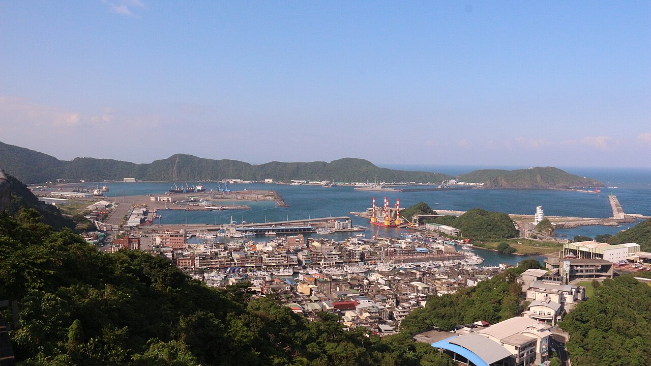
中文(臺灣):南方澳昔稱南風澳,昔為猴猴社番聚落,約在1838年,由花蓮太魯閣立霧溪遷移至南方澳西北方猴猴高地,後又遷移至龍德猴猴〈今育英國小〉,約1851-1861年再遷回南方澳。1921(大正10)年,因居地築漁港被迫往大南澳地區遷移,少部分回到花蓮。 南風澳,噶瑪蘭廳誌載:「蘇澳距城南四十五里,為蘭界東勢之盡頭,澳口即深水外洋,該澳內寬外窄,中有石礁鎖束,左為北風澳,右為南風澳,皆可避風湧(湧因風而起,其浪如山,舟多溺覆)。當春夏間,內地漁舟、小商艇亦有收泊於此者。」閩南語「風」與「方」字讀音相同,南風澳便成了南方澳。 我們現今所稱南方澳,是屬南正、南安、南成、南興、南寧、南建六里總稱。日本於1923年完成南方澳漁港,成為台灣三大漁港。開港之初,日本漁民、漢人、琉球人陸續移居,時至今日,南方澳的居民來自四面八方,恆春、東港、澎湖、龜山島、小琉球等,早已在此成家立業。小小的南方澳,十足的台灣移民縮影。 |
| Source | https://memory.culture.tw/Home/Detail?Id=282879&IndexCode=Culture_Place |
| Author | 創作者:莊文生;鐘碧娟。貢獻者:宜蘭縣政府文化局 |
| Camera location | | View this and other nearby images on: OpenStreetMap |
|---|
Licensing[edit]
This file is licensed under the Creative Commons Attribution 3.0 Taiwan license.
- You are free:
- to share – to copy, distribute and transmit the work
- to remix – to adapt the work
- Under the following conditions:
- attribution – You must give appropriate credit, provide a link to the license, and indicate if changes were made. You may do so in any reasonable manner, but not in any way that suggests the licensor endorses you or your use.


|
This file, which was originally posted to an external website, has not yet been reviewed by an administrator or reviewer to confirm that the above license is valid. See Category:License review needed for further instructions.
|
File history
Click on a date/time to view the file as it appeared at that time.
| Date/Time | Thumbnail | Dimensions | User | Comment | |
|---|---|---|---|---|---|
| current | 08:22, 13 April 2022 | | 5,184 × 2,912 (9.32 MB) | Muyueh Bot (talk | contribs) |
You cannot overwrite this file.
File usage on Commons
There are no pages that use this file.