File:古志の松原紀念碑.JPG
Jump to navigation
Jump to search

Size of this preview: 450 × 600 pixels. Other resolutions: 180 × 240 pixels | 360 × 480 pixels | 576 × 768 pixels | 768 × 1,024 pixels | 1,536 × 2,048 pixels | 3,024 × 4,032 pixels.
Original file (3,024 × 4,032 pixels, file size: 3.49 MB, MIME type: image/jpeg)
Captions
Captions
Add a one-line explanation of what this file represents
Summary
[edit]
| Description |
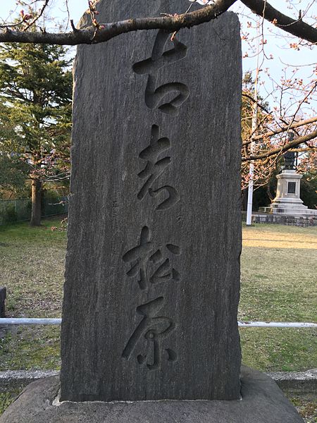
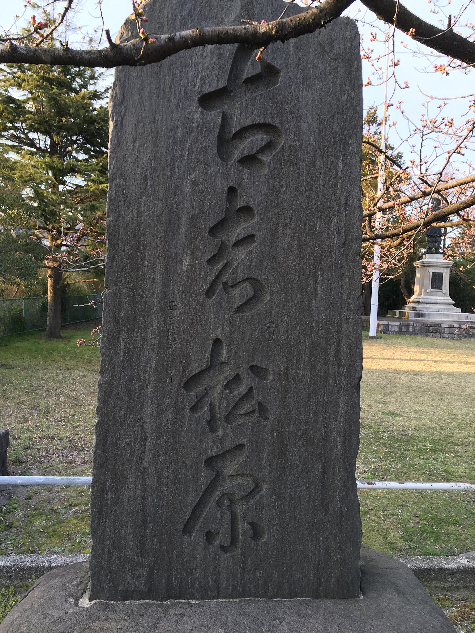
日本語: 碑文に曰く、「昭和七年十一月二日帝国美術院長正木直彦先生国立公園候補地巡視ノ序ニ来町松原ノ風光絶佳ナルヲ激賞シ古志乃松原ト命名セラレタルヲ以テ記念ノ為此碑ヲ建設シ後代ニ伝ヘントスト云尓
昭和九年秋建之 後援者東岩瀬史蹟保存会長 米田元吉郎 東岩瀬町長 佐渡傳二 帝国美術院推薦 山崎覺太郎」 |
| Date | |
| Source | Own work |
| Author | 赤座 |
| Other versions |
 |
| Camera location | | View this and other nearby images on: OpenStreetMap |
|---|
今この紀念碑の所在地は富山県道1号富山魚津線沿線の東岩瀬天神町天満宮の境内であって、鉄道にては富山港線岩瀬浜駅より5分ほどで着く。
Licensing
[edit]
I, the copyright holder of this work, hereby publish it under the following license:
This file is licensed under the Creative Commons Attribution-Share Alike 4.0 International license.
- You are free:
- to share – to copy, distribute and transmit the work
- to remix – to adapt the work
- Under the following conditions:
- attribution – You must give appropriate credit, provide a link to the license, and indicate if changes were made. You may do so in any reasonable manner, but not in any way that suggests the licensor endorses you or your use.
- share alike – If you remix, transform, or build upon the material, you must distribute your contributions under the same or compatible license as the original.
File history
Click on a date/time to view the file as it appeared at that time.
| Date/Time | Thumbnail | Dimensions | User | Comment | |
|---|---|---|---|---|---|
| current | 16:13, 27 March 2016 | | 3,024 × 4,032 (3.49 MB) | 赤座 (talk | contribs) | User created page with UploadWizard |
You cannot overwrite this file.
File usage on Commons
The following page uses this file:
File usage on other wikis
The following other wikis use this file:
- Usage on ja.wikipedia.org