File:国土交通省 国土地理院 地図・空中写真閲覧サービスの空中写真を基に作成した殿田を中心とした日吉町。2000年5月30日.jpg
Jump to navigation
Jump to search

Size of this preview: 657 × 599 pixels. Other resolutions: 263 × 240 pixels | 526 × 480 pixels | 842 × 768 pixels | 1,123 × 1,024 pixels | 2,245 × 2,048 pixels | 3,223 × 2,940 pixels.
Original file (3,223 × 2,940 pixels, file size: 6.03 MB, MIME type: image/jpeg)
Captions
Captions
Add a one-line explanation of what this file represents
Summary
[edit]
| Description |
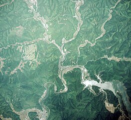
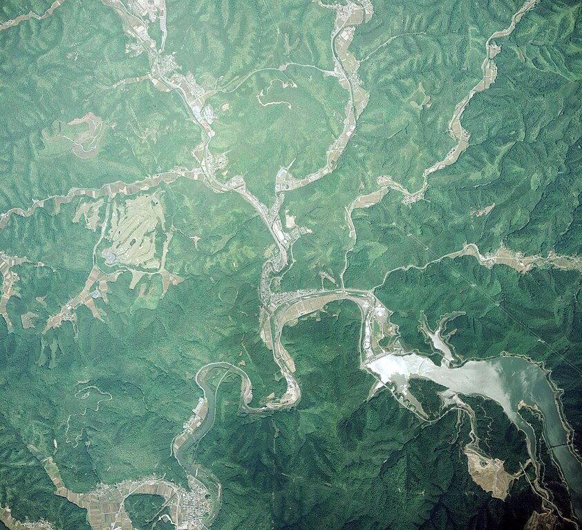
日本語: 国土交通省 国土地理院 地図・空中写真閲覧サービスの空中写真を基に作成した殿田を中心とした日吉町。2000年5月30日撮影をトリミング編集 |
| Date | |
| Source | https://mapps.gsi.go.jp/maplibSearch.do#1 |
| Author | 国土交通省国土地理院 |
Licensing
[edit]

|
This work is licensed under the Government of Japan Standard Terms of Use (Ver.2.0). The Terms of Use are compatible with the Creative Commons Attribution License 4.0 International. For the terms of use of this work, see this license page.
|
This file is licensed under the Creative Commons Attribution 4.0 International license.
Attribution: 国土地理院 (GSI)
- You are free:
- to share – to copy, distribute and transmit the work
- to remix – to adapt the work
- Under the following conditions:
- attribution – You must give appropriate credit, provide a link to the license, and indicate if changes were made. You may do so in any reasonable manner, but not in any way that suggests the licensor endorses you or your use.
File history
Click on a date/time to view the file as it appeared at that time.
| Date/Time | Thumbnail | Dimensions | User | Comment | |
|---|---|---|---|---|---|
| current | 04:59, 11 April 2024 | | 3,223 × 2,940 (6.03 MB) | Spedi-sit (talk | contribs) | Uploaded a work by 国土交通省国土地理院 from https://mapps.gsi.go.jp/maplibSearch.do#1 with UploadWizard |
You cannot overwrite this file.
File usage on Commons
There are no pages that use this file.
File usage on other wikis
The following other wikis use this file:
- Usage on ja.wikipedia.org