File:岩手県-地方行政区分-地図.jpg
Jump to navigation
Jump to search

Size of this preview: 399 × 600 pixels. Other resolutions: 159 × 240 pixels | 319 × 480 pixels | 511 × 768 pixels | 681 × 1,024 pixels | 1,530 × 2,300 pixels.
Original file (1,530 × 2,300 pixels, file size: 497 KB, MIME type: image/jpeg)
Captions
Captions
Add a one-line explanation of what this file represents
Summary
[edit]
| Description |
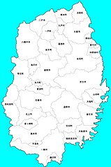
日本語: 岩手県の地方行政区分の地図です。 |
| Date | |
| Source | http://www.freemap.jp/download.php?area=todoufuken&country=iwate&file_name=1001_3.png |
| Author |
Licensing
[edit]
| I, the copyright holder of this work, release this work into the public domain. This applies worldwide. In some countries this may not be legally possible; if so: I grant anyone the right to use this work for any purpose, without any conditions, unless such conditions are required by law. |
File history
Click on a date/time to view the file as it appeared at that time.
| Date/Time | Thumbnail | Dimensions | User | Comment | |
|---|---|---|---|---|---|
| current | 20:30, 23 November 2010 | | 1,530 × 2,300 (497 KB) | Dubianman (talk | contribs) | {{Information |Description={{ja|1=岩手県の地方行政区分の地図です。}} |Source=http://www.freemap.jp/download.php?area=todoufuken&country=iwate&file_name=1001_3.png |Author=*Source: Sankakukei, InoueKeisuke.[http://www.freemap.jp/] *Derivati |
You cannot overwrite this file.
File usage on Commons
There are no pages that use this file.
File usage on other wikis
The following other wikis use this file:
- Usage on de.wikipedia.org
- Usage on ja.wikipedia.org