File:新社車路頭.jpg
Jump to navigation
Jump to search

Size of this preview: 800 × 569 pixels. Other resolutions: 320 × 228 pixels | 640 × 455 pixels | 1,024 × 729 pixels | 1,280 × 911 pixels | 2,560 × 1,821 pixels | 3,508 × 2,496 pixels.
Original file (3,508 × 2,496 pixels, file size: 1.32 MB, MIME type: image/jpeg)
Captions
Captions
Add a one-line explanation of what this file represents
Summary
[edit]
| Description |
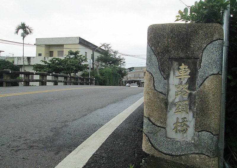
中文(臺灣): 早期蘭陽平原河川密佈,內陸運輸以河川航運為主,而水陸轉運的地方,通稱為「車路頭」。新社車路頭位於192縣道與十三股大排之間,礁溪鄉與壯圍鄉交界處,昔日為頭城河船隻停泊貨物集散處,自古為交通要地,早成街肆,稱為「車路頭庄」,該庄位於玉田村的東側,與礁溪塭底及壯圍大福相鄰。庄內有十三股溪,曾是宜蘭河的支流,在「三抱竹」匯入宜蘭河後,繼續北流至烏石港出海。由於昔日這裡是烏石港進出口貨物的水陸轉運點,因此行旅繁忙,在清日時期皆自成一庄。
日治時期為運送甘蔗,此地並築有一五分車道,可通至大福,然隨著河流淤淺不利舟楫,又1924年鐵路通車之後,內河航運沒落,「車路頭庄」乃迅速蕭條。戰後行政區分別併入礁溪與壯圍兩鄉,由於新社車路頭位處要道交界,東可達濱海公路,西可通宜蘭市,地理位置至今仍為重要。 |
| Source | https://memory.culture.tw/Home/Detail?Id=602998&IndexCode=Culture_Place |
| Author | 創作者:莊文生;鐘碧娟;謝淑娟。貢獻者:宜蘭縣政府文化局 |
| Camera location | | View this and other nearby images on: OpenStreetMap |
|---|
Licensing
[edit]
This file is licensed under the Creative Commons Attribution 3.0 Taiwan license.
- You are free:
- to share – to copy, distribute and transmit the work
- to remix – to adapt the work
- Under the following conditions:
- attribution – You must give appropriate credit, provide a link to the license, and indicate if changes were made. You may do so in any reasonable manner, but not in any way that suggests the licensor endorses you or your use.

File history
Click on a date/time to view the file as it appeared at that time.
| Date/Time | Thumbnail | Dimensions | User | Comment | |
|---|---|---|---|---|---|
| current | 04:52, 14 April 2022 | | 3,508 × 2,496 (1.32 MB) | Muyueh Bot (talk | contribs) |
You cannot overwrite this file.
File usage on Commons
There are no pages that use this file.
File usage on other wikis
The following other wikis use this file:
- Usage on zh.wikipedia.org