File:衆議院小選挙区 茨城県.png
Jump to navigation
Jump to search

Size of this preview: 481 × 599 pixels. Other resolutions: 193 × 240 pixels | 385 × 480 pixels | 616 × 768 pixels | 822 × 1,024 pixels | 1,644 × 2,048 pixels | 9,040 × 11,263 pixels.
Original file (9,040 × 11,263 pixels, file size: 2.94 MB, MIME type: image/png)
Captions
Captions
Add a one-line explanation of what this file represents
Summary[edit]
| Warning | The original file is very high-resolution. It might not load properly or could cause your browser to freeze when opened at full size. |
|---|
| Description |
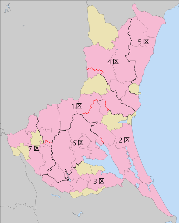
English: Map of Japanese House of Representatives districts in Ibaraki Prefecture, based on the municipal map created by Japanese user Lincun |
| Date | |
| Source | Utilized base map created by Japanese user Lincun, which was disseminated with a CC BY-SA 3.0 license |
| Author | Ynot101796 |
Licensing[edit]
I, the copyright holder of this work, hereby publish it under the following licenses:

|
Permission is granted to copy, distribute and/or modify this document under the terms of the GNU Free Documentation License, Version 1.2 or any later version published by the Free Software Foundation; with no Invariant Sections, no Front-Cover Texts, and no Back-Cover Texts. A copy of the license is included in the section entitled GNU Free Documentation License. |
This file is licensed under the Creative Commons Attribution-Share Alike 4.0 International license.
- You are free:
- to share – to copy, distribute and transmit the work
- to remix – to adapt the work
- Under the following conditions:
- attribution – You must give appropriate credit, provide a link to the license, and indicate if changes were made. You may do so in any reasonable manner, but not in any way that suggests the licensor endorses you or your use.
- share alike – If you remix, transform, or build upon the material, you must distribute your contributions under the same or compatible license as the original.
You may select the license of your choice.
File history
Click on a date/time to view the file as it appeared at that time.
| Date/Time | Thumbnail | Dimensions | User | Comment | |
|---|---|---|---|---|---|
| current | 12:51, 17 February 2019 | | 9,040 × 11,263 (2.94 MB) | そらみみ (talk | contribs) | Reverted to version as of 08:01, 6 December 2016 (UTC) |
| 12:48, 17 February 2019 |  | 813 × 1,024 (130 KB) | そらみみ (talk | contribs) | Updating. Showing difference of towns and villages. | |
| 08:01, 6 December 2016 |  | 9,040 × 11,263 (2.94 MB) | Ynot101796 (talk | contribs) | {{subst:Upload marker added by en.wp UW}} {{Information |Description = {{en|Map of Japanese House of Representatives districts in Ibaraki Prefecture, based on the municipal map created by Japanese user Lincun}} |Source = Utilized base map created by Ja... |
You cannot overwrite this file.
File usage on Commons
The following 2 pages use this file: