File:那娘仔.jpg
Jump to navigation
Jump to search

Size of this preview: 800 × 409 pixels. Other resolutions: 320 × 163 pixels | 640 × 327 pixels | 1,024 × 523 pixels | 1,280 × 654 pixels | 2,560 × 1,308 pixels | 5,135 × 2,623 pixels.
Original file (5,135 × 2,623 pixels, file size: 5.31 MB, MIME type: image/jpeg)
Captions
Captions
Add a one-line explanation of what this file represents
Summary
[edit]
| Description |
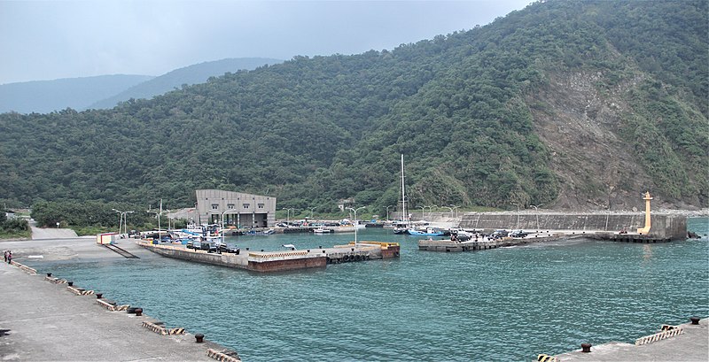
中文(臺灣):舊名「那娘仔」的「朝陽里」位於宜蘭縣蘇澳鎮內,蘇花公路以東,南澳嶺南側至南澳溪北岸之間,為濱海平地,有朝陽漁港。清代稱「大南澳」,雖宣稱納入國土,但實為未治之番地。1914年日本政府理番成功之後,平地人始集體入墾,三年後將大南澳改列為一般行政區。今當地耆老習慣以「那娘仔」稱呼本地,應係浪速之訛音,緣由於1907年日治時期,日本軍艦「浪速丸」在台灣理蕃政策中曾停泊於南澳灣,為紀念浪速艦至此地協助理番,遂以「浪速」為地名(1917(大正6)年〈宜蘭廳報〉等文獻皆稱此地為”浪速”),戰後改為「朝陽」。 |
| Source | https://memory.culture.tw/Home/Detail?Id=282820&IndexCode=Culture_Place |
| Author | 創作者:莊文生;鐘碧娟;謝淑娟。貢獻者:宜蘭縣政府文化局 |
| Camera location | | View this and other nearby images on: OpenStreetMap |
|---|
Licensing
[edit]
This file is licensed under the Creative Commons Attribution 3.0 Taiwan license.
- You are free:
- to share – to copy, distribute and transmit the work
- to remix – to adapt the work
- Under the following conditions:
- attribution – You must give appropriate credit, provide a link to the license, and indicate if changes were made. You may do so in any reasonable manner, but not in any way that suggests the licensor endorses you or your use.

File history
Click on a date/time to view the file as it appeared at that time.
| Date/Time | Thumbnail | Dimensions | User | Comment | |
|---|---|---|---|---|---|
| current | 08:08, 13 April 2022 | | 5,135 × 2,623 (5.31 MB) | Muyueh Bot (talk | contribs) |
You cannot overwrite this file.
File usage on Commons
There are no pages that use this file.
File usage on other wikis
The following other wikis use this file:
- Usage on zh.wikipedia.org