File:(No Title) Township 9 North, Township 8 North and Rang 10 East, Range 9 East - DPLA - e1e0539913ba3fc6e54abb51653f02bd.jpg
Jump to navigation
Jump to search

Size of this preview: 247 × 599 pixels. Other resolutions: 99 × 240 pixels | 198 × 480 pixels | 317 × 768 pixels | 422 × 1,024 pixels | 1,650 × 4,000 pixels.
Original file (1,650 × 4,000 pixels, file size: 1.61 MB, MIME type: image/jpeg)
Captions
Captions
Add a one-line explanation of what this file represents
Summary
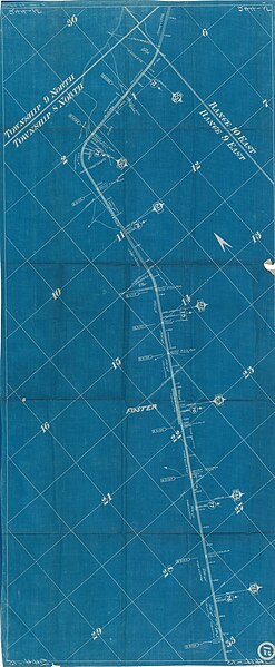
[edit]| [No Title] Township 9 North, Township 8 North and Rang 10 East, Range 9 East
( |
|||||||||||||||||||||
|---|---|---|---|---|---|---|---|---|---|---|---|---|---|---|---|---|---|---|---|---|---|
| Creator | Department of the Interior. Office of Indian Affairs. Five Civilized Tribes Agency. 1914-9/17/1947 | ||||||||||||||||||||
| Title |
[No Title] Township 9 North, Township 8 North and Rang 10 East, Range 9 East |
||||||||||||||||||||
| Date | 1906 | ||||||||||||||||||||
| Collection |
|
||||||||||||||||||||
| Source/Photographer |
|
||||||||||||||||||||
| Permission (Reusing this file) |
|
||||||||||||||||||||
| Standardized rights statement |
|
||||||||||||||||||||


_Township_9_North,_Township_8_North_and_Rang_10_East,_Range_9_East_-_DPLA_-_e1e0539913ba3fc6e54abb51653f02bd.jpg&action=edit§ion=1)
File history
Click on a date/time to view the file as it appeared at that time.
| Date/Time | Thumbnail | Dimensions | User | Comment | |
|---|---|---|---|---|---|
| current | 16:42, 9 November 2022 | 1,650 × 4,000 (1.61 MB) | DPLA bot (talk | contribs) | Uploading DPLA ID e1e0539913ba3fc6e54abb51653f02bd |
You cannot overwrite this file.
File usage on Commons
The following page uses this file:
_Township_9_North,_Township_8_North_and_Rang_10_East,_Range_9_East_-_DPLA_-_e1e0539913ba3fc6e54abb51653f02bd.jpg)
_Township_9_North,_Township_8_North_and_Rang_10_East,_Range_9_East_-_DPLA_-_e1e0539913ba3fc6e54abb51653f02bd.jpg&oldid=864959890)