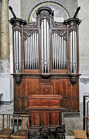
File:(Toulouse) - St Pierre des Chartreux church - choir organ.jpg
Jump to navigation
Jump to search

Size of this preview: 383 × 600 pixels. Other resolutions: 153 × 240 pixels | 306 × 480 pixels | 490 × 768 pixels | 654 × 1,024 pixels | 1,308 × 2,048 pixels | 3,562 × 5,578 pixels.
Original file (3,562 × 5,578 pixels, file size: 10.67 MB, MIME type: image/jpeg)
Captions
Captions
Add a one-line explanation of what this file represents
Summary[edit]
|
| |||||||||||||||||||||


_-_St_Pierre_des_Chartreux_church_-_choir_organ.jpg)


_-_Clo%C3%AEtre_de_l%27%C3%89glise_Saint-Pierre_des_Chartreux_2.jpg)
_-_St_Pierre_des_Chartreux_church_-_choir_organ.jpg&action=edit§ion=1)
_-_St_Pierre_des_Chartreux_church_-_choir_organ.jpg)
_-_St_Pierre_des_Chartreux_church_-_choir_organ.jpg¶ms=043.604801_N_0001.436495_E_globe:Earth_type:camera_alt:175.34_source:exif_&language=en)
_-_St_Pierre_des_Chartreux_church_-_choir_organ.jpg¶ms=043.604683_N_0001.436458_E_globe:Earth_class:object_type:object_region:FR_&language=en)
File history
Click on a date/time to view the file as it appeared at that time.
| Date/Time | Thumbnail | Dimensions | User | Comment | |
|---|---|---|---|---|---|
| current | 18:57, 1 July 2021 | | 3,562 × 5,578 (10.67 MB) | Archaeodontosaurus (talk | contribs) | {{Information |Description= |Source={{own}} |Date= |Author= Archaeodontosaurus |Permission= |other_versions= }} |
You cannot overwrite this file.
File usage on Commons
The following 12 pages use this file:
- User:Archaeodontosaurus/De aout 2021 à janvier2022
- User talk:Archaeodontosaurus/De aout 2021 à janvier2022
- Commons:Valued image candidates/(Toulouse) - St Pierre des Chartreux church - choir organ.jpg
- Commons:Valued images by topic/Works of art/Music
- File:(Toulouse) - St Pierre des Chartreux church - choir organ.jpg
- File:Eglise Saint-Pierre des Chartreux de Toulouse - Chaire.jpg
- File:Eglise Saint-Pierre des Chartreux de Toulouse - Façade.jpg
- File:Eglise Saint-Pierre des Chartreux de Toulouse - Les anges couronnant le Saint Sacrement - François Lucas 1785 PM31000920.jpg
- File:Eglise Saint-Pierre des Chartreux de Toulouse - Monument aux morts.jpg
- File:Eglise Saint-Pierre des Chartreux de Toulouse - Pieta.jpg
- File:Eglise Saint-Pierre des Chartreux de Toulouse Fonts baptismaux.jpg
- File:Église Saint-Pierre des Chartreux de Toulouse - Orgue de tribune.jpg
File usage on other wikis
The following other wikis use this file:
- Usage on de.wikipedia.org
- Usage on fr.wikipedia.org
- Usage on zh.wikipedia.org
_-_St_Pierre_des_Chartreux_church_-_choir_organ.jpg&oldid=827080325)