File:-2018-10-08 WWI pillbox, Bacton wood Staithe, North Walsham and Dilham Canal, Norfolk (2).JPG
Jump to navigation
Jump to search

Size of this preview: 800 × 600 pixels. Other resolutions: 320 × 240 pixels | 640 × 480 pixels | 1,024 × 768 pixels | 1,280 × 960 pixels | 2,560 × 1,920 pixels | 5,152 × 3,864 pixels.
Original file (5,152 × 3,864 pixels, file size: 7.8 MB, MIME type: image/jpeg)
Captions
Captions
Add a one-line explanation of what this file represents
Summary[edit]
| Description |
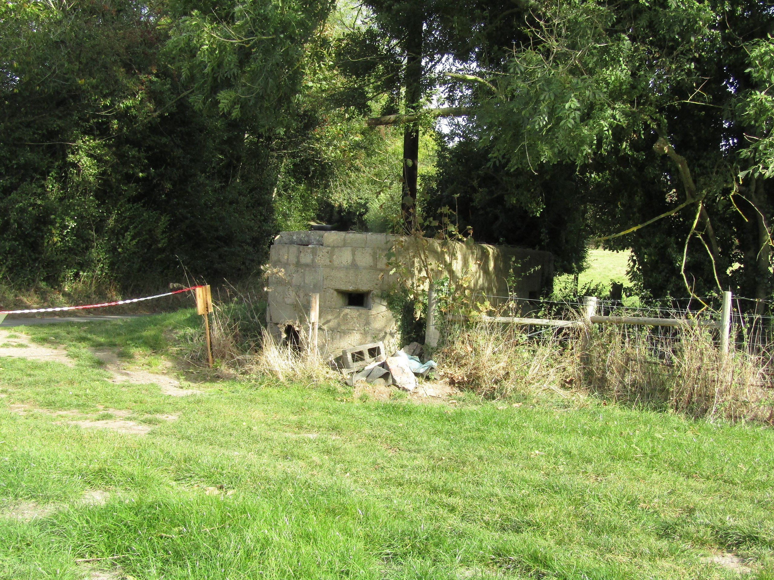
English: A World War 1 pillbox which guarded over the bridge over the canal arm connecting Bacton Wood corn mill to Bacton Wood Staithe and the North Walsham and Dilham Canal east of the town of North Walsham. Norfolk, England. This rare semi-circular pillbox was part of the River Ant Fortifications line which ran inland from the coast at Weybourne and along the course of the River Ant and the North Walsham and Dilham Canal all the way to Wayford Bridge and the natural defence of the Norfolk Broads. |
|
| Date |
Taken on 8 October 2018 Português: tirada a 08 de outubro de 2018 |
|
| Source | Own work | |
| Author |
This file is licensed under the Creative Commons Attribution-Share Alike 4.0 International license.
|

.JPG&action=edit§ion=1)
| Camera location | | View this and other nearby images on: OpenStreetMap |
|---|
.JPG¶ms=052.823999_N_0001.412338_E_globe:Earth_type:camera_region:GB_&language=en)
| Object location | | View this and other nearby images on: OpenStreetMap |
|---|
.JPG¶ms=052.824056_N_0001.412464_E_globe:Earth_class:object_type:object_region:GB_&language=en)

|
The copyright holder of this file, Kolforn (Wikimedia), allows anyone to use it for any purpose, provided that the copyright holder is properly attributed. Redistribution, derivative work, commercial use, and all other use is permitted. |
Attribution:
Kolforn (Wikimedia)
|
File history
Click on a date/time to view the file as it appeared at that time.
| Date/Time | Thumbnail | Dimensions | User | Comment | |
|---|---|---|---|---|---|
| current | 09:41, 14 October 2018 | | 5,152 × 3,864 (7.8 MB) | Kolforn (talk | contribs) | {{Information |Description={{en|A World War 1 pillbox which guarded over the bridge over the canal arm connecting Bacton Wood corn mill to Bacton Wood Staithe and the {{w|North Walsham and Dilham Canal}} east of the town of {{w|North Walsham}}. Norfolk, England. This rare semi-circular pillbox was part of the River Ant Fortifications line which ran inland from the coast at {{w|Weybourne}} and along the course of the River Ant and the North Walsham and Dilham Canal all the way to {{w|Wayford B... |
You cannot overwrite this file.
File usage on Commons
There are no pages that use this file.
.JPG&oldid=734504026)